|
|
Nile River Travel Map. Lehnert & Landrock. A detailed strip map of the Nile River, ideal for cruises and exploring the ruins along the river.
Recommended!
Cairo city map. 1:16,000. Editions Laure Kane. A colorful and informative map for visitors showing streets, railways, river buses, tram and metro lines, parks and districts. Coverage extends from El-Giza in the south-west to Abbassiya in the north-east.
Indexed for streets, mosques & selected places of interest. Large symbols depict such features as: railway stations, cemeteries, places of worship, administrative buildings, police stations, schools, hospitals, embassies, souks & post offices.
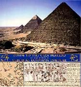
There is an inset plan of the pyramids at Giza and a small road map ot the region around Cairo. With bilingual legend, map size 84 x 54 cm.
Cairo city map. 1:15,000 (approx.). Lehnert & Landrock, Cairo. No date. A detailed map of the central section of Cairo, with street index and tourist information.
Egypt City Topographic Maps. 1:10,000. Soviet government. These maps are regular topographic maps that include contour lines, power lines, rail/trolley lines, etc. In Russian. Available as raster files only.
Egypt Topographic Maps and Atlases & Political & Physical Maps
ONC 1:1,000,000 Charts
Egypt 1:200,000 Topographic Quadrangle Maps - click here. Includes paper original map sheets, non-georeferenced and georeferenced digital raster files. Includes index map, sample images, and itemized sheet listings. Egypt 1:100,000 Topographic Quadrangle Maps - click here. Includes paper original map sheets, non-georeferenced and georeferenced digital raster files. Includes index map.
Egypt Geological and Thematic MapsLimited supply
Sinai Aeromagnetic Map. 1:500,000. Survey of Israel, 1980. A double-wide map with the aeromagnetic information overprinted on the Geologic Map of the Sinai (see 64-8170 in our Israel section). Includes bathymetric information along the coastline. A 1:500,000 scale geological-photomap is also included adjacent to the aeromagnetic map.
Egypt Flags
|
||||||||||||||||||||||||||||||||||||||||||||||||||||||||||||||||||||||||||||||||||||||||||||||||||||||||||||||||||||||||||||||||||||||||||||||||||||||||||

 Superb wall map
 Sample of the map detail.
 Thumbnail image of the entire map
 Waterproof!
 Sample detail of the Egypt adventure map
 Image of the front of the Egypt adventure map
 Image of the back of the Egypt adventure map
 Laminated
 Sample detail of the Berndtson Egypt road map
 Image of the front of the Berndtson Egypt road map
 Image of the back of the Berndtson Egypt road map
 Sample of the Egypt map detail
 Sketch map showing area covered by the Egypt map.
 Sample of the Egypt map detail
 Waterproof
 Sample detail of the Egypt Travel Map


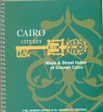
 Sample detail from the Cairo City Key atlas.
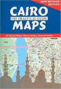
 Laminated
 Sample detail of the Berndtson Cairo city map
 Image of the front of the Berndtson Cairo city map
 Image of the back of the Berndtson Cairo city map
 Sample from the Heliopolis map
 Image of the reverse of the map.


 Index showing sheet coverage
 Sample from this series (image is from a sheet covering Korea)