Congo (Brazzaville)


Note; this is not the former Zaire - please see D.R. Congo/Zaire for maps of that country.


Congo travel map
Congo, D.R. Congo, and Central African Republic Travel Map. 1:2,000,000. ITMB, 2012. It covers all of the Democratic Republic of Congo (the former Congo-Kinshasa, or Zaire), all of the People's Republic of the Congo (known as Congo-Brazzaville or French Congo), and the Central African Republic to the north. This is in reality a map of the vast rain forest known as the Congo River Basin. A word of warning: the road network in both Congos is primitive - that means largely non-existent or in such poor condition as to wreck army trucks. ITMB shows the roads, and tried to classify them by quality, but this is a 'work in progress' and I hope that this map will create sufficient feedback to improve this aspect of the map.
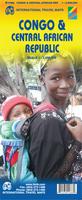
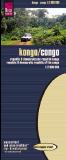
Sample detail #1 from the Congo Travel Map
Sample detail #2 from the Congo Travel Map
Ordering Congo & DR Congo road map (ITMB)64-429011 sheet, folded$12.95


Congo General/Physical Map (République populaire du Congo). 1:1,000,000. IGN, France, 1993. Shaded relief map; in French. Also serves as a good road map.
Sample #1 of the map detail.
Sample #2 of the map detail.
Ordering Congo--Travel Map. (IGN)64-4250Each, folded$16.95


Congo Road Map
Dem. Rep. Congo & Rep. Congo Travel Map. 1:2,000,000. Reise Know-How, 2007. This map covers both the Dem. Republic of the Congo (formerly Zaire) and the Republic of Congo. It is a detailed road map printed on waterproof and tear-resistant synthetic paper (Polyart). The map shows elevation with contour lines and elevation tinting. In German with multilingual legend.
Ordering Congo road map (Reise)65-57903Each, folded$15.99


Congo Atlas (Atlas du Congo). Editions Jaguar, 2001. Good, basic, thematic atlas which shows overview of economy, people and physical characteristics of the land. Includes text, photos, maps and charts. In French, 62 pages.
Ordering Congo Atlas (Jaguar) -64-42481Atlas$24.95


Congo Topographic Quadrangle Maps (TPC/Tactical Pilotage Charts). 1:500,000. NGA. World Aeronautical Charts, including TPC and ONC charts, cover land areas at a standard size and scale for navigation by aircraft operating at high altitudes. However, their level of detail makes them useful as topographic maps for those areas where little else is available. The topographical information includes city tints, principal roads, railroads, distinctive landmarks, drainage patterns, topography and relief. contour lines are at 500 feet intervals, with intermediate contours where appropriate, along with numerous spot heights. Color tints on a hypsometric scale are also shown. The aeronautical information includes visual and radio aids to navigation, airports, airways, restricted areas, obstructions and other pertinent data. There is less detail in some areas due to insufficient information - these areas are labelled on the charts. These are large maps, with a typical size of 42 x 56 inches. Due to the size and color variation of the different print runs and the Conformal Conic Projection, these maps do not splice together well. World Aeronautical Charts are not recommended for use by pilots of low speed, low altitude aircraft.
Index showing sheet coverage
Sample from this series (image is from a sheet covering Korea)

TPC 1:500,000 Charts
Ordering TPC Chart--Sheet M03B67-1055-M03BTPC Chart M03B. Congo/D.R. Congo/Gabon. South 0°-4°, East 13°-19°.$34
Ordering TPC Chart--Sheet M03C67-1055-M03CTPC Chart M03C. Angola/Congo/D.R. Congo. South 4°-8°, East 13°-19°. Print-on-demand color plot.$34
Ordering TPC Chart--Sheet M03D67-1055-M03DTPC Chart M03D. Angola/Congo/D.R. Congo. South 4°-8°, East 7°-13°.$34


ONC 1:1,000,000 Charts
Ordering ONC chart--sheet L-367-1056-L03ONC Chart L03. Africa. North 0°-8°, East 8°-16°.$34


Congo Geologic Map. 1:1,000,000. Ministry of Mines & Energy (South Africa). 1992 (1995). 1 sheet, in color, with legend in the margins. In French.
Ordering Congo--Geologic Map. 1:1M 199564-42011 set, folded$100.00


Congo Metallogenic Map of the Republic of Congo. 1:1,000,000. Ministry of Mines & Energy (South Africa). 1994. 1 sheet, in color.
Ordering Congo--Metallogenic map  1:1M.64-42401 sheet, folded$100.00


Congo Flags
Ordering Flag-Congo67-1070CONCongo flag, small. Size 4 x 6 in.$3.99
Ordering Congo flag.  2 x 367-1073CONCongo flag, large. Size 2 x 3 ft.$49.95


image


© Copyright 2025 East View Companies, Inc.
5130 Industrial Street, Suite 100, Maple Plain, MN 55359-8005
All Rights Reserved
For more information please Contact Us