|
|
N'Djamena city map. Scale approx. 1:14,080. FAIM/PS, 1986. This is a simple 8 x 10" inch black/white map of central N'Djamena. Also included is a color 5 x 4-1/2" sketch map of all of N'Djamena.
Chad Topographic MapsChad 1:200,000 Topographic Quadrangle Maps. 1:200,000. Russian government. High quality topographic maps with good detail. Complete coverage of Chad in 194 sheets. In Russian. 1:50,000 Topographic Map of the Chad Basin. 1:50,000. OS. These maps are vintage 1960's, but are the only detailed mapping available for the region.
TPC 1:500,000 Charts
ONC 1:1,000,000 Charts.
|
||||||||||||||||||||||||||||||||||||||||||||||||||||||||||||||||||||||||||
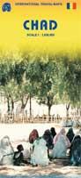
 Chad Maps
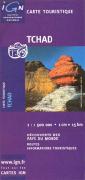
 Sample of the map detail
 Sample of the map detail
 Index showing sheet coverage
 Sample from this series (image is from a sheet covering Korea)
 Chad Flags