Cameroon/Gabon Travel Map. 1:1,500,000. ITMB. A good shaded relief travel map that covers both Cameroon and Gabon. Cameroon is one of the most interesting countries in West Africa to visit. The far north has lava outcrops and unusual villages, the centre is excellent agricultural land, and the south is steamy tropical forest. The legend includes international boundaries, roads by classification, distance between points, national parks, lakes, rivers, contours, airports, places of interest, campsites, churches, and other information.
64-5890
Each, folded
$12.95
Waterproof! Cameroon/Gabon Road Map. 1:1,300,000. Reise Know-How. This double-sided map combines topographic mapping with road and tourist information. The map has an index of place names, a 30' latitude/longitude grid, and names of major towns are given in both Latin script and Cyrillic. The map shows six different types of roads, highlighting scenic routes, places of interest, archaeological sites, monasteries, monuments and viewpoints. Size is 70 x 100 cm. In German with multilingual legend.
64-25902
1 sheet, folded
$15.99
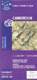
Cameroon Travel Map. IGN, France. General road map with a large number of small villages and settlements indicated. Relief shading indicates the terrain, showing forested areas, the savanna, swamps, and places liable to flooding. Road network shows which secondary roads are passable only during the dry season and highlights scenic routes. Other information includes railways, gas stations, accommodation, hospitals, post offices, as well as places of interest.
The map also includes small insets showing the surroundings of Yaoundé and Douala. Latitude and longitude are shown in the margins at intervals of 2 degrees and idicated by ticks on the map itself. The legend is in French and English.
64-2591
1 sheet, folded
$16.95
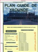
Cameroon City Maps. Cameroon. City street maps by the Cameroon Survey. These are not the most detailed maps, and dates range from 1987 to 2008, but they are the best that is available as paper maps. In French.
Sample detail from a Cameroon city map.
64-2592BA
Bamenda city map. 1:10,000. 2006.
$29.99
64-2592DO
Douala city map. 1:10,000. 2000/2002.
$29.99
64-2592EB
Ebolowa city map. 1:10,000. 1990.
$29.99
64-2592MA
Maroua city map. 1:10,000. 1987.
$29.99
64-2592YA
Yaounde city map. 1:15,000. 2008.
$29.99
Cameroon Topographic Maps
Cameroon 1:200,000 Topographic Maps. 1:200,000. France IGN. 1960's-1970's. These maps, although dated, are the best topographic maps available in a non-cyrillic language. 52 sheets offer complete coverage. Available as digital raster files only, not as original paper. In French. When ordering, please specify the sheet number in the "comments" section of the check-out form.
Sketch map showing available sheets Sample detail from a French Cameroon topographic map.
64-2565
Specify sheet number
$19.99
64-2565S
Set of 55 sheets.
$824.59
Cameroon 1:200,000 Topographic Maps. 1:200,000. Soviet Military. 1960's-1980's. These maps, although dated, offer the most detailed topographic coverage available for Cameroon. The maps are in cyrillic (Russian).
Sample detail from a Soviet Cameroon topographic map.
64-25509
Specify area
$19.99
64-2551
Set, 77 sheets
$924.00
Cameroon Topographic Maps - TPC/Tactical Pilotage Charts & ONC/Operational Navigation Charts. 1:500,000 & 1:1,000,000. NGA. Standard topographic maps of Sudan are restricted by the Angolans. World Aeronautical Charts, including TPC and ONC charts, cover land areas at a standard size and scale for navigation by aircraft operating at high altitudes. However, their level of detail makes them useful as topographic maps for those areas where little else is available. The topographical information includes city tints, principal roads, railroads, distinctive landmarks, drainage patterns, topography and relief. contour lines are at 500 feet intervals, with intermediate contours where appropriate, along with numerous spot heights. Color tints on a hypsometric scale are also shown. The aeronautical information includes visual and radio aids to navigation, airports, airways, restricted areas, obstructions and other pertinent data. There is less detail in some areas due to insufficient information - these areas are labelled on the charts. These are large maps, with a typical size of 42 x 56 inches. Due to the size and color variation of the different print runs and the Conformal Conic Projection, these maps do not splice together well. World Aeronautical Charts are not recommended for use by pilots of low speed, low altitude aircraft.
Index showing sheet coverage Sample from the TPC series (image is from a sheet covering Korea) Sample from the ONC series (image is from a sheet covering Korea)
67-1055-K03b
TPC Chart K03B. Cameroon/Chad/Nigeria. North 12°-16°, East 13°-19°.
$34
67-1055-K03C
TPC Chart K03C. Cameroon/Chad/Nigeria. North 8°-12°, East 13°-19°.
$34
67-1055-K03D
TPC Chart K03D. Cameroon/Nigeria. North 8°-12°, East 7°-13°.
$34
67-1055-L03A
TPC Chart L03A. Cameroon/Nigeria. North 4°-8°, East 6°-12°.
$34
67-1055-L03B
TPC Chart L03B. Cameroon/Central African Republic/Chad/Nigeria. North 4°-8°, East 12°-18°.
$34
67-1055-L03B
TPC Chart L03D. Cameroon/Central African Republic/Chad/Nigeria. North 0°-4°, East 6°-12°.
 Cameroon Maps
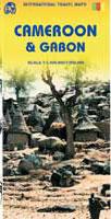


 Waterproof!


 Sample detail from a Cameroon city map.
 Cameroon 1:200,000 Topographic Maps. 1:200,000. France IGN. 1960's-1970's. These maps, although dated, are the best topographic maps available in a non-cyrillic language. 52 sheets offer complete coverage. Available as digital raster files only, not as original paper. In French. When ordering, please specify the sheet number in the "comments" section of the check-out form.
 Sketch map showing available sheets
 Sample detail from a French Cameroon topographic map.
 Cameroon 1:200,000 Topographic Maps. 1:200,000. Soviet Military. 1960's-1980's. These maps, although dated, offer the most detailed topographic coverage available for Cameroon. The maps are in cyrillic (Russian).
 Sample detail from a Soviet Cameroon topographic map.
 Index showing sheet coverage
 Sample from the TPC series (image is from a sheet covering Korea)
 Sample from the ONC series (image is from a sheet covering Korea)
 Cameroon Flags