|
|
Burkina Faso 1:50,000 Topographic Maps. IGN, France, late 1980's. Official French topographic maps for Burkina Faso. 54 sheets are currently available. In French. Color plots.
Burkina Faso (Upper Volta) 1:200,000 Topographic Quadrangle Map Set. 1:200,000. Soviet government. High quality topographic maps for a country where little else is available. This set of 54 sheets gives complete coverage of Burkina Faso. In Russian.
|
||||||||||||||||||||||||||||||||||||||||||||||||||||||
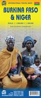
 Burkina Faso Maps
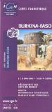
 Sample of the map detail
 Sample detail of the Burkina Faso road map
 Sample detail of the Ouagadougou map
 Thumbnail image of the Bobo-Dioulasso map
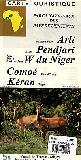


 Index showing sheet coverage
 Sample from the TPC series (image is from a sheet covering Korea)
 Sample from the ONC series (image is from a sheet covering Korea)
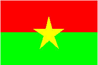
 Burkina Faso Flags