Bhutan - The land of the Thunder Dragon (Shaded Relief Map). 1:390,000. Nepa/Himalaya Map House, Kathmandu. This is a political map with tourist information added. The map shows the numerous, and large, national parks and the main administrative boundaries. The map uses symbols to show fortresses, monasteries, chortens (Buddhist monuments), broadcasting stations, airports, locations of telephones, post offices, mountain passes, etc. The map does not have any elevation information. There is a 1° lat-long grid, plus an alphanumeric grid for the places index included on the map. This same map, in a physical map version is available as 64-21902 below. Size is 87 x 58cm.
64-21901
1 sheet, folded.
$16.99
Bhutan: Himalaya Trekking Map. 1:390,000. Nepa/Himalaya Map House, Kathmandu. This is the same basic map as 64-21901 above, except as a physical map. The map shows the numerous, and large, national parks and three levels of road classification. The map uses symbols to show fortresses, monasteries, chortens (Buddhist monuments), broadcasting stations, airports, locations of telephones, post offices, mountain passes, etc. The map does not have any elevation information. There is a 1° lat-long grid, plus an alphanumeric grid for the places index included on the map. Size is 87 x 58cm.
64-21902
1 sheet, folded.
$26.99
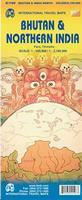
Bhutan & Northern India Travel Map. 1:380,000 & 1:2,100,000. ITMB. A decent map of Bhutan, fully indexed. Shaded relief shows elevation. This new edition has northern India at 1:2,100,000 on the reverse side.
Sample #1 of the Bhutan travel map Sample #2 of the Bhutan travel map
64-2191
1 sheet, folded
$12.95
Bhutan Himalaya Map. 1:500,000. Swiss Foundation for Alpine Research. No date. A simple two-color shaded relief map of Bhutan showing roads and paths. An older map, but useful as it shows the elevation terrain well without nearly the clutter and overprint of a tourist map. It is not usable as a travel/tourist map though.
64-2170
1 sheet, folded
$39.99
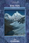
Bhutan Hiking Guide. Cicerone Guides, 2007. With 27 treks of between 2 to 24 days in length, this guide offers a unique perspective to trekking through Bhutan. A thorough introduction offers advice on preparation and fitness, when to go and how to get there, trekking in Bhutan as well as the people and culture of this country.
The guide includes:
All the stunning trails, accompanied by full route information
Information on preparation, health issues, permits and local culture
Bhutan 1:200,000 Topographic Quadrangle Map Set. 1:200,000. Soviet government. High quality topographic maps with good detail. 10 sheets give complete coverage of Bhutan. In Russian.


 Sample #1 of the Bhutan travel map
 Sample #2 of the Bhutan travel map
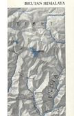
 Overview map showing all of the described hikes.
 Sample of the overview map for a specific hike.