Barbados Maps and Guidebooks


  • Barbados Travel Maps
  • Barbados Topographic Maps
  • Barbados Flags

Barbados Travel and City Maps


Barbados street atlas
Barbados Street Atlas. Scales range from 1:2,500 to 1:10,000. Skyviews, 1st edition, 2009. With more than 200 pages Skyviews' road atlas of Barbados features over 2,000 street names, districts and bays, and a business section listing places of interest, restaurants, businesses of all types and accommodation on the island. Full colour satelite imagery of the whole island serves as the base map with streets highlighted in bright colors. This offers easy navigation with precise road names. We bring to you the first ever Atlas of Barbados! Size is 9 x 12 inches, softcover.

  • 1:2,500 maps cover major towns and the southwest coast.
  • 1:5,000 maps cover the western and southern coast.
  • 1:10,000 maps cover the entire island.
  • Satellite images serve as base maps
  • Five classifications of roads are shown in different colors/styles.
  • Locations of tourist sites and services are shown using symbols.
  • Street names, one way streets, districts, villages, historical sights, beaches, bays, restaurants and utilities are shown.
    Sample detail from the Barbados street atlas.
    Ordering Barbados road atlas (Skyview)64-1888Atlas.$34.99


    Barbados travel map
    Barbados Travel Map. 1:40,000. ITMB, 2011. A new map of this popular travel destination at an excellent scale, with an inset map of Bridgetown. In addition to showing the roads that criss-cross the island and lead to such interesting villages as Glebe Land, Mile and a Quarter, and Mose Bottom, the map shows all known resort hotels, beaches, dive sites, and historic country manor houses. Barbados is a very friendly island, with its historic capital of Bridgetown providing a 'touch' of old Britain, while providing the best shopping in the Caribbean. Printed on paper, single-sided. I:SBN 9781553411253.
    Sample detail of the Barbados travel map.
    Ordering Barbados Road Map (ITMB)64-189011 sheet, folded.$12.95


    Barbados Topographic and Road Map. 1:50,000. 1993. Barbados Lands & Survey Dept. DOS418. This map offers basic topographic and tourist information on Barbados. We have limited stock of this out-of-print map.
    Ordering Barbados Topographic Map64-18501 sheet, color plot$19.95


    (Barbados) Bridgetown & Environs City Map. 1:5,000. OSD. 1999. Large single-sided map showing good detail of the city. Main streets are named while smaller streets are shown but not named. Building footprints are shown. Public buildings such as churches, medical facilities, government offices, hotels, etc. are shown and named. An index is included for these public buildings, but not for the street names.
    Ordering Barbados--Bridgetown city map64-18921 sheet, folded.$18.95


    Barbados guidebook Barbados DIRECTIONS Guide. Rough Guides.
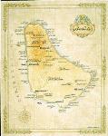
  • Focusing on islands, cities, and resort regions, DIRECTIONS Guides are richly illustrated, with a third of each guide in full color. Slim, stylish, and pocket-sized, they are Rough Guides 'lite', but no less up-to-date, accurate, informative, and reliable.
  • Mini-CD: Featuring a mini-CD in each guide which contains a pdf of every page in the guide, completely searchable, plus 100s of live web links to help plan your trip online. Usable in PC, Mac, Palm, Pocket PC.
  • Ideas: 48-64 pages of full-color inspiration and ideas, theme by theme.
  • Places, accommodation and essentials: 120-192 pages of concise, district-by-district coverage, with photos, maps and listings; hotels and other lodgings; and info on arrival, transport, opening hours and other essentials.
  • Language: 8 pages; pronunciation, phrases, food and drink.

    Rough Guide DIRECTIONS Barbados fits neatly in your pocket and is packed with ideas for making the most of your trip to this to this dazzling island. Full-colour throughout, the guide highlights the best the island have to offer - from the eerie rock formations of Harrison’s Cave to cocktails at Sandy Lane - helping you to decide what to do, 24 hours a day. Use the practical 'Places' section of the guide to explore the island, every attraction, walk, restaurant, hotel, bar and beach is given a review and organised by geographical area so you always know what's immediately around you and what's worth making a special trip to see.
    Ordering Barbados Directions guidebook (RG)64-1896BRDBarbados Directions Guide. 160 pages. 1-84353-320-0. $10.99


    Barbados wall map
    Barbados wall map. 28 x 23".
    A British colony since 1652, Barbados achieved its independence in 1966. It is the easternmost islands of the Lesser Antilles chain with a lush, gently rolling landscape. The island's 430 square miles are home to 255,000 people and its capital is Bridgetown. Sugar, molasses and rum are the foundation of the economy, along with a growing tourist industry.
    Ordering Barbados wall map (1-Treas.)64-18461 sheet, rolled.$25.00
    Ordering Barbados One Treasure map - de64-1846DDeluxe frame$275.00
    Ordering Barbados One Treasure map64-1846SStandard frame$224.99


    Barbados Topographic Maps


    Barbados Topographic Map. 1:50,000. 1993. Barbados Lands & Survey Dept. DOS418. This map offers basic topographic and tourist information on Barbados. We have limited stock left of this out-of-print map.
    Ordering Barbados Topographic Map64-18501 sheet, color plot$19.95


    Barbados Topographic Quadrangle Map. 1:10,000. 1986. DOS (218/1). This series offers complete coverage in 12 sheets. For ordering individual sheets or digital quads, please look at the index to figure out which sheet(s) you need and then order them using the "Each, specify area" order button below. On the order form, specify the sheet number in the "Comments" section of the check-out/order form.
    Index map.
    Ordering Barbados--Topographic Map64-1852Each$18.95
    Ordering Barbados 1:10,000 topo set: ITEMIZE64-1852SSet of 12 sheets$191.04


    Barbados Parish Boundaries Map. 1:50,000. OSD (2960). 1989.
    Ordering Barbados Parish boundaries map64-18701 sheet, rolled$9.99


    Barbados Electoral Boundaries Map. 1:50,000. OSD (2963). 1990. Single sheet that covers the entire island.
    Ordering Barbados Electoral Boundaries64-18711 sheet, rolled$9.99


    (Barbados) Bridgetown Area Electoral Boundaries Map. 1:15,000. OSD (2964). 1990. Single sheet that covers the Bridgetown area. This is a companion sheet to 64-1871 above.
    Ordering (Barbados) Bridgetown Elector64-18721 sheet, rolled$9.99


    Barbados Flags


    Barbados Flags
    Ordering Barbados  flag.  8 x 12"67-1071BARBarbados flag, medium. Size 8 x 12 in.$9.95
    Ordering Barbados flag.  2 x 367-1073BARBarbados flag, large. Size 2 x 3 ft.$59.95


    image


  • © Copyright 2025 East View Companies, Inc.
    5130 Industrial Street, Suite 100, Maple Plain, MN 55359-8005
    All Rights Reserved
    For more information please Contact Us