|
|
Bangladesh Transport Network Map. 1:1,000,000. Graphosman, Bangladesh. 1996. A basic travel map of the country. We currently have a good supply of these new, difficult-to-obtain maps.
Chittagong Tourist Map. Approx. 1:31,500. Graphosman. 1998. A good basic city map of Chittagong City. The map shows main roads, police stations, hospitals, railway, etc. Details of the three major residential areas are in the margins. The reverse side has a basic map of the Chittagong Division, including major roads, railways, district headquarters, etc.
Dhaka City Guide Map. 1:33,300. n.d. Graphosman. This road map of Dhaka does not label all the roads. It does label major roads and landmarks such as schools, hospitals, mosques, libraries, museums... This map is indexed. 80 x 54 cm. No ISBN.
Dhaka Tourist Map. 1:20,000. n.d. Parjatan Corporation. This map is simple and easy-to-read. The places of interest and major roads are indexed. There is descriptive text and pictures on the reverse. Two sided. 83 x 55 cm. No ISBN.
Bangladesh Political and Physical MapsBangladesh Political Map. 1:1,000,000. n.d. Graphosman. English. This is a political map of Bangladesh. It shows boundaries of Divisions, Districts and Thanas. Mapped are the headquarters of these political divisions. This map shows infrastructure such as roads, railroads and airports. 72 x 49 cm. No ISBN.
Bangladesh Political Map. 1:1,000,000. n.d. Graphosman. English. This is a political map of Bangladesh with less detail and bolder print than the one above. It shows boundaries of Divisions and Districts but not Thanas. The bolder text makes it easier to read at a distance and better for presentations where less information is sufficient. This map also shows infrastructure such as roads, railroads and airports. 72 x 49 cm. No ISBN.
Barisal Division Map. 1:200,000. 1994. Graphosman. This is an excellent political map of the Barisal Division. The print is bold and the colors are sharp. Division, District, Thana and Union boundaries are shown as well as roads and other infrastructure. Map includes tables of demographic data. 95 x 69 cm. No ISBN.
Bangladesh Sylhet Division Map. 1:250,000. 1994. Graphosman. This is an excellent political map of the Sylhet Division. The print is bold and the colors are sharp. Division, District and Thana boundaries are shown as well as roads and other infrastructure. Map includes tables of demographic data. 56 x 70 cm. No ISBN.
Bangladesh Physical Map. 1:1,000,000. 1992. Published by Graphosman with the courtesy of Bangladesh Director General. English. This is a simple physical map which shows three tracts of bedrock and the primary landform, alluvial plain. It is also a political map showing International and Division boundaries. 72 x 49 cm. No ISBN.
Bangladesh Topographic Maps
Bangladesh Geological and Thematic MapsBangladesh--Geologic Map. 1:1,000,000. GSB. 1990. Map includes text and 2 ancillary maps in margin.
Bangladesh Bouguer Gravity Map. 1:1,000,000. GSB. 1990. Map includes text in margin.
Bangladesh Natural Hazards Map Set of 6 sheets. 1:1,000,000. 1992. Published by Graphosman with the courtesy of Bangladesh Director General. English. These maps are all printed over the same political base map which shows International, Division, District and Thana boundaries. This set contains the following 6 thematic maps:
(Bangladesh) Rivers of Bangladesh. 1:1,000,000. 1992. Published by Graphosman with the courtesy of Bangladesh Director General. English. This is a simple map of the rivers of Bangladesh. It is also a political map showing International and Division boundaries. 72 x 49 cm. No ISBN.
|
|||||||||||||||||||||||||||||||||||||||||||||||||||||||||||||||||||||||||||||||||||||||||||||||||||||||||||||||
 Bangladesh Maps


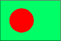
 Bangladesh Flags