Across the Eastern Alps - The E5 Trail. 2007. Launched on the shores of beautiful Lake Constance, this well-established long-distance European pathway (600km) takes 30 days to make its way through a remarkable kaleidoscope of landscapes and culture spanning rural alpine regions in Germany, Switzerland, Austria and Italy.
Passes as high as 2900m above sea level are crossed en route to the northern Italian city of Bolzano. Gentler gradients follow as the E5 bears south parallel to the mighty Adige river through the Lagorai, Pasubio and Lessini groups. The final destination is marvellous Verona, romantic city par excellence.
A well-organised network of alpine refuges and cosy guesthouses welcome walkers along the route, and convenient transport links make it possible to join or leave the trek at virtually every stage to fit in with individual holiday needs.
Traverses the Allgauer, Lechtaler and Ötztaler Alps
Visits spectacular geological sites and First World War remains
Can be easily split into shorter stages
The author recommends the two 1:50,000 Kompass maps (see below) for the entire trail. These two maps are also available as a spiral-bound hiking atlas. He also recommends additional maps at various scales for more detail on specific parts of the trail (see below).
Map showing the trail route Sample of a trail description and strip map
66-22951E5
Guide
$28.95
Author-recommended Hiking Maps for the entire trail:
66-2273-X120
Fernwanderweg E5 North sheet. 1:50,000. Kompass #120.
$13.99
66-2273-X121
Fernwanderweg E5 South sheet. 1:50,000. Kompass #121.
Stages 11-13: Val Passiria. 1:25,000. Tabacco #039.
$15.99
64-8275-11
Stage 14: Merano e dintorni/Meran und Umgebung. 1:25,000. Tabacco #011.
$15.99
64-8275-34
Stages 15-16: Bolzano-Renon-Tschögglberg (St Jakob to Deutschnofen only). 1:25,000. Tabacco #034.
$15.99
64-8275-29
Stages 15-16: Sciliar/Schlern (Bozen to Oberraden). 1:25,000. Tabacco #029.
$15.99
South Eastern Europe Rock Climbing Atlas. Rocks Unlimited, 2006. Enjoy the hospitality of the Bulgarians and climb high quality routes at crags where yearly international competitions are held. Climb well-bolted, 300m high, multi-pitch routes in Croatia. Check out the climbing in the old abandoned quarries of Hungary. Share your experience with other climbers at the various crags of picturesque Macedonia. Travel back in time to Romania and surprise yourself with outstanding, well protected, climbing routes. Check out the climbing in Slovenia, Europe's top-spot for for extreme sports.
Index of coverage Detailed information about each crag:
Number of routes
Level of difficulty
Quality of bolting
Face direction & weather suitability
Family friendliness
Necessary information about each climbing area:
How to get there and how to move around
Where to stay
Where to find the local climbing guidebook
Other things to see & do on rest days
Relevant information and facts about each country: climate, costs of travelling, accommodation, food, etc..
Clear maps and route descriptions to each crag with the GPS waypoints of the parking and the location of the crags.
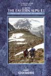
 Map showing the trail route
 Sample of a trail description and strip map
 Index of coverage