Click here for our complete cycling maps listings for the USA and Europe.
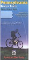
Pennsylvania Bicycle Trails Map. American Bike Trails. This map covers over 180 bike trails in Pennsylvania. It includes a trail to map index, city & county-to-trail index, lat/long coordinates, facts on each trail (length, surface, description, etc.), trail settings, trail facilities, etc. This series of maps offers full state coverage of several mid-western & eastern states.
Sample from the Ohio map in the same series
62-9085
1 sheet, folded
$7.95
Pennsylvania Bicycle Trails Guidebook. American Bike Trails. Where to bike on over 50 off-road trails throughout Pennsylvania, both surfaced and Mountain Biking.
Features Include:
Directions to Trail Sites and Accesses
Trail Distances, general setting and conditions
Points of Interest
Sectional overviews
Riding Tips
Contacts for Additional Information
Alternate Trails and Uses
Nearby Facilities and Activities
62-9087
Guide
$16.95
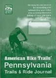
Pennsylvania Bicycle Trails & Ride Journal. American Bike Trails. An easy-to-use journal for recording your notes and rides for each trail. Trail information includes directions, descriptions, lengths, trail surface, facilities, and much more.
62-9086
Journal
$9.95
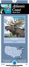
Atlantic Coast Route
Atlantic Coast Route Series. Adventure Cycling Association. 2,525 miles -- Adventure Cycling's Atlantic Coast
route, from Bar Harbor, Maine, to Ft. Myers Beach, Florida, takes you through a region rich in history. The route passes directly through Washington, D.C. and Richmond, and is linked with spurs to Boston,
New York, Philadelphia, Baltimore, Charleston and Savannah. The Florida Connector map offers a tranquil side trip from St. Augustine to Ft. Myers Beach via the Orlando area, then on to Ft. Lauderdale, bypassing the busy A1A coastal route.
Route map.
62-2230-AC
Bar Harbor, ME to Ft. Myers Beach, FL. Set of 8 maps. 10% discount!
$120.60
62-2230-AC1
Bar Harbor, ME to Windsor Locks, CT
$16.75
62-2230-AC2
Windsor Locks, CT to Norristown, PA
$16.75
62-2230-AC3
Norristown, PA to Richmond, VA
$16.75
62-2230-AC4
Richmond, VA to Wilmington, NC
$16.75
62-2230-AC5
Wilmington, NC to Statesboro, GA
$16.75
62-2230-AC6
Statesboro, GA to St. Augustine, FL
$16.75
62-2230-AC7
St. Augustine to Key West, FL
$16.75
62-2230-AC8
Florida Connector map - St. Augustine, DisneyWorld, Ft. Myers Beach, to Ft. Lauderdale.
$16.75
Northern Tier Route
Northern Tier Route Series. Adventure Cycling Association. 4,315 miles -- From the Puget Sound to fishing villages in Maine, the Northern Tier crosses three mountain ranges - the Cascades, Rockies and
Adirondacks. Along the way the route passes through Glacier National Park, the headwaters of the Mississippi and Amish country. Discover the beauty of America by crossing the country on the Northern Tier.
Route map.
62-2230-NT
Anacortes, WA, to Bar Harbor, ME. Set of 11 maps. 10% discount!
$165.82
62-2230-NT01
Anacortes, WA, to Sandpoint, ID
$16.75
62-2230-NT02
Sandpoint, ID, to Cut Bank, MT
$16.75
62-2230-NT03
Cut Bank, MT, to Minot, ND
$16.75
62-2230-NT04
Minot, ND, to Fargo, ND
$16.75
62-2230-NT05
Fargo, ND, to Grand Rapids, MN
$16.75
62-2230-NT06
Grand Rapids, MN, to Stillwater, MN
$16.75
62-2230-NT07
Stillwater, MN, to Muscatine, IA
$16.75
62-2230-NT08
Muscatine, IA, to Monroeville, IN
$16.75
62-2230-NT09
Monroeville, IN, to Lackawanna, NY
$16.75
62-2230-NT10
Lackawanna, NY, to Ticonderoga, NY
$16.75
62-2230-NT11
Ticonderoga, NY, to Bar Harbor, ME
$16.75
Pittsburgh Connector Route
Pittsburgh Connector Trail Map. Adventure Cycling Association. This 152.5-mile spur connects Pittsburgh, Pennsylvania, to the Underground Railroad Bicycle Route and the Northern Tier Route at Erie, Pennsylvania. The route begins at the Senator John Heinz History Center and quickly crosses the Allegheny River to the 3.5 mile North Shore Trail. Across the water, cyclists have a view of Point State Park, the tip of Pittsburgh's "Golden Triangle" where the Allegheny and Monongahela rivers join. Cyclists continue along the North Shore trail which borders the shores of the Ohio River and takes them through the most urban section of the route. Underground Railroad sites, historic markers and museums dot the route with the highest concentrations in Pittsburgh and Mercer. Rolling hills make up the terrain in western Pennsylvania but most of the route is on fairly low-level traffic rural roads and highways.
Sketch map of the route.
62-2230-PIC
1 sheet, folded.
$24.99
Underground Railroad Bike Route
Historic Underground Railroad Bike Route. Adventure Cycling Association. Mobile, AL to Owen Sound, Ontario. 2058 miles. The Underground Railroad Bicycle Route honors the bravery of those that fled bondage and those that provided shelter. This route passes points of interest and historic sites along a 2,100-mile corridor. Beginning in Mobile, Alabama - a busy port for slavery during the pre-civil war era - the route goes north following rivers through Alabama, Mississippi, Tennessee, and Kentucky. Waterways, as well as the North Star, were often used by freedom seekers as a guide in their journeys to escape slavery.
Upon crossing into Ohio, the route leaves the river to head inland toward Lake Erie and enters Canada at the Peace Bridge near Buffalo, New York. In Ontario, the route circumvents the shores of Lake Ontario and ends at Owen Sound, a town founded by freedom seekers 150 years ago.
Route map.
62-2230-UR
Mobile, AL to Owen Sound, Ontario. Set of 5 maps. 10% discount!
 Sample from the Ohio map in the same series

 Route map.
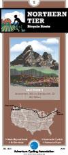
 Route map.
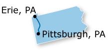
 Sketch map of the route.
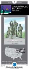
 Route map.


