Oregon is crossed by four very popular long-distance trail - each has a set of detailed cycling maps for that trail. The trails are the Pacific Coast Trail, the Lewis & Clark Trail, the Sierra Nevada Trail, and the TransAmerica Trail. We also have three single-sheet cycling maps of the state.
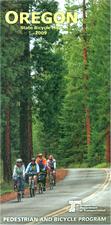
Oregon State Bicycle Map. Oregon Dept. of Transportation, 2009. This free map offers cyclists an overview of the cycling routes in Oregon. The main map covers all of Oregon with the main roads and highways showing how much, if any, shoulder is available for riding. Fourteen safety tips and bike law blurbs are in one margin. The reverse side of the map has a more detailed map of the Willamette Valley. It has inset maps showing the traffic volume of roads throughout the state - useful for planning your routes to avoid traffic. There are seven route elevation profiles, a small inset climate map, mileage table, general tourist info aimed at cyclists, etc.
NOTE: The map is free, but shipping is charged if ordered by itself.
Sample detail of the Oregon Bicycling Map
Oregon Coast Bicycle Map. Oregon Dept. of Transportation, 2011. This free map offers cyclists an overview of the cycling routes along the spectacular Oregon coast. The map shows traffic information, preferred routes, tourist sites, and much more.
NOTE: The map is free, but shipping is charged if ordered by itself.
Sample detail of the Oregon Bicycling Map
Columbia River Gorge Bike Map. Oregon Dept. of Transportation, 2004. This is a very useful cycling map/guide to the Columbia River Gorge, giving information on the three main routes for cyclists, traffice hazards, recommended stops, museums, and much more.
NOTE: The map is free, but shipping is charged if ordered by itself.
Sample detail of the Oregon Bicycling Map
62-8972-CO
1 sheet, folded.
$5.00
Lewis & Clark Trail Route
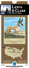
Lewis & Clark Bicycle Trail. Adventure Cycling Association. 4,618 miles. Since 1998, Adventure Cycling Association has been compiling a new and ambitious set of bicycling maps following the route of Lewis and Clark. The Lewis & Clark Bicycle Trail was born of a desire to offer bicyclists a way to celebrate the bicentennial anniversary of the Corps of Discovery's journey, which began in 1804.
The Lewis & Clark Bicycle Trail's 4,618 miles cross nine mountain passes, pass through four national parks and monuments, overlook dozens of rivers in addition to the Missouri and the Columbia, and promise you views of bison, elk, deer, antelope and other wildlife. The Trail will be the best possible way to experience the magnificent landscapes witnessed by Lewis and Clark: all of the sense of wonder, all of the adventure, but a lot less inconvenience and hardship.
Our main 1804 westward route of Lewis and Clark is 3,254 miles in length, but overall the maps will cover 4,618 miles. The maps have been divided into eight sections covering both the westbound and eastbound routes taken by the Corps. There will be some mountain biking options available. Services are sometimes few and far between, making this one of our most challenging routes.
Route map.
62-2230-LCS
Hanford, IL to Astoria, OR & back. Set of 8 maps. 10% discount!
$120.60
62-2230-LC1
Hartford, IL to Council Bluffs, IA (555 miles).
$16.75
62-2230-LC2
Council Bluffs, IA to Pierre, SD (485.5 miles).
$16.75
62-2230-LC3
Pierre, SD to Williston, ND (510.5 miles).
$16.75
62-2230-LC4
Williston, ND to Great Falls, MT (538.5 miles).
$16.75
62-2230-LC5
Great Falls, MT to Missoula, MT (479.5 miles).
$16.75
62-2230-LC6
Missoula, MT to Clarkston, WA (242.5 miles), Lolo Trail (145.3 miles), Blackfoot Option (187.5 miles).
$16.75
62-2230-LC7
Clarkston, WA to Astoria, OR (442.5 miles).
$16.75
62-2230-LC8
Three Forks, MT to Williston, ND (506 miles).
$16.75
Pacific Coast Route
Pacific Coast Route. Adventure Cycling Association. 1,830 miles - The Pacific Coast Bicycle Route follows the scenic West Coast from Vancouver, BC to Imperial Beach, California. Breathtaking cliffs,
redwood forests, lighthouses, beaches, and a rugged coastline make this a very popular route. Discover the variety of terrain and culture to be found between Canada and Mexico.
Route map.
62-2230-PC
Pacific Coast Route, 5 maps. 10% discount!
$75.37
62-2230-PC1
Vancouver, B.C., to Astoria, OR
$16.75
62-2230-PC2
Astoria, OR, to Crescent City, CA
$16.75
62-2230-PC3
Crescent City, CA, to San Francisco, CA
$16.75
62-2230-PC4
San Francisco, CA, to Santa Barbara, CA
$16.75
62-2230-PC5
Santa Barbara, CA, to Imperial Beach, CA
$16.75
Sierra-Cascades Bicycle Trail
Sierra-Cascades Bicycle Trail. Adventure Cycling Association. The Sierra Cascades Bicycle Route runs roughly parallel to the Pacific Crest Trail along the Cascade Range and Sierra Nevada from the Canadian border to the Mexican border. Sumas, WA to Tecate, CA; 5 map set (2,389 mi.)
Sierra-Cascades Route sketch map.
62-2230-SC
Sierra-Cascades Route; San Francisco, CA to Yorktown, VA. Set of 10 maps. 10% discount!
$75.37
62-2230-SC1
Sumas, WA to Mt. Rainier NP, WA (447.0 mi.).
$16.75
62-2230-SC2
Mt. Rainier NP, WA to Crater Lake NP, OR (445.9 mi.).
$16.75
62-2230-SC3
Crater Lake NP, OR to Truckee, CA (455.6 mi.).
$16.75
62-2230-SC4
Truckee, CA to Lake Isabella, CA (554.3 mi.).
$16.75
62-2230-SC5
Lake Isabella, CA to Tecate, CA (486.2 mi.)
$16.75
TransAmerica Bicycle Trail
TransAmerica Bicycle Trail. Adventure Cycling Association. 4,245 miles - The route that made cross-country cycling famous (Outside Magazine calls the TransAmerica the "ultimate bicycle tour").
Ride through the history of the nation - Colonial Virginia, plantations, Civil War battlefields, Lincoln's birthplace, and the Oregon Trail.
Route map.
62-2230-TA
TransAmerica Route; Astoria, OR to Yorktown, VA. Set of 12 maps. 10% discount!
 Sample detail of the Oregon Bicycling Map
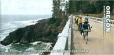
 Sample detail of the Oregon Bicycling Map
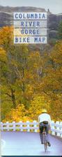
 Sample detail of the Oregon Bicycling Map
 Route map.
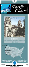
 Route map.
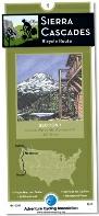
 Sierra-Cascades Route sketch map.
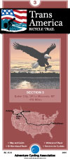
 Route map.