Grand Island NRA map. A visit to Grand Island means a visit to a place rich in scenic beauty, natural history, exciting recreational opportunities, and heritage. Standing atop one of the Island's shoreline clisffs, or digging you toes into a sandy beach, there is no question why Grand Island was as attractive to early America Indians and European explorers as it is to us today. It's rugged landscape provides the perfect backdrop for outdoor recreation of many kinds, as well as for quiet contemplation.
$19.99
62-74780
Hiawatha NF map. Waterproof edition. The Hiawatha national Forest is geographically tucked between three Great Lakes in the central and eastern portions of Michigan's Upper Penninsula. Rolling hills forested with northern hardwoods, white pine and hemlock, flatland covered by red pine, jack pine, and aspen, and large open and tree covered wetlands from the 890,000 acres of the Hiawatha National Forest.
$19.99
62-74781
Huron NF map.
$19.99
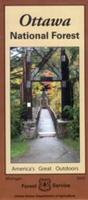
62-74783
Ottawa NF map. Welcome to the Ottawa National Forest. The nearly one million acres of Ottawa are home to beautiful hardwood forests, crystal clear lakes, remote wilderness areas, and a multitude of wildlife species.