Tom Harrison produces a series of excellent hiking maps for various California hiking regions. He bases his maps on USGS topographic maps, upon which he adds information on hiking and trails. All maps have latitude-longitude markings and UTM grid as well. The maps are printed on "Polyart" synthetic paper. The maps are folded to 4" x 9" size.
Index map showing coverage of each map Sample from the Lake Tahoe map. Enlarged to show the detail.
Bishop Pass. North Lake-South Lake, Evolution Valley. 1:47,520 (one inch = 3/4 miles). 80 ft. contours.
$9.95
62-5693DF
Devils Postpile. Minarets-Agnew Meadows, Thousand Island Lake. 1:39,600 (one inch = .625 miles). 80 ft. contours.
$9.95
62-5693EM
Emigrant Wilderness. 1:63,360. 80 foot contours.
$9.95
62-5693GO
Golden Trout Wilderness. 1:63,360. 80 foot contours.
$9.95
62-5693HB
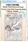
Half Dome Hiking/Topographic Map. 1:31,680 (one inch = 1/2 mile). Glacier Point-Yosemite Creek and Tenaya Lake-Little Yosemite Valley. 80 ft. contours.
$9.95
62-5693KI
Kings Canyon High Country.1:63,360. Covers the area from Bubbs Creek to Wanda Lake and includes Mt. Pinchot, Marion Peak, and Mt. Goddard. Contour interval is 80 feet.
$9.95
62-5693MB
Mammoth High Country.1:63,360. Covers the area from Mono Lake to Cascade Valley, including Devils Postpile, Mammoth Mountain, and McGhee Creek. Contour interval is 80 feet.
$9.95
62-5693MO
Mono Divide High Country.1:63,360. Covers the area from Wanda Lake to Cascade VAlley, including Florence Lake and Lake Edison. Contour interval is 80 feet.
$9.95
62-5693BB
Mt. Baldy. Cucamonga Wilderness. 1:31,680 (one inch = 1/2 mile). 80 ft. contours.
$9.95
62-5693MT
Mt. Whitney High Country.1:63,360. Covers the area from Mineral King to Bubbs Creek and includes Mt. Whitney, Triple Divide Peak, and Giant Forest. Contour interval is 80 feet.
$9.95
62-5693EM
Mt. Whitney Zone. 1:31,680. 80 foot contours.
$9.95
62-5693SH
Sespe Wilderness. 1:63,360 (1 inch = 1 miles). 100 ft. contours.
$9.95
62-5693YO
Yosemite High Country.1:63,360. Includes the surrounding areas of Sierra, Stanislaus, and Inyo National Forests. Contour interval is 80 feet.
Other Sierran and California Maps
$9.95
62-5693AF
Angeles Front Country. 1:63,360. Covers the portion of the San Gabriel Mountains between Placerita Canyon Park and Chilao Campground. Contour interval is 80 feet, with elevations in meters and feet.
$9.95
62-5693AH
Angeles High Country. 1:63,360. Covers the San Gabriel Mountains from just east of Chlao to Lytle Creek. Contour interval is 80 feet; elevations in meters and feet.
$9.95
62-5693CU
Cuyamaca Rancho State Park. 1:31,680. This is a beautiful State Park in San Diego County that is very popular with hikers, mountain bikers, and equestians. Contour intervalis 40 feet.
Desolation Wilderness. 1:42,240. One of the most popular day-hiking and backpacking areas in the Lake Tahoe area. Contour interval is 40 feet.
$12.95
62-5693HE
Hetch Hetchy Trail. 1:63,360.
$9.95
62-5693JO
Joshua Tree Recreation Map. 1:125,000. This is the only topographic map ever produced showing the entire park on a single sheet. Contour interval is 50 meters; elevations in both meters and feet.
$8.95
62-5693KE
Kearsarge Pass - Rae Lakes Loop. Includes trails in Sequoia/Kings Canyon N.P, including Paradise Valley, Vidette Meadow, Charlotte Lake, Onion Valley, Bubbs Creek. ISBN 1-877689-84-X.
$9.95
62-5693LT
Lake Tahoe Recreation Map. 1:71,280. Includes the route of the Lake Tahoe Rim Trail. The only topographic map that shows all of Lake Tahoe on a single sheet. 80 foot contours.
$8.95
62-5693MI
Mineral King. Includes trails in Sequoia/Kings Canyon N.P., including Bearpaw Meadow, Franklin Pass, Little Five Lakes, Hockett Meadow, High Sierra Trail, Funston Meadow, Silver City, Chagoopa Plateau.
$8.95
62-5693MN
Mono Lake. 1:63,360. 2003. 80 foot contours.
$9.95
62-5693MM
Mojave National Preserve. 1:250,000. The only topographic map available for teh newest member of the National Park system in California. Contour interval is 200 feet.
$9.95
62-5693MS
Mt. Shasta Wilderness. 1:63,360. The only shaded-relief map ever produced of this beautiful mountain. Contour interval is 80 feet.
$8.95
62-5693MU
Mt. Tamalpias. 1:24,000. 40 foot contours.
$8.95
62-5693MW
Mt. Wilson. 1:31,680. 80 foot contours.
$9.95
62-5693PR
Pt. Reyes N.S. 1:48,000. This is the only shaded-relief, topographic map ever produced of the Seashore. Covers all hiking and biking trails, plus trails in Samuel P. Taylor and Tomales Bay State Parks. Contour interval is 80 feet. New series, printed on Polyart, with lat-long and UTM.
$9.95
62-5693SD
San Diego Backcountry: Anza-Borrego. 1:125,000. Covers the entire Anza-Borrego Desert as well as a portion of the Cleveland National Forest. Contour interval is 200 feet, with elevations in both meters and feet. Printed on Polyart, with lat-long and UTM.
$9.95
62-5693SG
San Gorgonio Wilderness. 1:42,520. Covers the entire Wilderness area with Trail mileages and trail camps shown. Contour interval is 80 feet.
$9.95
62-5693SJ
San Jacinto Wilderness. 1:42,240. Covers both the State Park and National Forest wilderness areas. Contour interval is 80 feet.
$8.95
62-5693SM
Santa Monica Mts. West. 1:30,000. Covers Point Mugu, Leo Carrillo, and Circle X. Contour interval is 50 feet.
$8.95
62-5693SN
Santa Monica Mts. East. 1:30,000. Covers the area between Cold Creek Preserve and Trancas Canyon, including Castro Crest and Malibu Creek. Contour interval is 50 feet.
$9.95
62-5693SE
Sequoia/Kings Canyon Recreation Map. 1:125,000. Includes the surrounding portions of Sierra, Sequoia, and Inyo National Forests. Contour interval is 200 feet.
$9.95
62-5693YP
Yosemite Natl.Park. 1:125,000. Includes the surrounding areas of Sierra, Stanislaus, and Inyo National Forests. Contour interval is 200 feet.
$10.95
62-5693YQ
Yosemite Valley. 1:24,000. Unique legend panel with five languages - English, Spanish, French, German, and Japanese. Contour interval is 40 feet.
Front view of the map Detail of the map.
 Index map showing coverage of each map
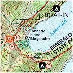
 Sample from the Lake Tahoe map.
 Enlarged to show the detail.
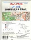
 Index showing coverage of the maps in this pack
 Legend of the map.
 Front view of the map
 Detail from the map.

 Front view of the map
 Detail of the map.