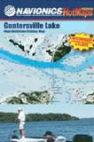
Navionics Fishing Maps. Using advanced computerized hydrographic survey technology, Navionics collected thousands of man-hours of data including water depth, lake bottom characteristics, sonar imagery and global positioning points for selected lakes across the country. The data, ranging from several hundred thousand to several million data points per map, is edited to create highly detailed lake bottom fishing maps.
Features of the lake maps.
Color shaded depth contours.
Major routes and highways.
Double-sided with detailed area insets.
Area points-of-interest.
Top-down satellite photo overlay.
Tear resistant.
3D lake overview.
Water resistant or water proof.
Measures approximately 24" x 36" - folds to small booklet size.
Most popular lakes have multiple sheets for the most detailed coverage.
Buy
Sample
Catalog #
Title
Price
62-87932-MO
(OH) Mosquito Creek Lake fishing map.
$19.99
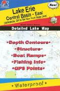
Ohio Fishing Maps by Fishing Hot Spots are superb maps showing the lake bottoms for hundreds of lakes and rivers across the USA. These maps are printed on either kimdura or Hop-syn (both tear-resistent waterproof synthetic materials), making them nearly indestructible. The maps show lake bottom contours, shoreline features, roads leading to the lakes, boating facilities along the lake shore, and much more.
Fishing Map sample Enlargement
62-8793-L293
Lake Erie Central Basin - East fishing map. Ashtabula OH to NY State Line.
$14.95
62-8793-L295
Lake Erie Central Basin - West fishing map. Ruggles Beach to Geneva.
$14.95
62-8793-L127
Lake Erie Western Basin fishing map.
$12.99
62-8793-M291
Lake Erie Western Basin Bass Islands fishing map.
$14.95
62-8793-M292
Lake Erie Western Basin Major Reefs fishing map. Out of print and only available while supplies last.
$14.95
62-8793-M376
Mosquito Lake fishing map.
$14.95
62-9093-L122
(OH/PA) Pymatuning Lake fishing map.
$14.95
Ohio's Rivers Fishing Maps by Wilderness Adventures Press. An essential tool for a successful fly-fishing trip is a detailed map of the water. One that will give you the access points, boat launches, campgrounds, public areas, roads, and GPS coordinates to pinpoint your location.


 Fishing Map sample
 Enlargement
 Front of the Little Miami River fishing map
 Sample detail from the front of a river map from this series (Deschutes River)
 Sample detail from the back of a river map from this series (Truckee River)
 Sample detail #2 from the back of a river map from this series (Metolius River)