Fishing Maps from Fishing Hot Spots. These maps, printed on waterproof paper, offer detailed bathymetric and fishing information for the Maryland coast.
Sample from the Cape Hatteras map
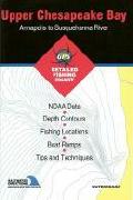
Maryland region.
62-7293-MD0102
Upper Chesapeake Bay - Cove Point to Annapolis. MD0102.
$19.95
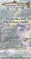
North Branch Potomac River Fishing Map. C.S. Gibbs Design. The North Branch, near Cumberland Maryland, is a true gem. Once devoid of life due to mining operations, the river has made an amazing comeback through conservation efforts and is on the verge of becoming one of the east's top tailwater fisheries. It is also one of the few places on the east coast to catch Cutthroat Trout. Our map features all of the management zones as well as the storied Savage River, which is a destination all in itself. The map measures 11 x 17 inches and is printed on waterproof, tear resistant synthetic paper. They are finely crafted, highly graphic and completely functional. Each map features a hatch chart and recommended fly selection as well as other important information about the river and area. The maps also feature photographs of the river, and information to help you find local food and lodging.
Thumbnail of the North Branch map.
62-72933-NB
1 sheet, folded.
$10.99
Chesapeake Bay Chartbook. 1:80,000. GMCO Maps, 2005. This waterproof atlas covers the entire Chesapeake Bay and its tidal tributaries. It includes: 1 Minute Grid System for GPS, Facility Listing, Local area names, and Much, Much More!!
Sample detail of the Chesapeake Bay Chartbook
62-7292CC
Atlas.
$59.95
Chesapeake Bay Regional Road Map. GMCO Maps. Complete view of the entire Chesapeake Bay Region. Full Color. Covers from Havre de Grace MD to Virginia Beach VA and from Richmond VA to Atlantic Ocean See the whole Chesapeake Region including the entire Eastern Shore. Extensive index of place names of cultural, geographic and populated places is on the reverse of the map.
Sample detail of the Chesapeake Bay Regional Road Map
62-9891R
1 sheet, folded.
$4.99
Waterproof! Chesapeake Bay Sectional Charts. 1:80,000. GMCO Maps, 2008. Folded, printed on waterproof, tear-resistant synthetic paper. These charts include Loran C, 1-Minute Lat/Long Grid System for GPS, Navigational Aids, Local Names index and More!!
Sample detail of the Chesapeake Bay Regional Road Map
62-9891N
Northern Chesapeake Bay Chart. From Havre de Grace, Chesapeake City to Little Choptank River. Enlargements of Annapolis and Baltimore harbors.
$12.95
62-9891C
Central Chesapeake Bay Chart. From Calvert Cliff to Smith Point, Piney Point to Crisfield. Includes enlargements of Solomons Island and Crisfield.
$12.95
62-9891S
Southern Chesapeake Bay Chart. From Smith Pt. to Virginia Beach.
$12.95
Waterproof! (MD/VA/WV) Upper Potomac River Chart & Fishing Map. 1:24,000. GMCO Maps. From Dam 4 to Great Falls. Large Scale, Waterproof, Special LAT/LONG Grid for GPS, Facilities listing, Local Area Names, Aids to Navigation and MUCH MORE!!
 Sample from the Cape Hatteras map
 Thumbnail of the North Branch map.
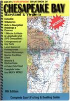
 Sample detail of the Chesapeake Bay Chartbook
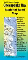
 Sample detail of the Chesapeake Bay Regional Road Map
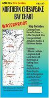 Waterproof!
 Sample detail of the Chesapeake Bay Regional Road Map
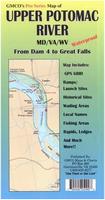 Waterproof!