Fish-N-Map Company underwater topography maps are printed on a
waterproof, tear-resistant material and are folded to 9" x 4". When opened, each map is approximately
3' x 2' in size and is printed on both sides. These maps feature waterproof plastic "paper"; underwater
depth contours; fish locations; latitude and longitude for GPS; often multiple lakes on one map; boat
ramps; recreational facilities; and much more.
(ID/OR) Brownlee Reservoir fishing map. 1:24,000. 20' depth contours. Brownlee Reservoir is located on the Idaho and Oregon border. Brownlee Reservoir is the uppermost reservoir of the Hells Canyon Complex on the Snake River.
$18.95
62-6493-CJ
(ID) C.J. Strike Reservoir fishing map. 1:17,000. 10' depth contours. CJ Strike Reservoir, located in southwest Idaho, is a 7,500-acre reservoir which impounds the Snake and Bruneau Rivers.
$16.95
62-6493-CO
(ID) Coeur d'Alene Lake, Priest Lake fishing map. 15' contours.
$16.95
62-6493-PE
(ID) Pend Oreille Lake fishing map. 15' contours.
$16.95
62-6493-RU
(ID/WA) Rufus Woods & Cascade Lake fishing map. 1:28,900 & 1:28,200. 2009. The lake is on the Columbia River behind the Chief Joseph Dam.
$16.95
62-9993-SN
(ID/WA) Snake River Lake fishing map. 1:50,000. This map covers the Snake River from Ice Harbor Dam in Washington through Lewiston, Idaho.
$16.95
Idaho's Rivers Fishing Maps by Wilderness Adventures Press. An essential tool for a successful fly-fishing trip is a detailed map of the water. One that will give you the access points, boat launches, campgrounds, public areas, roads, and GPS coordinates to pinpoint your location.
Henry's Fork Snake River fishing map. From Henry's Lake to Snake River.
$9.95
62-64933-KEL
Kelly Creek fishing map. Kelly Creek, from headwaters of its forks to the confluence with the North Fork of the Clearwater River.
$9.95
62-64933-MID
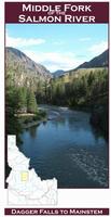
Middle Fork Salmon River fishing map. From headwaters to mainstem Salmon River.
$9.95
62-64933-SIL
Silver Creek fishing map. Headwaters to Little Wood River.
$9.95
62-64933-SOB
South Fork Boise River fishing map. From Featherville area to Arrowrock Reservoir and Lucky Peak Lake.
$9.95
62-64933-SOS
South Fork Snake River fishing map. From Palisades Reservoir to Idaho Falls.
$9.95
Idaho's Best Fishing Waters Guide. Wilderness Adventures Press.
This book features 167 detailed maps of 26 of the best rivers, streams, and lakes of Idaho. It now includes GPS information. Each 8 1/2x11-inch map shows all the access sites with GPS coordinates, along with boat ramps, campgrounds, roads, trails, rapids, dams and a wealth of other useful information.
Each water starts with an overview map. Then each water is covered with a number of detailed maps. For example, the Henry's Fork of the Snake River has an overview map and eight detailed maps for a total of nine maps. The Clearwater river has a total of 10 maps. The Snake River is covered in 27-detailed maps from Grand Teton National Park in Wyoming to Lewiston. Other waters include, Big Lost River, Big and Little Wood rivers, Boise, Clearwater, Coeur d'Alene, Fort Hall bottoms, Kelly Creek, Kootenai, Lochsa, Payette, Salmon, Selway, Silver Creek, South Fork of the Boise, the St. Joe, the Teton River, and others.
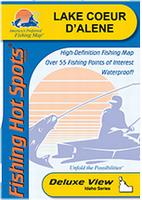
 Thumbnail of the front of the Coeur d'Alene fishing map.


 A sample of a map legend.
 Sample detail from the Couer d'Alene lake map.
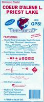 Idaho Fishing Maps
 Front of the Silver Creek fishing map
 Sample detail from the front of a river map from this series (Deschutes River)
 Sample detail from the back of a river map from this series (Truckee River)
 Sample detail #2 from the back of a river map from this series (Metolius River)
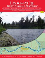 Idaho's Best Fishing Waters Guide. Wilderness Adventures Press.