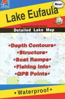
Fishing Hot Spots Lake & Fishing Maps are superb maps showing the lake bottoms for hundreds of lakes and rivers across the USA. These maps are printed on either kimdura or Hop-syn (both tear-resistent waterproof synthetic materials), making them nearly indestructible. The maps show lake bottom contours, shoreline features, roads leading to the lakes, boating facilities along the lake shore, and much more.
Fishing Map sample Enlargement
$14.95
62-6293-L392
Allatoona Lake map.
$14.95
62-6293-L650
Clarks Hill Lake (J. Strom Thurmond) (GA/SC) map.
$14.95
62-6293-L393
Lake Eufaula (Walter F. George Reservoir) (GA/AL) map.
$14.95
62-6293-L394
Hartwell East map.
$14.95
62-6293-L395
Hartwell West map.
$14.95
62-6293-L508
Lake Oconee map.
$14.95
62-6293-L649
Russell Lake (GA/SC) map.
$14.95
62-6293-L390
Lake Sidney Lanier-North (North of Browns Bridge) map.
$14.95
62-6293-L391
Lake Sidney Lanier-South (Dam to Browns Bridge) map.
$14.95
62-6293-L507
Lake Sinclair map.
$14.95
62-6293-L506
West Point Lake (GA/AL) map.
Georgia and South Carolina Fishing Maps. A.I.D. Associates Publishers.
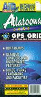
A.I.D. Lake Maps have up-to-date navigation markers, road systems, access points and public areas. They locate the area's goods and services featuring full-color photographs and information on popular Resorts, Marinas, Motels, Bait and Tackle stores, Restaurants and other businesses, as shown on the facilities link. Waterproof and tear resistant. The maps have a 60 second grid over the lake area.
Sample map detail from the Allatoona Lake fishing map
$12.99
62-62931-HW
(GA/SC) Hartwell West fishing map.
$12.99
62-62931-WW
(GA/SC) Weiss Lake and West Point fishing map.
Georgia Fishwater River and Fishing Maps. Fishwater Maps by Chris Gibbs.
Fishwater Maps is dedicated to making high quality, finely crafted, accurate maps and fishing guides. We specialize in creating river maps and coastal maps for fly fisherman and light tackle anglers that include all the information you need to get there and get fishing. Our full color maps measure 11" x 17" and are printed on waterproof; heavy duty synthetic paper that can take years of abuse on the water. They feature regional maps, access points, hatch charts, GPS Points, water release travel times on tailwaters, float times for boaters, fly and tackle recommendations, important phone numbers and local information such as where to eat, where to sleep and other services of interest to fisherman.
Click here to see additional North Carolina fishing maps by Fishwater Maps and others.
$12.99
62-62933-CHA
Chattooga River Fishing Map. Georgia-South Carolina-North Carolina.
$12.99
62-62933-TOC
Toccoa Tailwater Fishing Map. Blue Ridge, Georgia.
$12.99
62-62933-UTO
Upper Toccoa River Fishing Map. Blue Ridge, Georgia.
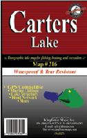
Georgia Lake Fishing Maps by Kingfisher. These maps show the topography of the lakebottoms and locations of shore facilities and lake buoys. Folded maps printed on Polyart synthetic "paper," making them nearly indestructible. With GPS coordinate information unless noted otherwise.
$11.99
62-6293-AL
Allatoona map.
$10.99
62-6293-BK
Blackshear fishing map. 1:31,000. 23" x 35". Lake Blackshear spreads for over 15 miles starting at the city of Warwick. The formation of the lake began in 1930 when the Crisp County Power Commission established the Crisp County Power Dam on the Flint River. The lake is fed by the Flint River with over 8,700 surface acres and 77 miles of shoreline.
$10.99
62-6293-BL
Blue Ridge & Burton Lakes fishing map. 1:24,000 (Blue Ridge) and 1:30,000 (Burton). Single-sided, 25" x 38". There are 50' contorus for Blue Ridge Lake and no contours for the Burton Lake portion.
$11.99
62-6293-CA
Carters Lake fishing map. 1:20,000. Single-sided, 25" x 38". Carters Lake embraces a spectacular tract of mountain-and-valley scenery in the Blue Ridge Mountains of North Georgia. Its sparkling waters and rugged shoreline provide a beautiful surrounding for a variety of recreational opportunities which include camping, fishing, picnicking, boating, mountain biking and hunting.
North Chattahoochee River fishing map. 1:36,000. Double-sided, 24" x 36".
$11.99
62-6293-HB
Hartwell fishing map.
$11.99
62-6293-JU
Juliette and Jackson Lakes fishing map. 1:20,000. Double-sided, 24" x 36". With 10' contours for Lake Juliette and no contours for Lake Jackson.
$11.99
62-6293-SI
Sinclair fishing map. Without GPS coordinate information.
Georgia River Fishing Maps by Wilderness Adventures Press. An essential tool for a successful fly-fishing trip is a detailed map of the water. One that will give you the access points, boat launches, campgrounds, public areas, roads, and GPS coordinates to pinpoint your location.
 Fishing Map sample
 Enlargement
 Sample map detail from the Allatoona Lake fishing map
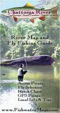


 Georgia Lake Fishing Maps by Kingfisher. These maps show the topography of the lakebottoms and locations of shore facilities and lake buoys. Folded maps printed on Polyart synthetic "paper," making them nearly indestructible. With GPS coordinate information unless noted otherwise.


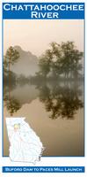
 Front of the Chattachoochee River fishing map
 Sample detail from the back of the a river map from this series (Truckee River)
 Sample detail from the front of a river map from this series (Deschutes River)