Arkansas Fishing Maps by Fishing Hot Spots are superb maps showing the lake bottoms for hundreds of lakes and rivers across the USA. These maps are printed on either kimdura or Hop-syn (both tear-resistent waterproof synthetic materials), making them nearly indestructible. The maps show lake bottom contours, shoreline features, roads leading to the lakes, boating facilities along the lake shore, and much more.
Fishing Map sample Enlargement
$14.95
62-5593-L173
Beaver Lake fishing map.
$14.95
62-5593-L171
Bull Shoals-East (Bull Shoals Dam to Hwy 125) (AR/MO) fishing map.
$14.95
62-5593-L172
Bull Shoals-West (Hwy 125 to Taneycomo Dam) (AR/MO) fishing map.
$14.95
62-5593-A119
Dardanelle Lake fishing map.
$14.95
62-5593-L701
DeGray Lake fishing map. 2010.
$14.95
62-5593-A121
Greers Ferry Lake fishing map.
$14.95
62-5593-A123
Millwood Lake fishing map.
$14.95
62-5593-L174
Norfork Lake fishing map.
$14.95
62-5593-A124
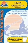
Ouachita fishing map.
Navionics Fishing Maps. Using advanced computerized hydrographic survey technology, Navionics collected thousands of man-hours of data including water depth, lake bottom characteristics, sonar imagery and global positioning points for selected lakes across the country. The data, ranging from several hundred thousand to several million data points per map, is edited to create highly detailed lake bottom fishing maps.
Features of the lake maps.
Color shaded depth contours.
Major routes and highways.
Double-sided with detailed area insets.
Area points-of-interest.
Top-down satellite photo overlay.
Tear resistant.
3D lake overview.
Water resistant or water proof.
Measures approximately 24" x 36" - folds to small booklet size.
Most popular lakes have multiple sheets for the most detailed coverage.
Buy
Sample
Catalog #
Title
Price
62-55932-GR
(AR) Greers Ferry Lake fishing map set. 2 sheets.
$29.99
Arkansas Fishing Maps by A.I.D. Assoc. These maps are well researched to show accurately underwater details, including ponds, creeks, ridges, valleys, trees, roads, and cemeteries.
Full-color photographs and information on the map tell you what resorts, marinas, motels, bait and tackle stores, restaurants, and other businesses in the area have to offer and how to phone ahead for reservations. The maps below are printed on waterproof synthetic paper. The maps have a 60-second latitude/longitude grid.
Unfortunately this company has closed and we have limited stock left.
Sample #1. Sample from the Belton-Stillhouse, Texas map.
Sample #2. Sample from the Fayette County, Texas map.
Sample #3. Sample from the Conroe, Texas map.
Sample #4. Sample from the Red River, Louisiana map.
$12.99
62-55931-GR
Greers Ferry fishing map.
$12.99
62-55931-OU
Ouachita fishing map.
$12.99
62-77931-TW
Table Rock West fishing map.
Wilderness Adventures River Fishing Maps. An essential tool for a successful fly-fishing trip is a detailed map of the water. One that will give you the access points, boat launches, campgrounds, public areas, roads, and GPS coordinates to pinpoint your location.
 Fishing Map sample
 Enlargement


 Sample #1.
 Sample #2.
 Sample #3.
 Sample #4.
 Front of the White River fishing map
 Sample detail from the front of a river map from this series (Deschutes River)
 Sample detail from the back of a river map from this series (Truckee River)