The Atmosphere Chart. For the first time ever, here is a wall chart that depicts all of the major weather phenomena used by meteorologists, aviators and space scientists. The chart illustrates each weather system with a diagram and brief explanation. It shows spectacular color photographs of the basic cloud types, frontal systems, and more. Intended for students, hobbyists and professionals alike, The Atmosphere will prove invaluable as an easy wall reference. Size 55" x 33".
71-5250
Each, rolled
$17.95
71-5250L
Each, laminated
$29.95
Environment Chart
The Environment Chart. This attractive book-in-a-chart format will raise students' awareness of environmental hazards. 42 color photos illustrate the hazards of deforestation, toxic wastes, ozone depletion, oil spills, pollution, chemical accidents, severe weather, and more. Size is 55" x 33".
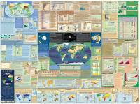
Detail of one of the inset maps. View of the entire chart.


 Detail of one of the inset maps.
 View of the entire chart.