Hot Springs to Branson Road Map. 1:265,000. Seeger Maps, 2015.
This map covers the popular scenic drive through the wooded Ozark Mountains from Hot Springs, Arkansas, to Branson Missouri.
$7.99
62-5592HSB
1 sheet, folded.
Pennsylvania Street Atlases & Street Maps
Pennsylvania City and County Street Atlases. Franklin Maps.
The atlases and maps listed here are not new titles, but are items we have just started to carry.
$16.95
62-90922DEL
(PA) Chester and Delaware Counties Street Atlas.
$19.95
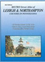
62-90922LEH
(PA) Lehigh and Northampton Counties Street Atlas.
$17.95
62-90922YOR
(PA) York and Adams Counties Street Atlas.
Pennsylvania City and County Street Maps. Franklin Maps.
The atlases and maps listed here are not new titles, but are items we have just started to carry.
$8.99
62-9092HA
(PA) Harrisburg & Vicinity Street Map.
$8.95
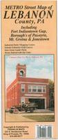
62-9092LEB
(PA) Lebanon County Street Map.
$4.95
62-9092Y
(PA) York County Street Map.
Canada Travel Maps and Atlases
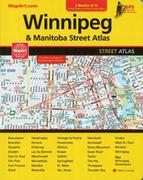
Winnepeg and Manitoba Street and Road Atlas. CCC Maps, 2017.
The 2017 MapArt Winnipeg and Manitoba Atlas is a 300 page guide that contains not only the detailed street information for Winnipeg and Area (including Ontario with Thunder Bay, Fort Frances, Kenora and Dryden) but also a 1:250,000 scale GPS compatible back road Atlas that extends to Minnesota and North Western Ontario!
$19.95
64-36921WJ
Atlas.
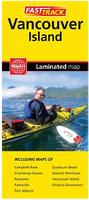
Vancouver Island Fast Track Map. CCC Maps, 2017.
This laminated road map covers the entire island. The laminated design allows you to mark your route, make notes, then wipe the surface clean for further use. The color-coded freeways and clear exit names make for quick and easy navigation.
$9.95
64-36922VAN
1 sheet, folded.
New series! Canada Province Maps by GM Johnson. GM Johnson, 2017.
GM Johnson is launching a new line of Canadian city and province maps. There will be 48 maps in the series, becoming available over the next 3 months. The first province map is available now and is listed below. Map size is 27 x 39 inches unfolded.
New series! Canada City Maps by GM Johnson. GM Johnson, 2017.
GM Johnson is launching a new line of Canadian city and province maps. There will be 48 maps in the series, becoming available over the next 3 months. The first three city maps are available now and are listed below. Mp size is 27 x 39 inches unfolded.
Niagara Falls & St. Catharines city map. 1:31,000 / 1:25,000. Folded.
$5.95
64-3292QU
Quebec city map. 1:25,000. Folded.
(Denmark) Copenhagen City Map
Copenhagen Street Map - laminated. 1:12,500. Norstedts Maps, Sweden, 2017.
A clear and easy-to-read city map on one side and an overview map on the reverse. Also on the reverse is a street index and tourist information describing the city's most popular attractions and excursions.
With Metro system map on the outside cover of the map.
New edition Finland Road Atlas. 1:40,000 - 1:250,000. Karttakauppa, 2017.
This atlas covers Southern Finland up to the height of Oulu at a scale of 1:200,000. The map of Northern Finland is 1:250,000. The Helsinki Metropolitan Area as well as Turku, Tampere and Oulu with its surroundings are covered at 1:100,000 maps. In addition, the largest cities are covered at 1:40,000. Multilingual legend. ISBN 9789522664068.
Sample of the map detail. Sample of the map detail.
$67.99
64-55891
Atlas.
Finland Road Map - laminated. 1:1,000,000. Karttakeskus, 2016.
This double-sided map of Finland shows the main roads along with the road numbers plus a wealth of nomenclatures and tourist information. The map also acts as a travel guide, as it presents texts and photographs about 90 attractions from all over Finland. Items are also marked on the map. Map is in English. Map size is 39 x 19 inches unfolded.
Sample of the Finland road map detail.
$16.99
64-55908
1 sheet, folded.
Helsinki Street Map - laminated. 1:14,750. Norstedts Maps, Sweden, 2015.
A clear and easy-to-read city map on one side and an overview map on the reverse. Also on the reverse is a large-scale map of the city-center, a street, index, plus tourist information describing the city's most popular attractions and excursions.
With Metro system map on the outside cover of the map.
In Swedish only.
$14.99
64-5592HD
1 sheet, folded.
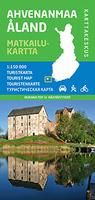
Ahvenanmaa ja Turun (Aland) Outdoor Map. 1:150,000. Karttakauppa, 2014.
Tourist map of the southern Finland Archipelago. The map shows a wealth of information for tourists and cyclists, including cycling and hiking trails, attractions, accommodations, restaurants, museums, guest harbors and cruise liners. In addition to the terrain data, the maps typically show huts, routes and other hiking services as well as dining and accommodation. Ten attractions or experiences have been added to some of the maps, with a few sentences on the map border in Finnish and English. Printed on waterproof, tear-resistant, synthetic paper. ISBN 9789522662170.
Sample of the map detail. Thumbnail of the front of the map.
$28.99
64-5567-7
1 sheet, folded.
Lemmenjoki Hiking Map. 1:100,000. Karttakauppa, 2015.
Wilderness enchantment in the Lemmenjoki National Park. In the Lemmenjoki National Park, you can enjoy the peace of the wilderness. Landscapes are dominated by the mighty river valley, the rugged mountain ranges and the wide tides. Those interested in wilderness culture will find gold miners, reindeer herding structures and historical rocks in Lemmenjoki. The outer map covers the entire national park and stretches from Menesjärvi to Nuntaa and from Angel to Pulju. In the north there is the Norwegian border. In addition to the terrain data, the maps typically show huts, routes and other hiking services as well as dining and accommodation. Ten attractions or experiences have been added to some of the maps, with a few sentences on the map border in Finnish and English. Printed on waterproof, tear-resistant, synthetic paper. ISBN 9789522663238.
Sample of the map detail. Sketch map of the area covered
$26.95
64-5580-24
1 sheet, folded.
Ylias-Levi (Pallas-Yllastunturi National Park) Hiking Map. 1:50,000. Karttakauppa, 2017.
West Lapland's most popular forest area. The two-sided map covers the southern part of the Pallas-Yllästunturi National Park with its surroundings. Ylläs' s majestic mountain range is located in the villages of Äkäslompolo and Ylläsjärvi and in the village of Sirka, Levin Tourist Center. The region has a comprehensive hiking, skiing and mountain biking trail that joins the Aakenus area to Levi's routes. In the north, the hiking trails lead to Olos and Pallas. The map is also marked by the challenging mountain bike route between Ylläs and Levi. In addition to the terrain data, the maps typically show huts, routes and other hiking services as well as dining and accommodation. Ten attractions or experiences have been added to some of the maps, with a few sentences on the map border in Finnish and English. Printed on waterproof, tear-resistant, synthetic paper. ISBN 9789522663870.
Sample of the map detail. Sketch map of the area covered
$26.95
64-5580-48
1 sheet, folded.
Finland Outdoor Map Series - includes Cycling Routes (Pyöräilykartat). 1:250,000 & 1:400,000. Karttakeskus.
This series replaces the previous six-sheet series. These maps have cycling routes with information on if they are paved or unpaved. Paddlers will find information on kayak and canoe trails, dangerous rapids and portage trails. To help hikers plan their journey, the map shows extensively the various marked hiking trails and wilderness huts in the area.
An Outdoor GT map is based on a road map with wetlands and contour lines (20-metre intervals) added and with plenty of travelling information.
Sample of the map detail showing gas stations, campgrounds, etc. Thumbnail of the front of the Finland North cycling map. Thumbnail of the reverse of the Finland North cycling map.
$28.95
64-5565-1
Sheet 1. South Finland (Etelä-Suomi). 1:250,000.
$28.95
64-5565-2
Sheet 2. West Finland (Länsi-Suomi). 1:250,000.
$28.95
64-5565-3
Sheet 3. East Finland (Itä-Suomi). 1:250,000.
$28.95
64-5565-4
Sheet 4. North Finland (Pohjois-Suomi). 1:400,000.
France road maps
France Road Map Series. 1:250,000 - 1:300,000. Michelin, 2016.
$12.95
64-5654-512
Sheet 512. Bretagne road map.
$12.95
64-5654-514
Sheet 514. Ile-de-France road map.
$12.95
64-5654-517
Sheet 517. Pays de la Loire road map.
$12.95
64-5654-518
Sheet 518. Centre road map.
$12.95
64-5654-521
Sheet 521. Poitou-Charentes road map.
$12.95
64-5654-524
Sheet 524. Aquitane road map.
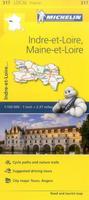
France Road Map Series. 1:150,000. Michelin, 2016.
$11.95
64-5653-317
Sheet 317. Indre et Loire road map.
Lithuania Road Maps
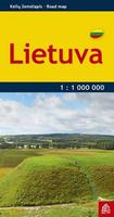
Lithuania Pocket Road Map. 1:1,000,000. Jana Seta, 2016.
One side of the map shows the road network, the distances, and the largest villages. The other side includes city maps of Vilnius, Kaunas, Klaipeda, Siauliai, Panevezys, and Alytus. Size is 12 x 15.5 inches unfolded.
$8.95
65-83905
1 sheet, folded.
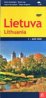
Waterproof! Lithuania Road Map - waterproof. 1:600,000. Jana Seta, 2016.
A waterproof and tear-resistant, indexed road map of Lithuania. Includes small inset maps of Vilnius and Kaunas, plus a distance table. Map size is 19 x 26 inches unfolded.
Sample detail of the Lithuania road map.
$11.95
65-83906
1 sheet, folded.
Nepal Maps
Nepal Rafting and Kayaking Maps. 1:500,000. Himalaya Map House - Nepa.
This three-map series offers complete coverage of Nepal. The maps shows the river network graded into five classes. Additional panels list rivers with rafting and kayaking summaries, providing stretch by stretch information about class, volume, scenery, number of days, etc. Also provided are month-by-month profiles of high and low water ratios.
The maps show topography by shaded relief and also show the road network. The maps use symbols to show locations of airports, campsites and other tourist accommodation, places of interest, etc. The maps are indexed.
Serengeti, Ngorongoro, Lake Manyara & Masai-Mara Safari Handbook / Atlas. Scales vary. Harms Verlag, 2014.
This spiral-bound Safari Handbook is a touring atlas, offering 1:250,000 scale coverage of the Greater Serengeti Ecosystem. Maps of the craters are in 1:120,000 scale. Legend in English, German, and Kiswahili.
Also featured:
Detailed map of Ngorongoro Crater
City Maps of Arusha, Mombasa, Mwanza, and Nairobi
Major Tourist Attractions
Illustrations of Vegetation and Wildlife, including Migration Map
Photographic Guide to Animal and Tree Species of the Serengeti
Camino de Santiago Pocket Atlas. 1:150,000. Michelin.
This pocket atlas covers the Camino de Santiago which is the main route of the Way of St. James across northern Spain. The atlas starts in St-Jean-Pied-de-Port on the French side of the Pyrenees and makes it's way to Santiago de Compostela in north west Spain.
Each double page spread of the atlas covers between 12 and 18 miles of the route. One page has a Michelin map with the route highlighted on it, the other page shows a route profile with accomodation and other services marked out. Opening times, number of beds and contact details are given for the hotels along the way as well as their distance from the starting point of the map.
Sample detail of the maps.
$12.95
65-32730
Atlas.
Visiting North Carolina? Like to visit Omni? Please click here for a Mapquest map to our offices. If you are passing through central North Carolina, we would be pleased to have you visit our store and warehouse. We are located about 30 minutes east of Greensboro, 60 minutes west of Raleigh, and 2 hours northeast of Charlotte. We are open Monday-Friday 8am - 5:30pm and weekends by prior arrangement.
Contact information: For information on a map or other product: [email protected] To place an order or check on an order: [email protected] For questions on an invoice: [email protected] Phone: (1) 336-227-8300
Fax: (1) 336-227-3748

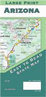 New map!
 Sample detail of the Arizona map.
 Thumbnail of the front of the Arizona map.
 Thumbnail of the reverse of the Arizona map.
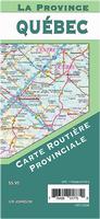 New series!
 Sample detail of the Quebec map.
 Thumbnail of the front of the Quebec map.
 Thumbnail of the reverse of the Quebec map.
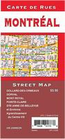 New series!
 Sample detail of the Montreal map.
 Thumbnail of the front of the Montreal map.
 Thumbnail of the reverse of the Montreal map.
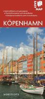
 Sample of the Copenhagen street map detail.
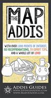
 Sample of the Addis Ababa map detail.
 Sample of the Addis Ababa map detail.
 Sample of the Addis Ababa map detail.
 Sample of the Addis Ababa map detail.
 Sample of the Addis Ababa map detail.
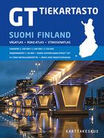 New edition
 Sample of the map detail.
 Sample of the map detail.
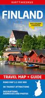
 Sample of the Finland road map detail.
 Sample of the map detail.
 Thumbnail of the front of the map.
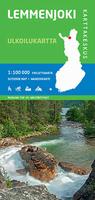
 Sample of the map detail.
 Sketch map of the area covered
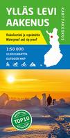
 Sample of the map detail.
 Sketch map of the area covered
 Sample of the map detail showing gas stations, campgrounds, etc.
 Thumbnail of the front of the Finland North cycling map.
 Thumbnail of the reverse of the Finland North cycling map.
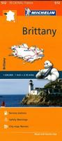
 Waterproof!
 Sample detail of the Lithuania road map.
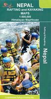
 Sample detail of the maps.
 Sketch map showing coverage of each map.
 Sample detail of the maps.
 Sketch map of the area covered by the Serengeti atlas
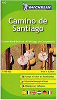
 Sample detail of the maps.