Contact information. Includes contact e-mails, telephone and fax numbers, and mailing address.
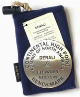
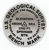
Benchmark Paperweights and Lapel Pins
Benchmark paperweights. Geo-Situ.
Whether you're a climber, hiker, geography buff, or armchair traveler, you'll love to collect or give these unique bench mark paperweights that celebrate the spirit of exploration, athletic challenge, and personal achievement. Cast in pewter these summit marker paperweights are exact replicas of official USGS benchmark markers. Please click the "sample" button below to see an enlargement of the paperweight. Each marker has a soft felt pad on the bottom so these can be used on glass, wood, or any surface. Supplied in a soft fleece drawstring pouch, 3¼" diameter.
$59.95
62-6297BR
Brasstown Bald, GA paperweight - state high piont.
$59.95
62-5397DEN
Denali Continental High Point, Denali National Park, AK paperweight - new elevation.
$59.95
62-5397MCN
Mt. McKinley, Denali National Park paperweight - new elevation. This is different than the continental high point Denali paperweight listed below.
Benchmark Lapel Pins. Geo-Situ.
Brasstown Bald, Kennesaw Mountain, and Springer Mountain benchmark lapel pins. Lapel pins are 1 inch diameter, cast in fine pewter, with a military clutch back, and mounted on a story card.
Larger image of the Springer Mountain lapel pin.
$11.95
62-6297BRL
Brasstown Bald, GA benchmark lapel pin.
$11.95
62-6297KEL
Kennesaw Mountain, GA benchmark lapel pin.
$11.95
62-6297SPL
Springer Mountain, GA benchmark lapel pin.
New Jersey & Pennsylvania Maps and Atlases by Franklin Maps
Franklin Maps has been publishing maps and atlases of Pennsylvania and New Jersey since 1928. We are now carrying their product line to fill a gap left as other publishers' maps have gone out of print. These maps and atlases are detailed with an extensive street index.
New Jersey & Pennsylvania Street Maps. Franklin Maps.
Folded paper street maps with detailed street index.
$8.95
62-8292AT
Atlantic County street map. 2006. ISBN 9781600480690.
$8.95
62-8292BUR
Burlington County street map. 2005. ISBN 9781600480614.
$4.95
62-8292CM
Cape May street map. 2004. ISBN 9781928955771.
$4.95
62-8292CU
Cumberland County street map. 2002. ISBN 9781928955788.
$4.95
62-8292ESS
Essex County street map. 2007. ISBN 9781928955818.
$5.99
62-8292GL
Gloucester County street map. 2007. ISBN 9781600480263.
$8.99
62-9092HA
Harrisburg (PA) City street map. 2005. ISBN 9781600480676.
$4.95
62-8292SAL
Salem County street map. 2004. ISBN 9781928955832.
New Jersey & Pennsylvania Street Atlases. Franklin Maps.
Spiral-bound street atlases with detailed street index.
$14.99
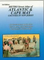
62-82922AT
Atlantic County & Cape May street atlas. 2006. ISBN 9781600480027.
$17.95
62-82922BUR
Burlington & Camden Counties street atlas. 2007. ISBN 9781600480171.
$35.95
62-82922ACCS
4-County street atlas - Atlantic, Cape May, Cumberland, and Salem Counties. 2006. ISBN 9781600480003.
$38.95
62-82922MBCG
4- County street atlas - Mercer, Burlington, Camden, and Gloucester Counties. 2006. ISBN 9781600480010.
$14.95
62-82922MOR
Morris County street atlas. 2004. ISBN 9781877911286.
$15.99
62-82922OC
Ocean County street atlas. 2007. ISBN 9781600480232.
$17.95
62-82922SC
Salem & Cumberland County street atlas. 2007. ISBN 9781600480102.
(KY) Bowling Green & Warren County street map. 1:32,000. GM Johnson, 2017. ISBN 9781770685840.
$6.95
62-6792CER
(IA) Cedar Rapids & Iowa City street map. 1:32,000. GM Johnson, 2017. ISBN 9781770685871.
$6.95
62-7792COL
(MO) Columbia & Jefferson City street map. 1:32,000. GM Johnson, 2017. ISBN 9781770685864.
$6.95
62-9092ERIE
(PA) Erie & Erie County street map. 1:28,800. GM Johnson, 2017. ISBN 9781770686199.
$6.95
62-9592HOT
(TX) Houston SW Suburbs & Sugarland street map. 1:40,000. GM Johnson, 2016. ISBN 9781770685703.
$6.95
62-9292MY
(SC) Myrtle Beach street map. 1:32,000. GM Johnson, 2016. ISBN 9781770685710.
$6.95
62-9392RC
(MO) Rapid City, Sturgis, and the Black Hills street map. 1:36,000. GM Johnson, 2017. ISBN 9781897359082.
$6.95
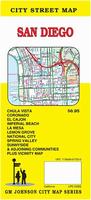
62-5692SDG
CA) San Diego street map. GM Johnson, 2017. ISBN 9781770686182.
$6.95
62-7792SP
(MO) Springfield & Joplin street map. 1:32,000. GM Johnson, 2017. ISBN 9781770685888.
$6.95
62-9592HON
(TX) The Woodlands & Conroe street map. 1:40,000. GM Johnson, 2016. ISBN 9781770685697.
Kappa Map Group New Maps & New Editions
Street Maps. Kappa Map Group (Mapsco, Universal Map).
$7.99
62-5792COL
Colorado Springs, Colorado street map. 2016. Mapsco. ISBN 9780762588718.
$7.99
62-7792SPR
Springfield & Joplin, Missouri street map. 2016. Mapsco. ISBN 9780762585625.
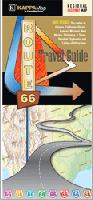
Route 66 Road Map. Kappa Map Group, 2016.
Route 66 is one of America's most cherished byways and remains a popular tourist attraction and travel route for tourists each year. The journey from Chicago to Santa Monica is full of roadside attractions, historical landmarks, and incredible natural landscapes for travelors of all ages. ISBN 9780762588541.
Detailed insets of 9 major cities along route 66
Listing of attractions
Trivia
$6.99
62-20975
1 sheet, folded
Street Atlases.
$21.99
62-5991N
New Castle County, Delaware Street Atlas. 2017. 104 pages, saddle-stitched. Size is 10.25 x 13.25". ISBN 0762591234.
$14.99
62-90921SCR
Scranton Street Atlas. 2017. 124 pages, spiral-bound. Size is 10.25 x 13.25". ISBN 076259117X.
$26.99
62-98922HA
South Hampton Roads Street Atlas. Mapsco, 2017. ISBN .
$25.99
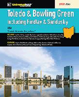
62-87922TOL
Toledo and Bowling Green Street Atlas. Universal Map, 2017. 116 pages. ISBN 0762591080.
$25.99
62-6092ME
Washington D.C. Metro Street Atlas. ADC, 2017. 11 x 14", softcover. ISBN 0762590440.
US Forest Service New Maps & New Editions
U.S. Forest Service new edition maps. U.S. Forest Service.
$14.95
62-56797
Marble Mountain & Russian Wildernesses map, Klamath National Frest, California. 2016. Waterproof. ISBN 9781628114157.
$19.99
63-02796
Sierra Madre Range, Brush Creek, Hayden Ranger District map, Medicine Bow National Frest, California. 2016. Waterproof.
Brazil Maps
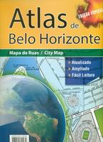
Atlas de Belo Horizonte Street Atlas. Guia Rivera, 2014.
Detailed street atlas of Belo Horizonte. 108 pages, with a street index. In Portuguese. Size is 9 x 13".
Sample detail from the Belo Horizonte atlas.
$29.99
64-2490BF
Atlas.
Brasil Street Maps. Guia Rivera, 2010-2013.
These are detailed, folded street maps of Brasilia, Sao Paulo, and major cities in Minas Gerais state of Brasil. In Portuguese. Some maps are two-color, others are three-color or four-color.
Sample detail from the Brasilia map.
$13.99
64-2491BR
Brasilia and Distrito Federal street map. 1:25,000. 7898919822331.
$13.99
64-2491BF
Belo Horizonte, Contagem, and Betim street map. No scale. 7898919822348.
$13.99
64-2491VA
Governador Valadares, Teofilo Otoni, and Itambacuri street map. No scale. 7898919822324.
$13.99
64-2491JU
Juiz de Fora street map. No scale. 7898919822300.
$13.99
64-2491MO
Montes Claros street map. No scale.
$13.99
64-2491SE
Sete Lagoas street map. Four-color map. No scale.
$13.99
64-2491UB
Uberaba street map. No scale. 7898919822355.
$13.99
64-2491UBL
Uberlandia street map. No scale. 7898919822423.
$13.99
64-2491VAE
Vale do Aco street map. No scale.
North Korea Maps
Pyongyang city map. North Korea Tourism Bureau.
Updated version, but no date on the map; brought back from North Korea in 2016. Semi-glossy, folded map. One side is a "tourist-style" city map showing significant streets/monuments/points of interest. The reverse side has tourist information and some pictures. In English.
Thumbnail image of the reverse of the map.
$14.99
64-8992PY
1 sheet, folded
Oman Maps
Muscat City Map. 1:16,000. Explorer Publishing, UAE, 2015.
This large fold-out map shows the whole of the city in pinpoint detail. The easy-to-read map features road names and numbers, hotels, malls, parks, beaches, schools, hospitals, and places of interest. Double-sided. Size is 60 x 98 cm. ISBN 9789948229032.
Sample detail of the Muscat City Map
$21.99
65-1292MUS
1 sheet, folded.
Saudi Arabia Maps
Limited stock left Saudi Arabia Road Map. 1:3,250,000. Farsi Maps.
The publsher has stopped making maps, so our current stock is all that is available.
A folded map of Saudi Arabia containing a list of names and locations of cities and towns, the latest Road Network with a number assigned to each and distances between intersections in kilometers. It also includes a list of shortest roads linking the Kingdom's main cities.
The back of the map contains inset maps of the major cities & towns all over the Kingdom. The map is bilingual, Arabic and English. Map size is 100 x 70 cm when open.
Sample detail from the Saudi Arabia road map.
$19.99
65-2591
1 sheet, folded
Limited stock left! Saudi Arabia City Maps. Farsi Maps.
The publsher has stopped making maps, so our current stock is all that is available.
These maps have a detailed city street map on one side and a regional map on the reverse. The maps use color shading and spot heights to show elevation. Many buildings and neighborhoods are named on the maps and each map has a separate index booklet inside the map cover. Maps are typically bilingual English/Arabic and measure 100 x 70 cm when opened.
Sample detail from the Jeddah city map.
$19.99
65-2592AH
Al Ahsa city map. 1:30,000. The front side of the map has the Al Ahsa city map at 1:30,000. The reverse side has a 1:50,000 regional map. Indexed, bilingual.
$19.99
65-2592AR
Arar city map & Northern Frontier Road Map. The front side has a map of Arar (1:36,000) and the reverse side has a 1:900,000 physical map covering the Asir region. Bilingual.
$19.99
65-2592BA
Al Bahah city map. 1:22,000. The main map covers Al Bahah and the nearby area at 1:22,000. There is an inset map of the central city at 1:12,500. There is also a city map of Baljurashi City at 1:15,000. The reverse side has a 1:250,000 regional physical map.
$19.99
65-2592JA
Al Jouf region and Skaka city map. 1:25,000. The front side shows a physical map of Al Jouf Region at 1:700,000, names of cities and towns, classification of Ministry of Interior, Ministry of Municipalities and Rural Affairs, administrative centers, distances, historical sites, etc. The reverse side contains detailed maps for Skaka at 1:25,000 and smaller inset maps of Qurayat, Dawmat Al-Jandal and Tabarjal. It also contains differently classified roads, government services such as banks, commercial, medical, educational, social, and etc. Bilingual.
$19.99
65-2592DA
Damman city map & Eastern Region road map. The front side has a map of Damman (1:10,000) and a small map of the Eastern Region at 1:500,000 scale. The reverse side has a physical/road map covering the Damman, Khubar, and Dhahran region at 1:60,000 scale. Bilingual.
$19.99
65-2592NA
Najran city map. 1:55,000. Includes city maps of Al Faisaliah (1:20,000), Sharurah (1:25,000).
$19.99
65-2592QA
Al Qassim region and Buraydah city map. 1:30,000 and 1:500,000. The front side has city maps of Buraydah and Unayzah plus inset maps of the downtown areas of both cities. The reverse has a regional physical map. Bilingual.
$19.99
65-2592TA
Tabuk Region and Tabuk city map. 1:26,600. Bilingual.
$19.99
65-2592YA
Yanbu Al Bahr city map. 1:35,000. Bilingual.
In Arabic only Saudi Arabia City Maps - in Arabic only. Farsi Maps.
The publsher has stopped making maps, so our current stock is all that is available.
These maps typically have a detailed city street map on one side and a regional map on the reverse. The maps use color shading and spot heights to show elevation. Many buildings and neighborhoods are named on the maps and each map has a separate index booklet inside the map cover. Maps are in Arabic only and measure about 24 x 36 inches when opened.
Sample detail from the Jeddah city map.
$19.99
65-2592JEA
Jeddah city map.
$19.99
65-2592MA
Madinah city map.
Limited stock left! Saudi Arabia Regional Road Maps. 1:700,000. Farsi Maps.
These sectional maps are now out of print. Four maps from this five-map set are still available. The four sheets offer partial coverage of Saudi Arabia - please see the index map for coverage. The maps show elevation by color shading and spot heights. Bilingual, map size is 100 x 70 cm when open.
Sketch map showing sheet coverage.
$19.99
65-25905-CE
Central Saudi Arabia road map. Sheet 2.
$19.99
65-25905-EA
Eastern Saudi Arabia road map. Sheet 1.
$19.99
65-25905-NO
Northern Saudi Arabia road map. Sheet 3.
$19.99
65-25905-SO
Southern Saudi Arabia road map. Sheet 5.
Africa Atlases
Historical Atlas of Africa. Editions Jaguar, 2007.
The Atlas historique de lAfrique (Historical Atlas of Africa) is a work of reference, one of a kind because of covers the complete history of the continent, from the origins of man to the beginning of the 1980s.
In 72 large format maps, it illustrates the diverse developments such as the Iron Age, the birth of agriculture, Egypt during the Pharaohs, the Roman Empire in North Africa and Ethiopia, the growth of Islam, the trans-Saharan trade routes, the rise and fall of the West African empires Ghana, Mali and Songhai the slave trade and the African Diaspora, the Zulu migration in Southern Africa, the colonial conquests and the African resistance, the role of Africa in both world wars, its position in the global economy and, finally, the political and economic realities of the Africa of our time. ISBN 2869500794.
$59.99
66-17461
Atlas.
Africa A-Z: Continental and Country Profiles Atlas. Africa Institute of South Africa, 2008.
Africa is a vast and fascinating continent whose population is fast approaching one billion. Africa also has more politically independent states than any other continent. Africa A-Z attempts to provide, in a concise manner, the facts for an elementary understanding of the continent and its complex problems.
The book falls into two main sections: the five chapters in the first main section focus on the continent as a whole, dealing with its physical and human diversity, its eventful history and Africans' struggle for economic survival.
The second main section contains profiles of 57 independent and non-independent countries, ranging from Algeria to Zimbabwe Presentation of the profiles is uniform in that the same themes are covered in each profile. The data panels with the profiles contain data not provided in the text The maps appearing throughout the text were produced by the Africa Institute's computerized cartography section. ISBN 9780798301992.
$49.99
66-17463
Atlas.
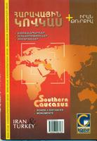
Caucasus Atlas
Waterproof! Southern Caucasus Road Atlas. Collage, 2010.
This road atlas shows the main roads, tourist infrastructure, cities, towns, villages, and physical features of the western Caucasus countries. Scales vary with the subregion covered. Bilingual English and Armenian. Published by a popular Armenian publisher.
$31.99
65-62905
1 sheet, folded
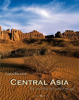
Central Asia Atlas
Central Asia: "The land that will not let you go." Kelet Kiado, 2008.
This photo-book contains hundreds of of photographs of the high deserts between the Aral Sea and the Caspian Sea. The author spent nearly a year traveling through the region photographing the people and the geography, taking notes. ISBN 9789638762597.
$59.99
66-2095CE
Atlas.
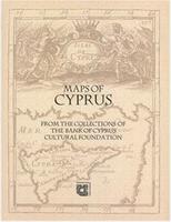
Cyprus Atlases
Maps of Cyprus from the Collections of the Bank of Cyprus Cultural Foundation. Bank of Cyprus Cultural Foundation, 2003.
This publication accompanied the exhibition entitled "The Cyprus of the European Cartographers, 16th-20th Century", held in Nicosia to coincide with the 22nd International Symposium of the International Map Collectors' Society (IMCoS) (14-16 October 2003), which was organised by the Bank of Cyprus Cultural Foundation. It includes 307 cartographic items, almost the entire Map Collection of the Foundation. Maps are arranged in chronological order, according to the date each map first appeared in print, followed by one or more descriptions of a map or maps based on the specific print. The introduction on "The History of the Cartography of Cyprus" is the work of the late Andreas Hadjipaschalis and first appeared in Maps and Atlases (Nicosia 1989).
177 entries of Cypriotic maps, all illustrated. Extensive indexes, and lengthy descriptions by the esteemed scholar Leonora Navari.
$76.99
64-45442
Atlas.
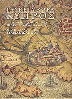
The Sweet Land of Cyprus Atlas. Cyprus Research Centre, 1980.
Since the late 1970s, Sylvia Ioannou systematically began to collect books on her homeland, Cyprus. Today, the collection includes unique manuscripts and rare books covering the period from the late 15th to the late 19th century, and one of the most comprehensive of their kind. This atlas is the catalog from a special exhibit prepared for the entry of Cyprus into the EU. ISBN 9789608779204.
$74.99
64-45443
Atlas.
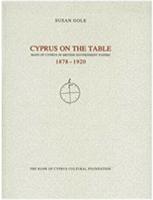
Cyprus on the table: Maps of Cyprus in British government papers, 1878-1920: Cyprus Cartography Lectures #3. Bank of Cyprus Cultural Foundation, 1996.
Soft-cover book, 60 pages. The book has about 30 pages of text and 30 pages of color images of maps. In English.
$22.99
64-45444
Atlas.
Kitchener's Survey of Cyprus 1878-1883: The Full Triangulated Survey and Mapping of The Island. Bank Of Cyprus Cultural Foundation, 2001.
The first 26 pages are the lecture notes from the Cyprus Cartography Lecture #5 on Kitchener's Survey of Cyprus. There are 28 pages of color and black and white illustrations and map images.
$39.99
64-45445
Atlas.
Cyprus 1542. The Great Map of the Island Atlas. Bank of Cyprus Cultural Foundation, 2007.
The 7th lecture in the series "Cyprus Cartography", entitled "Cyprus 1542: The great map of the island by Leonida Attar" was delivered in October 2003. The large scale map of Cyprus (139 × 64 cm) was drawn in 1542 by Cypriot Leonida Attar. Attar was appointed by the Venetian authorities as a specialist in irrigation works and military fortifications, which he undertook together with Michelle and Girolamo Sanmicheli in both Venice and Cyprus. At the same time, he acquired technical knowledge and experience in drawing maps. The map remained hidden in the archives of Venice from the 16th century onwards, most likely for strategic and military reasons, and was practically unknown until a few years ago. The discovery and study of the map by the authors has demonstrated its importance as a primary source for cartography and the history of Cyprus. ISBN 9789963428489.
$59.99
64-45446
Atlas.
The History of the Cartography of Cyprus Atlas. Cyprus Research Centre, 1980.
Hardcover atlas that contains more than two hundred black/white images of historical maps of Cyprus, plus 150 pages of notes on the images. No ISBN.
$149.99
64-45447
Atlas.
Finland Atlases
Finland Historical Atlas. Karttakeskus, 2007.
Hardcover atlas, in Finnish only. The atlas deals with the changes of the environment, habitation and population history, economic history and political and cultural phenomena, and includeding the Finnish territory cross-border contacts. The book has hundreds of maps and charts that have been drawn up on the basis of source materials for this work. The atlas also has a section that illustrates changes in the borders of Finland and changes in mapping technology over time. I?SBN 9789515930293
$134.95
64-5545
Atlas.
Iran Atlases
Iran Travel Map Atlas. 1:1,000,000. Irangardan, 2009.
An atlas and tourist guide to Iran, with 1:1,000,000 maps covering all of Iran. The maps show tourist routes, physical feateures, etc. In addition to the 1:1,000,000 maps of Iran, there are 30 maps covering the provincial capital cities, plus a list of attractions of the provinces and cities of Iran that is included at the end of this guide. ISBN 9789646635951.
$22.99
64-78921
Atlas.
Russia Atlases
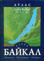
Lake Baikal Atlas: Past, Present, Future. Roskartografiya, 2005.
This atlas details the geology, climate, natural resources, tourism, ecology, and wildlife management of the region surrounding Lake Baikal. Includes information on the origins and history of the lake and prospects for the future of the lake. In Russian only. ISBN 9785952301092.
$49.99
65-3197LB
Atlas.
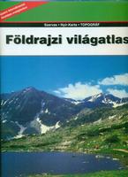
World Atlas in Hungarian
World Atlas - in Hungarian. World atlas in Hungarian. Hardcover, 9.5 x 13 inches in size. Includes 128 pages of physical maps of the world. Also includes 238 pages of country profiles and photos plus over 75 pages of index.
$59.95
61-0604
Atlas.
Visiting North Carolina? Like to visit Omni? Please click here for a Mapquest map to our offices. If you are passing through central North Carolina, we would be pleased to have you visit our store and warehouse. We are located about 30 minutes east of Greensboro, 60 minutes west of Raleigh, and 2 hours northeast of Charlotte. We are open Monday-Friday 8am - 5:30pm and weekends by prior arrangement.
Contact information: For information on a map or other product: [email protected] To place an order or check on an order: [email protected] For questions on an invoice: [email protected] Phone: (1) 800-742-2677 (USA) or (1) 336-227-8300 (International)
Fax: (1) 336-227-3748


 Larger image of the Springer Mountain lapel pin.
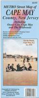
 Sample detail from the Bowling Green street map.
 Sample detail from the San Diego street map.
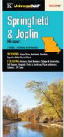
 Sample detail from the Belo Horizonte atlas.
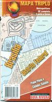
 Sample detail from the Brasilia map.
 Pyongyang city map. North Korea Tourism Bureau.
 Thumbnail image of the reverse of the map.
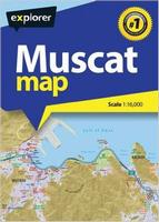
 Sample detail of the Muscat City Map
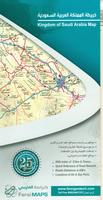 Limited stock left
 Sample detail from the Saudi Arabia road map.
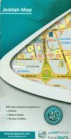 Limited stock left!
 Sample detail from the Jeddah city map.
 In Arabic only
 Sample detail from the Jeddah city map.
 Limited stock left!
 Sketch map showing sheet coverage.

 Waterproof!