Yemen Travel Map. Gizimap.
We are very pleased with this map, especially considering the current events in Yemen. The map shows details of the roads, towns and villages, physical features, and much more. The maps include small inset maps of Sana'a and Aden. Multilingual.
Sample detail of the Yemen Travel Map Sketch map showing area covered by this map
$14.99
65-55906
1 sheet, folded.
$19.99
65-55906R
1 sheet, flat/rolled.
$36.99
65-55906L
Laminated.
Oman, Yemen, and U.A.E. Travel Map. 1:1,400,000. ITMB.
Oman is a stark and wild mountainous country. This map shows its physical features and road network exceptionally well. Yemen is one of the most unusual countries in the world, but well worth a visit if you can get in. This map certainly shows the country to good advantage, especially its exotic terrain. Politically, this is a country one would have to define as challenging; touristically, as well.
Sample of the Oman map detail Sample of the Oman map detail.
$12.95
65-12905
1 sheet, folded.
Yemen Travel Map. Freytag/Berndt.
Probably the best map for Yemen. Clear road detail is overlaid onto a physical map of the country. Administrative boundaries are clearly marked and there is a 1:150,000 map of Aden. Road information includes distances. Airports and railways are shown along with wadis, salt flats, palm groves, etc. Tourist information includes beaches, hostels and hotels. The map also gives latitude and longitude in 1º intervals. Size is approx. 98 x 69 cm.
Detail of the map.
$15.99
65-55905
1 sheet, folded
Waterproof! Yemen Travel Map. 1:850,000. Reise Know-How.
Excellent mapping of Yemen on waterproof, tear-proof synthetic paper. On one side is the western part of the country and on the reverse, the east with an index of placenames and an inset with a map of the island of Socotra. Size is approx. 62 x 46 cm.
Sample of the map detail.
$15.99
65-55902
1 sheet, folded
Yemen Travel Map. 1:1,400,000. ITMB. An attractive road map of the country with altitude colouring to show the relief. The cartography also shows physiography eg. dunes & lava, and hydrographic details eg. marshes and intermittent rivers.
Intermediate road distances are indicated on main roads, and some unsurfaced roads and tracks are included.
Symbols show the presence of many further features eg. airports, airfields, ports, hospitals, border crossings, antiquities, oases and beaches. Latitude an longitude lines are at 1° intervals. The map is indexed and also provides a glossary of Arabic geographical terms. Size approximately 100 x 68 cm.
Sample of the map detail.
$12.95
65-55901
1 sheet, folded
Yemen Topographic Maps
Yemen 1:200,000 Topographic Quadrangle Map Set. 1:200,000. Soviet government. 1978-1979. High quality topographic maps for a country where little else is available. This set of 71 sheets gives complete coverage of the combined Yemen. In Russian.
 Yemen Maps
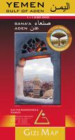
 Sample detail of the Yemen Travel Map
 Sketch map showing area covered by this map

 Sample of the Oman map detail
 Sample of the Oman map detail.
 Detail of the map.
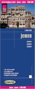 Waterproof!
 Sample of the map detail.
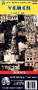
 Sample of the map detail.
 Yemen Flags