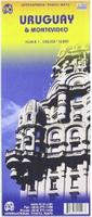
Uruguay & Montevideo Travel Map. 1:800,000 (Uruguay) and 1:10,000 (Montevideo). ITMB, Vancouver. A good quality travel map with elevation color shading, detailed road network, tourist information and tourist sites. The reverse side has a large detailed map of Montevideo..
Sample #1 Sample #2
65-50901
1 sheet, folded
$12.95
Waterproof!
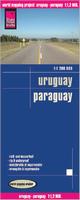
Uruguay and Paraguay Travel Map. 1:1,200,000. Reise Know-How. Detailed double-sided road map of Uruguay and Paraguay, printed on waterproof, tear-resistant synthetic paper. Uruguay is on one side, while Paraguay is on the reverse. Elevation is shown by contour lines and color shading, while the road network shows dirt tracks to main roads, with intermediate distances marked on the main routes. Size is 70 x 100 cm (27.5 x 39.4").
Sample map detail from the Uruguay road map
65-5090
1 sheet, folded
$15.99
Montevideo city map. 1:25,000. de Dios. Street Map covering the following Districts: Aguada, Arroyo Seco, Atahualpa, Barrio Sur, Bella Vista, Brazo Oriental, Buceo, Carrasco, Centro, Ciudad Vieja, Cordon, Jacinto Vera, La Comercial, Malvin, Palermo, Parque Battle, Parque Rodo, Pocitos, Prado, Punta Carretas, Punta Gorda, Retiro, Tres Cruces, Villa del Cerro.
Includes a subway map, index of all the streets covered, attractions, points of interest, museums, parks,etc., and useful phone numbers. Map size is 22.5 x 68 cm.
65-5092MR
1 sheet, folded.
$11.99
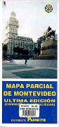
Montevideo city map. 1:26,000. TEC Asociados, 1999. Most complete city map of Montevideo, even though it is a bit old. In Spanish. Often out of stock and difficult to obtain.
65-5092MO
1 sheet, folded.
$21.95
Uruguay Topographic Maps
(Uruguay) Montevideo Topographic Quadrangle Maps. 1:25,000. 1989. SGM. This series of 44 maps covers the Montevideo region in excellent detail. The maps are compiled from aerial photography flown in late 1987. In Spanish.
(Uruguay) Montevideo 1:25,000 Topographic Map Index.
Uruguay Political Wall Map. 1:500,000. 1992. SGM. Available as two sheets spliced together, laminated, and with wood rails top and bottom, or as the two sheets, not spliced nor mounted. In Spanish.
65-50537W
Wall map.
$31.99
65-50537
Two sheets, rolled.
$29.95
Uruguay Topographic/Physical Map (Republica Oriental del Uruguay Carta Geografica Hipsografia). 1:500,000. 1992. SGM. Two sheets with hypsometric contour lines, cultural information, and roads. In Spanish.
65-50538
2 sheets, rolled
$29.95
Uruguay Topographic/Physical Map (Carta Regional de la Republica Oriental del Uruguay). 1:1,000,000. 1981. SGM. One sheet with contour lines, cultural information, and roads. In Spanish.
65-5054
1 sheet, rolled
$18.00
Uruguay Geologic and Thematic Maps
Uruguay Free-Air Gravity Map. 1:1,000,000. 2005. In Spanish. Color plot, in Spanish.
65-5013
1 sheet, flat
$24.95
Uruguay Hydrogeologic Map (Carta Hidrogeologica). 1:2,000,000. 1986. DNMG. Generalized map with three inset maps. With a 70-page text. Sheet size is 60 x 78 cm. In Spanish.
65-5030
Set, folded
$39.95
Uruguay Soils Map (Carta Suelos). Black and white map showing major soil horizons for Uruguay. In Spanish.

 Sample #1
 Sample #2
 Waterproof!
 Sample map detail from the Uruguay road map
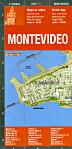

 (Uruguay) Montevideo 1:25,000 Topographic Map Index.