|
|
Automobile Map of Ukraine & Moldova. 1:1,250,000. GUGK. Road map with vegetation shading, roads, villages, and mileages between intersections. In Russian.
Ukraine Road Map. 1:1,000,000. Kartografia, Ukraine. Detailed road map by the largest commercial map publishers in Ukraine. In Ukrainian with a bilingual legend.
Ukraine Tourist Map. 1:1,250,000. Kartografia, Ukraine, 2004. A good quality English-language road/travel map of Ukraine. The reverse side of the map has extensive descriptive text for tourists. ISBN 966-631-412-5.
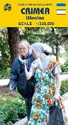
(Ukraine) Crimea Road Atlas. 1:300,000. Kartographia, Kyiv. In Ukrainian.
Crimea Road Map. 1:400,000. Kartographia, Kyiv. With a shaded relief map on one side and a reproduction of an 1847 map on the reverse. In Ukrainian.
(Ukraine) Crimea Road Map. 1:320,000. ITMB. Good road map of Crimea, in English.
The Crimea - Panorama of the Peninsula. Kartografia, Ukraine, 2004. This is a bird's-eye view panorama map of the Crimean Peninsula plus inset bird's-eye views of 9 cities on the Peninsula, in English. Attractive souvenir map. ISBN 966-631-411-8.
Ukraine City Maps
Ukraine Hiking Maps
Carpathians & Crimea sites.
Ukraine Topographic Maps
Ukraine Political, Administrative, and Physical Maps and Atlases
This atlas includes 64 maps, dozens of figures and tables accompanied by an explanatory text, written in a popular, scientific manner. The book is an attempt to outline the geographical setting and geopolitical context of Ukraine, as well as its history, natural environment, population, settlements and economy. 147 pages.

Ukraine Reference Map (Geographic/Physical Map). 1:1,500,000. In English. The folded version has a full city/town index on the reverse. Both have hypsometric shading to show elevation. Available in rolled or folded vesions.
Ukraine Political Map. 1:2,000,000. 1992. One sheet, in Ukrainian.
Ukraine Administrative Map. 1:750,000. In Ukrainian.
Ukraine Administrative Map. 1:3,750,000. In English.
Ukraine Geologic and Thematic Maps
Ukraine Landscapes Map. 1:1,000,000. In Ukrainian. 2 sheets.
Ukraine Ecological Situation Map. 1:2,000,000. Ukrheodezkartohrafiia, Kiev. 1996. One double-sided sheet, in color, 47 x 68 cm. One side shows the map of ecologic zones, with three inset maps. The reverse side has descriptive text. In Ukrainian.
Kharkivs'ka Oblast Ecological Map. 1:300,000. Kartografia, Kiev. 1995. One double-sided sheet, in color, 86 x 106 cm. One side has the oblast map showing pollution sites, pollution zones, etc. The reverse has descriptive text. In Russian.
Ukraine Metallurgical Complex Map. 1:1,000,000. In Ukrainian. 2 sheets.
Ukraine Chemical, Oil Refining Industry Map. 1:1,000,000. In Ukrainian. 2 sheets.
Ukraine Engineering and Metal-Working Industry Map. 1:1,000,000. In Ukrainian. 2 sheets.
Ukraine Agriculture and Processing Industries Map. 1:1,000,000. In Ukrainian. 2 sheets.
Ukraine Industry Map. 1:2,000,000. Mapa Ltd., Kiev. 1994. One double-sided sheet, in color, 48 x 68 cm. One side has the map showing locations of major industrial sites, color-coded by type. The reverse side has descriptive text. In Ukrainian.
Ukraine Population Map. 1:1,000,000. In Ukrainian. 2 sheets.
|
|||||||||||||||||||||||||||||||||||||||||||||||||||||||||||||||||||||||||||||||||||||||||||||||||||||||||||||||||||||||||||||||||||||||||||||||||||||||||||||||||||||||||||||||||||||||||||||||||||||||||||||||||||||||||||||||||||||||||||||||||||||||||||||||||||||||||||||||||||||||||||||||||||||||||||||||||||||||||||||||||||||||||||||||||||||||||||||||||||||||||||||||||||||||||||||||||||||||||||||||||||||||||||||||||||||||||||||||||
 Ukraine Republic Maps and Atlases
  Recommended
 Sample of the map
 Sample of the Ukraine road map detail.
 Waterproof
 Sample of the map
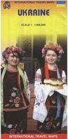
 Sample of the map
 (Ukraine) Crimea Tourist/Topographic Atlas. 1:100,000. Kartografia, 2006. In Ukrainian. A detailed topographic road atlas of the Crimean autonomous region. The maps have a 20' latitude/longitude grid. ISBN 966-631-805-9.

 Waterproof
 Sample of the map
 Recommended!


 East-Carpathians Map - Swidovets, Chorna Hora, Rakhivskiy Mtns. 1:50,000. Dimap. A detailed topographic hiking map of the East Carpathian region of western Ukraine along the Romanian border. Multilingual.
 Sample of the Dnepropetrovks map detail
 Sample from one of the Kartografia maps.
 Sample of 1:10,000 side of Kiev map 66-0392L
 Sample of 1:35,000 side of Kiev map 66-0392L
 Sample of Odessa map.
 Sample of Zolochiv map.

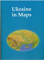 Ukraine in Maps (Atlas). Institute of Geography, National Academy of Science of Ukraine, 2008.

 Ukraine On Old Maps (Atlas). Kartografia, 2004. Bilingual English/Ukrainian. This beautiful atlas contains 83 historic map reproductions, all showing the Ukraine territory throughout history. The maps range in age from 1493 to 1649. Each map is accompanied by a page or so of bilingual descriptive text.

 Ukraine Geographic Atlas. Kartografia, 2004. In Ukrainian. The Atlas of Ukraine is the source of knowledge for the Ukraine, giving precise information about the geography of Ukraine, its regions and the biggest cities. The Atlas reflects the geopolitical position of Ukraine in Europe, includes the maps of oblast's of Ukraine, detailed maps of the Carpathians, the Crimean mountains, the Southern coast of the Crimea, Donbas. For the first time the substantial maps of the national parks are included. The Atlas contains altogether more than 20,000 geographical names, has exquisite design and high-level graphic arts quality.
 Political-Administrative Atlas Ukraine. Kartografia, 2006. In Ukrainian. The maps range from 1:1,000,000 political-administrative maps for the oblasts to 1:200,000 or 1:150,000 administrative & street maps for regions or city regions. Hardcover, 120 pages, including 100 pages of maps and 20 pages of index. ISBN 966-631-674-9.

 Ukraine General Atlas. Kartografia, 2004. In Ukrainian. A companion atlas to the one above, this atlas covers a wide range of economic and industrial topics, with the maps ranging from 1:3,000,000 to 1:7,000,000. Hardcover, 96 pages. ISBN 966-631-561-0.


 Ukraine Flags