Mount Ararat Region. 1:200,000. West Col Productions. 1988. A generalized topographic map showing the main routes up Mt. Ararat. The map shows contours, spot elevations of mountains, trekking trails, and villages. A small 32-page booklet gives trekking information.
Sample image
$25.95
65-4578
1 sheet, folded
A Tour Guide (Map) to Gallipoli: The Gallipoli Campaign 1915. Footstep Maps, Australia.
'A Tour Guide to Gallipoli" is both an historical and tour guide map designed for those wishing to visit the World War One battlefield on the Gallipoli peninsula and know more about why it happened and the consequences.
Both sides of the map use satellite imagery as a base. The historical side is a terrain image with a concise history of the battle and a number of black and white photographs of the time.
The tourist guide provides an image of the peninsula showing roads and locations of memorials and the main military cemeteries. A small scale map indicates the location of Gallipoli in relation to Istanbul.
There is additional information and a number of colour photographs of the memorials, cemeteries and sites of interest.
Sample #1 of the Gallipoli map Sample #2 of the Gallipoli map
$19.95
65-45972
1 sheet, folded.
Turkey Road & Street Atlases
Recommended Turkey Road Atlas (Köy Köy Türkiye Yol Atlasi). 1:400,000. Map Medya Basin Yayin, 2008. Very detailed physical/road atlas for all of Turkey. 211 map pages with hypsometric shading and 128 pages of location index. The maps show roads (coded by type), distances, railroads and rail stations, museums, cemeteries, hotels, etc. Paperback, In Turkish with bilingual legend, 28 x 27 cm in size. This is an excellent, detailed, current atlas and highly recommended.
Sample detail of the Turkey road atlas Sample detail of the Turkey road atlas.
$79.99
65-45882
Road atlas
Ankara Street Atlas (Sokak Sokak Ankara Kent Atlasi). 1:10,000. MapMedya, 2004. The most detailed street atlas for Ankara. Shows bus routes, metro lines, motels, religious buildings, cinemas, police stations, etc. In Turkish. Softcover, ISBN 975-6206-01-2.
Sample detail of the Ankara Street Atlas
$24.95
65-4592AM
Atlas.
Bursa Step by Step Atlas (Adim Adim Bursa Kent Plani). 1:9,000. Map Media. In Turkish. Pocket-sized tourist atlas of the Bursa city center. Paperback 5 x 7½".
$17.95
65-4592BW
Atlas.
Istanbul Mosque Atlas (Istanbul Inanç Atlasi). MapMedya. This Turkish-language street atlas has descriptions and photos of all of mosques in Istanbul, along with being located on the street atlas. Paperback, 5 x 7.5", ISBN 975-6206-02-0.
$19.95
65-4592IV
Atlas.
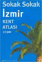
Izmir City Street Atlas (Sokak Sokak Izmir Kent Atlasi). 1:7,500. MapMedya. The most detailed street atlas available for Izmir with over 22,000 streets, hotels, schools, mosques, metro stations, police stations, post offices, and much more. With complete street index. 294 pages, in Turkish, ISBN 975-6206-03-9.
$29.95
65-4592IW
Atlas.
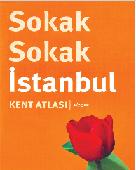
Recommended Istanbul City Atlas (Sokak Sokak Istanbul). 1:7,500. Map Media Basin Yayin. Very detailed city street atlas. Paperback, 583 map pages and 199 pages of street index. All sorts of tourist information is shown on the maps using symbols - cemeteries, hotels, rail stations, cafes, banks, museums, etc. In Turkish. This is an excellent, detailed, current atlas and highly recommended.
Sample image
$49.95
65-4592IU
Road atlas
Turkey Road & Street Maps
Turkey Adventure Map. 1:1,200,000. National Geographic Maps. The front side of the Turkey map details the eastern region of the country, from its border with Syria and Iraq to the south, Iran and Armenia to the East, extending to the Black Sea and Georgia to the north. The regions featured on this side are Southeast Anatolia and East Anatolia. The reverse side of the map details Turkey's western portion of the country, from its border with Greece to the west, to the Mediterranean Sea to the south, extending to the Black Sea to the north. This side covers the Black Sea Region, Aegean Region, Central Anatolia Region and the Mediterranean Region. Map size is 26 x 38" unfolded.
$11.95
65-4590
1 sheet, folded.
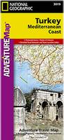
Turkey's Mediterranean Coast Adventure Map. 1:760,000. National Geographic Maps. The front side of the Turkey Mediterranean Coast map details the southern coastal region of the country. This side shows the Mediterranean Sea to the south and Syria to the east. The coastline expands from Kas to Iskenderum. The reverse side of the map details Turkey's western coastal region of the country and its border with Greece and Bulgaria. This side shows the western coast from Sea of Marmara down to the Mediterranean Sea. Map size is 26 x 38" unfolded.
$11.95
65-45908
1 sheet, folded.
Turkey Travel Map. 1:1,100,000. ITMB. Turkey is one of the safe, reliable and friendly travel destinations for both holiday makers and intrepid explorers of more secluded regions in the East. Moreover, it provides easy access to the Caucasus and also the only road access to Iraq. This first edition presents immense amount of up-to-date geographical information as well as useful hints and tips for travellers. It includes an inset with street plan of central Istanbul (1:11,000) and a comprehensive place name index. Topography is presented by altitude colouring with spot heights. Printed on paper, double sided.
Sample detail #1 of the Turkey Travel Map Sample detail #2 of the Turkey Travel Map
$12.95
65-45907
1 sheet, folded.
New map, waterproof! Turkey South Coast Travel Map. 1:550,000. ITMB, February, 2016. ISBN 9781771297936.
The south, or Antalyan coast of Turkey is probably the most touristic in the country, loaded with hotels and superlative beaches. The region also has some wonderful Greek and Roman ruins to visit. This map covers from Izmir on the west coast to Antalya on the south coast.
Front of the Turkey South Coast travel map. Reverse of the Turkey South Coast travel map.
Turkey Road Map. 1:2,000,000. Mepmedya. Nice looking, good quality road map showing historic sites, railways, national parks, etc. This map is less detailed than some of the other road maps listed here but it includes a lot of tourist information (tri-lingual including English), and is a little smaller in size, so that you can use it in a bus or car.
Sample image
$16.99
65-45902
1 sheet, folded
Turkey Road Map. 1:1,000,000. Arkadas, Turkey, 2008. Numerous symbols locate tourist sites and services. Distances between major road junctions are marked on the map, along with mountain passes, rivers, tourist sites, etc. A city/town index and distance chart on inset on the reverse side of the map. The map is bilingual English/Turkish. Double-sided, size approximately 27 x 39 inches.
Sample of the map detail
$14.99
65-45903
1 sheet, folded
Turkey road map. 1:800,000. Freytag & Berndt. A detailed double-sided map (divided east and west). On one side is a 1:800,000 map of western Turkey. The rest of the country is on the reverse at a scale of 1:2,000,000. The mapping is clear and shows the relief very well by using shading and spot heights. Information for tourists (e.g. campsites, ruins and national parks) supplements standard detail like towns, roads and administrative boundaries. Size is 125 x 87 cm.
Sample of the map detail sketch showing map coverage
Western Turkish Riviera road map: Antalya - Kemer - Fethiye. 1:150,000. Freytag & Berndt. This is the western sheet of a 2-sheet set that covers the Turkish Riviera. This is a detailed shaded relief map with spot heights to show elevation. The map includes small inset maps for Fethiye and the historic sites of Perge and Termessos. Includes tips on Top 10 Sites and a full index.
Sample of the map detail Thumbnail of the Western Turkish Riviera map sketch showing map coverage
$14.95
65-45791
1 sheet, folded.
Turkey City & Region Tourist Maps. MepMedya. This series of trilingual maps (English/German/Turkish) includes extensive tourist information on the reverse of the map. Map sizes are 25 x 35" (64 x 90 cm).
Sample from the Turkey tourist road map Sample from the Istanbul map
$16.99
65-45902
Turkey tourist road map. 1:2,000,000.
$17.99
65-45904-7
Kapadokya regional map. 1:250,000.
$15.99
65-4592AK
Alanya city map. 1:9,000. Includes inset map of the Alanya Castle.
$15.99
65-4592BP
Bodrum city map. 1:6,500. Includes inset map of the Castle.
$15.99
65-4592IP
Istanbul city map. 1:8,500. Includes inset map of the Grand Bazaar.
$15.99
65-4592MC
Marmaris city map. 1:6,000. With inset maps of Datça and Içmeler.
Aegean Region (eastern Aegean/western Turkey) map. 1:400,000.
$17.99
65-45904-3
Black Sea Region map. 1:375,000.
$17.99
65-45904-4
Kapadokya. 1:230,000.
$17.99
65-45904-5
Marmara Region map. 1:375,000.
$17.99
65-45904-6
Middle Anatolia region. 1:400,000.
Turkey Street Maps
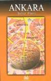
Ankara city street map. 1:12,500. Arkadas, Turkey, 2007. A detailed city street map of Ankara, in Turkish. There is a separate index booklet inside the front cover. Numerous symbols locate tourist sites and services. The map legend is bilingual English/Turkish, while the map is Turkish only.
Sample of the map detail
$14.99
65-4592AN
1 sheet, folded
Istanbul Laminated City Center Map. 1:11,000. Borch. Our soft-laminated folded map of Istanbul shows: Istanbul 1:11,000, Topkapi Palace 1:4,000, Grand Bazaar 1:3,000, Üsküdar 1:13,000, Greater Istanbul 1:150,000, Northwestern Turkey 1:2,000,000, Public Transport Istanbul, Turkey administrative & time zones, Top 30 sights. Borch Maps are easy to fold, durable and water-repellent with a wipeable surface. Borch Maps show hotels, museums, monuments, markets, public transport, top sights and points of interest, useful statistics, conversion charts for temperatures, weights and measurements, climate charts showing temperatures, sunshine hours and precipitation, overview maps, time zones, and much more...
Thumbnail of the front of the Istanbul map Thumbnail of the reverse of the Istanbul map
$9.95
65-4592IM
1 sheet, folded
Istanbul city street map. Variable scale. Arkadas, Turkey. A double-sided sheet with nine maps covering the major districts of the city. The map legend is bilingual English/Turkish, while the map is Turkish only.
$12.95
65-4592IR
1 sheet, folded
Istanbul City and Northwest Turkey Map. 1:11,000. ITMB. Covers the main tourist sections of Istanbul, including both banks of the river. Fully indexed.
$10.95
65-4592IS
1 sheet, folded.
Waterproof! Istanbul pocket city map. 1:10,000. Freytag & Berndt, 2008. Ideal-sized pocket map, with plenty of detail. Include the "big five" topics - sites, shopping, culinary, culture/history, and nightlife, along with info on the underground where applicable. Indexed, multi-lingual, including English. Size is 81 x 44.5 cm.
$6.95
65-4592IN
1 sheet, folded.
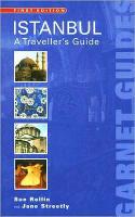
Istanbul - A Traveller's Guide. Garnet Guides, 2005. The incredible transformations that Istanbul has been subjected to in its history are reflected in its changes of name: Istanbul, Constantinople, Byzantium. The former capital of three successive empires (Roman, Byzantine and Ottoman), today Istanbul is still one of the great cities of the world. Embracing two continents, one arm reaching out to Asia and the other to Europe, through Istanbul run the waters of the Black Sea, the Sea of Marmara and the Golden Horn. The museums, churches, palaces, great mosques, bazaars and sights of natural beauty seem endless. The famous sky line reflects its past: the six minarets of the Blue Mosque and the impressive Suleymaniye Mosque strain to rival the great dome of St Sophia. This guidebook will help infuse the traveller to Istanbul with a clear sense of the different cultures and influences which contribute to the make-up of this fascinating city.
This guide includes detailed maps of walks around the city; comprehensive tours of monuments, tombs and ancient religious sites; frank, practical advice on where to stay and what to take; a complete account of the city's complex yet absorbing history.
Istanbul Neighborhood map - separate inset maps for Taksim-Galatasaray, Galatasaray-Tünel, Besiktas ve Cevresi, Ortaköy, Nisantasi, Yesilköy, Kumkapi.
$18.95
65-45921-03
Istanbul Peninsula map. 1:6,000.
$18.95
65-45921-04
Istanbul - European side main roads. 1:44,000.
$18.95
65-45921-05
Istanbul - Anatolian side main roads. 1:44,000.
$18.95
65-45921-06
Istanbul - Bosphorus. 1:5,000.
Turkey City Maps by the Turkish Government. Harita Genel Komutanligi. The most detailed maps of Istanbul and Izmir currently available. In Turkish.
$69.95
65-4592IT
Istanbul city map. 1:16,600. 6 sheets. In Turkish.
$69.95
65-4592IZ
Izmir city map. 1:15,000. 6 sheets. In Turkish.
Izmir city street map. 1:15,000. Arkadas, Turkey, 2002. One main map with two inset maps showing more detail. There is a booklet with the street index in a pocket in the map cover. The map legend is bilingual English/Turkish, while the map is Turkish only.
$14.99
65-4592IZM
1 sheet, folded
Turkey City Street Maps. A series of detailed, small city street maps for numerous cities in Turkey. Turkish maps, bilingual English-Turkish legend, with detailed street index booklet inside the cover.
Alanya city map. 1:9,000. Includes inset map of the Alanya Castle.
$14.99
65-4592AN
Ankara. 1:15,000.
$15.99
65-4592AP
Ankara. 1:36,000. Map Medya.
$15.99
65-4592AO
Antalya. 1:9,200.
$18.95
65-4592AY
Aydin (1:12,750) & Didim (1:10,000).
$18.95
65-4592BA
Bakirköy. 1:9,000.
$15.99
65-4592BE
Besiktas. 1:7,500.
$15.99
65-4592BF
Beyoglu. 1:8,250.
$15.99
65-4592BP
Bodrum city map. 1:6,500. Includes inset map of the Castle.
$18.95
65-4592BU
Bursa. 1:9,000.
$15.99
65-4592CB
Canakkale. 1:6,000.
$15.99
65-4592CE
Cesme. 1:6,000.
$15.99
65-4592DE
Denizli - Pamukkale. 1:8,000.
$18.95
65-4592FE
Fethiye. 1:7,000.
$18.95
65-4592GB
Gap Region city maps. Several inset maps at 1:6,000.
$17.99
65-4592GAZ
Gaziantep city map.
$15.99
65-4592IP
Istanbul city map. 1:8,500. Includes inset map of the Grand Bazaar.
$15.99
65-4592IX
Izmir. 1:40,000.
$18.95
65-4592IY
Izmit. 1:8,500.
$15.99
65-4592KA
Kadikoy. 1:9,000.
$15.99
65-4592KB
Kas (1:5,000) & Kalkan (1:11,000). Includes lots of detailed maps of historic ruins.
$15.99
65-4592KE
Kemer. 1:4,000.
$15.99
65-4592KO
Köycegiz (1:12,500) & Dalyan (1:7,500).
$17.95
65-4592KU
Kusadasi. 1:7,000.
$15.99
65-4592MC
Marmaris city map. 1:6,000. With inset maps of Datça and Içmeler.
$17.99
65-4592ME
Mersin & Tarsus. 1:5,000 & 1:375,000.
$15.99
65-4592SH
Side-Belek. 1:8,700.
$18.95
65-4592SI
Sile. 1:10,000.
$15.99
65-4592SJ
Sisli. 1:6,500.
$15.99
65-4592US
üsküdar. 1:10,000.
Turkey City Topographic Maps. 1:10,000. Soviet government. These maps are regular topographic maps that include contour lines, power lines, rail/trolley lines, etc. In Russian.
Sample from Ankara Map
Turkey 1:100,000 Topographic Quadrangle Map Set. 1:100,000. Soviet government. High quality topographic maps for a country where little else is available. This set offers complete coverage of Turkey. In Russian.
$7128.00
65-45505
Set of 564 sheets, rolled
Turkey 1:200,000 Topographic Quadrangle Map Set. 1:200,000. Soviet government. 1973-1986. High quality topographic maps for a country where little else is available. Each sheet has extensive descriptive texton the reverse. This set gives complete coverage of Turkey in 162 sheets. In Russian.
$50.00
65-4551-XXXXXX
Individual sheets
$50.00
65-45511-XXXXXX
Per quad
$1944.00
65-4551
Set of 162 sheets, rolled
Turkey Topographic Map. 1:500,000. General Command Mapping, Turkey. This set of 18 sheets offers complete coverage of Turkey.
$29.95
65-4552-XX
Per sheet, specify area
$495.00
65-45525
Set of 18 sheets
Turkey Topographic Map. 1:1,000,000. GCM. Complete coverage is available in 8 sheets.
$59.95
65-4553
Each
$425.00
65-45535
Set of 8 sheets
Turkey Physical Map (Turkiye Fiziki Haritasi). 1:1,000,000. GCM. This 3-sheet map offers general physical coverage of Turkey. The map lacks contour lines, but has good coverage of the road system.
$149.95
65-4554
Set of 3 sheets
Turkey Political Map. 1:1,000,000. GCM. This 3-sheet map offers complete political information for Turkey. It does not include physical information.
$149.95
65-45545
Set of 3 sheets
Turkey Physical Map (Türkiye Fiziki Haritasi). 1:1,000,000. Harita Genel Komutanligi. 1989. 3 sheets, in color. An excellent, detailed, shaded relief and hypsometric map. The map shows roads, towns, pipelines, etc., but no internal political boundaries. In Turkish.
$149.95
65-4554
3 sheets, rolled
Turkey Physical Map (Türkiye Fiziki Haritasi). 1:1,000,000. Harita Genel Komutanligi. 1997. 3 sheets, in color. This is an updated version of the map above. This map also has hypsometric shading, but it is barely visible. The older edition is more attractive, but one assumes that updates and/or corrections have been made from the 1987 edition.
An excellent, detailed, shaded relief and hypsometric (barely shows) map. The map shows roads, towns, pipelines, etc., but no internal political boundaries. In Turkish.
$99.95
65-45541
3 sheets, rolled
-Physical Map of the Turkey-Balkans Region (Türkiye Balkanlar-Ortagogu). 1:3,000,000. Harita Genel Komutanligi. October, 1982. Four sheets, in color. The map uses hypsometric tints to show elevation. The map shows roads, towns, oil and gas pipelines, etc. The map covers the Arabian Peninsula in the west to Karachi in the east.
$60.00
66-22675
4 sheets, rolled
Turkey Geologic and Thematic Maps
Landslide Inventory Map of Turkey (series) - Zonguldak sheet. 1:500,000. Maden Tetkik ve Arama Genel Müdürlügü, 2005. This is the first map in this new series of 1:500,000 maps, which will eventually cover all of Turkey. The maps show the active and inactive mass land movements across Turkey, categorized into large and small active and inactive, and slides, creep, flow, and fall. The map is bilingual Turkish/English and the 24-page text is Turkish only.
$49.95
65-4535-ZO
Set, folded.
Geologic Quadrangle Maps of Turkey. 1:500,000. Maden Tetkik ve Arama Genel Müdürlügü, 2002. This detailed geologic map covers all of Turkey (two sheets are temporarily out of stock) and replaces the 1960's series. Bilingual Turkish/English.
$34.95
65-4555-AD
Adana.
$34.95
65-4555-AN
Ankara.
$34.95
65-4555-CI
Cizre.
$34.95
65-4555-DE
Denizli.
$34.95
65-4555-DI
Diyarbakir.
$34.95
65-4555-ER
Erzurum.
$34.95
65-4555-HA
Hatay.
$34.95
65-4555-IS
Istanbul. 2002.
$34.95
65-4555-IZ
Izmir.
$34.95
65-4555-KA
Kars.
$34.95
65-4555-KO
Konya.
$34.95
65-4555-SA
Samsun.
$34.95
65-4555-SI
Sivas.
$34.95
65-4555-TR
Trabzon.
$34.95
65-4555-VA
Van.
$34.95
65-4555-ZO
Zonguldak.
$34.95
65-4555-LE
Legend sheet.
Geologic Map of the Taurus region (carte géologique du Taurus Occidental au sud de Beysehir, Turquie). 1:100,000. 1979. CNRS, France. A 55-page text accompanies the map. In French.


 Sample image
 Sample #1 of the Gallipoli map
 Sample #2 of the Gallipoli map
 Recommended
 Sample detail of the Turkey road atlas
 Sample detail of the Turkey road atlas.
 Sample detail of the Ankara Street Atlas

 Recommended
 Sample image
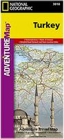
 Sample detail #1 of the Turkey Travel Map
 Sample detail #2 of the Turkey Travel Map
 New map, waterproof!
 Front of the Turkey South Coast travel map.
 Reverse of the Turkey South Coast travel map.
 New map
 Image of the front of the Western Turkey travel map
 Image of the reverse of the Western Turkey travel map
 Sample image
 Sample of the map detail

 Sample of the map detail
 sketch showing map coverage
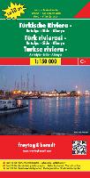
 Sample detail of the Turish Riviera map.
 Thumbnail of the front of the map.
 Sketch map showing area covered by this map.
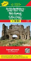
 Sample of the map detail
 Thumbnail of the Western Turkish Riviera map
 sketch showing map coverage
 Sample from the Istanbul map
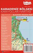
 Sample from the Anatolian Sea map
 Sample from the Aegean Sea map
 Sample of the map detail
 Thumbnail of the front of the Istanbul map
 Thumbnail of the reverse of the Istanbul map


 Waterproof!

 Sample from the Istanbul - Anatolian Side map
 Sample from the Istanbul - Bosphorus map
 Sample from the Ankara map
 Sample from the Antalya map
 Sample from the Aydin map
 Sample from the Bursa map
 Sample from the Gaziantep city map
 Sample from the Izmit map
 Sample from the Sisli map
 Sample from Ankara Map


