Togo Tourist Map (Carte Routière et Touristique). 1:500,000. Institut Geographique National, Paris. This is a good road and physical map. In French.
66-0090
1 sheet, folded
$16.99
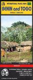
Togo and Benin Travel Map. 1:864,000. ITMB. General travel map with hypsometric shading and numerous tourist sites and information. Covers both Togo and Benin.
64-2090
1 sheet, folded.
$12.95
Togo Soils Map. 1:1,000,000. 1969. ORSTOM (NE 34). Illustrates the distribution and variation in soil types. With a 91-page text; in French. 46 x 69 cm.
 Togo
Togo


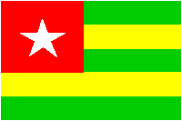
 Togo Flags