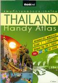
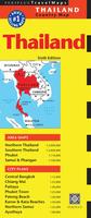
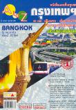
Thailand Handy Atlas. 1:1,000,000. Thinknet, Thailand, 2010, 2nd ed. This spiral-bound bilingual atlas covers all of Thailand with detailed maps of 85 major cities, the expressway and Outer Ring Road, a tourist attraction index,
a driving distance table, and a list of important telephone numbers. Atlas size is 25 x 18 cm, 148 pages. Bilingual.
Sample detail of the Thailand Handy Atlas road maps Sample detail of the Thailand Handy Atlas city maps
$19.99
65-42781
Atlas.
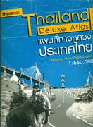
Thailand Deluxe Atlas. 1:550,000. Thinknet, Thailand, 2010, 4th ed. This softcover bilingual atlas has four parts: maps, index, city maps, and drive times and distance charts.
Provides comprehensive coverage of Thailand and its possessions
Uses the latest mapping in a large scale for easy reading
Scenic routes are shown
Shaded relief is shown
Comprehensive index of tourist sites and services (hospitals, police stations, etc.)
Includes maps of the largest 105 cities/towns in Thailand
Includes a drive time/distance map so you can plan your travelling times.
Thailand, Vietnam, Laos, and Cambodia Travel Atlas. 1:1,000,000. ITMB, 2012. The Indochina Region consists of five countries, including that portion of Burma that sweeps down the western part of the Malay Peninsula. The four other countries form a cohesive entity for travel, especially now that border and visa requirements for travel have been reduced. Thailand itself is definitely the Number One reason for visiting the region. The first portion of the atlas is devoted to Thailand, including detailed page-size maps of Bangkok, Chiang Mai, and Pattaya. Vietnam is the next most-popular destination and is shown in great detail, with inset maps of Hanoi, Hoi An, Hue, Da Nang, Da Lat, Can Tho, and the central Saigon portion of Ho Chi Minh City. Laos and Cambodia are shown with the same degree of attention to detail, including insets of Vientiane, Phnom Penh, and two maps concentrating on Angkor Wat. This is a compact and convenient way for visitors to the region to have everything they need in one format - easy to carry, easy to use.
Sample detail of the Indochina Travel Atlas
$19.95
66-20910
Atlas.
Waterproof!
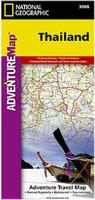
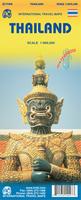
Thailand Travel Map. Scale 1:1,325,000. National Geographic Maps. The front side of the Thailand map shows the northern half of the country and extends south to the capital city of Bangkok. Border crossings are noted, as are many sites of interest in the neighboring countries of Laos, Myanmar (Burma), and Cambodia. The reverse side features the southern provinces located on the Malay Peninsula, a region popular for rock climbing, diving and snorkeling, or simply lying on the beach enjoying the view of the unique limestone islands that jut out of the Andaman Sea. Base cartography by Reise Know-How. Size is 26 x 38".
Sample detail of the Thailand travel map Front of the Thailand travel map Rear of the Thailand travel map
$11.95
65-42758
1 sheet, folded
Laminated! Thailand Travel Map. 1:1,500,000. Borch. Our soft-laminated folded map of Thailand in the 5th edition shows: Thailand 1:1 500 000, Bangkok 1:22 000, Greater Bangkok 1:125 000, Chiang Mai 1:22 000, Mae Hong Son 1:14 000, Northwest Thailand 1:835 000, Phuket 1:350 000, Ko Samui & Ko Phangan 1:350 000, Thailand administrative & time zones. Borch Maps are easy to fold, durable and water-repellent with a wipeable surface. Borch Maps show hotels, museums, monuments, markets, public transport, top sights and points of interest, useful statistics, conversion charts for temperatures, weights and measurements, climate charts showing temperatures, sunshine hours, precipitation and humidity, overview maps, time zones, and much more...
Sample of the Thailand map detail. Thumbnail image of the front of the Thailand map. Thumbnail image of the back of the Thailand map
Thailand Travel Map. 1:900,000. Freytag & Berndt, 2011. The map includes Top 10 Tips, sites, distances in km, and a multi-lingual legend which includes English. Size is 112.5 x 97 cm when open.
Sample detail of the Thailand Travel Map
$14.99
65-42771
1 sheet, folded.
Thailand Travel Map. 1:1,500,000. Nelles Verlag. An excellent road map with shaded relief to show elevation. Multilingual legend.
$17.95
64-4275
1 sheet, folded.
Thailand Travel Map. 1:2,000,000. Periplus. Area Maps: Northern Thailand 1:2,000,000; Southern Thailand 1:2,000,000; Phuket 1:110,000; Samui & Phangan 1:100,000.
City Plans: Central Bangkok 1:15,000; Chiang Mai 1:25,000; Pattaya 1:50,000; Phuket Town 1:25,000; Patong Beach 1:20,000; Karon & Kata Beaches 1:30,000; Northern Samui 1:25,000; Ayuthaya 1:40,000.
$8.95
64-42790
1 sheet, folded.
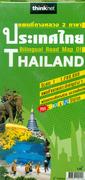
Thailand Bilingual Road Map. 1:1,200,000. Thinknet, Thailand, 8th ed., 2010. Double-sided, detailed, road map of Thailand. Includes inset maps of Phuket, Samui Island, Chang Island, Phangan Island, Samet Island. Bilingual. Map details include highways, main roads, political boundaries, airports, gas stations, hotel & resorts, police stations, toll roads and toll gates, and tourist spots such as shopping stores, waterfalls, national parks, islands, etc. Map size is 100 x 69 cm.
$10.99
65-42756
1 sheet, folded.
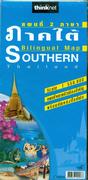
Thailand Regional Road Maps. 1:550,000. Thinknet, Thailand.
Five double-sided maps offer complete, detailed, road coverage of Thailand. Bilingual maps. Map detail includes highways, main roads, political boundaries, airports, gas stations, hotels and resorts, Police stations, and tourist spots such as shopping stores, waterfalls, national parks, islands, etc. Map size is 89 x 69 cm.
Skeetch map showing coverage of the map sheets. Sample detail of the northern Thailand Travel Map
$14.99
65-4272-NE
Chiang Mai Regional Thailand Road Map. Sheet #2
$14.99
65-4272-NE
Northeastern Thailand Road Map. Sheet #3.
$14.99
65-4272-NO
Northern Thailand Road Map. Sheet #1.
$14.99
65-4272-CE
Central Thailand Road Map. Sheet #5.
$14.99
65-4272-SO
Southern Thailand Road Map. Sheet #4.
Includes CD map MapMagic Road Maps of Thailand. Thinknet, Thailand. Bilingual. These maps include a paper map and a CD map. They offer more detail than the single-sheet country road maps listed elsewhere.
Map details include highways, main roads, political boundaries, airports, gas stations, hotel & resorts, police stations, toll roads and toll gates, and tourist spots such as shopping stores, waterfalls, national parks, islands, etc. Map size is 100 x 69 cm.
CD map ranges in scale from 1:3,000,000 to 1:1,000.
Bilingual.
User manual included on the CD.
$19.99
65-4267NE
MapMagic 19 Northeastern Provinces of Thailand Bilingual Road Map + CD Map. 1:550,000. Includes Khonkaen, Udon Thani, etc.
$19.99
65-4267NO
MapMagic 17 Northern Provinces of Thailand Bilingual Road Map + CD Map. 1:550,000. Includes Chiang Mai, Chiang Rai, Mae Hong Bon, etc.
$19.99
65-4267SO
MapMagic 14 Southern Provinces of Thailand Bilingual Road Map + CD Map. 1:550,000.
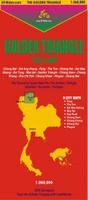
Northern Thailand Travel Maps.Golden Triangle Rider Ltd. is a small company specializing in customized motorcycle trips throughout Thailand and Laos. The owner of the company has made four maps covering northern Thailand and Laos as he was dissatisfied with the available maps. The maps have symbols/names locating hotels/guesthouses/resorts, restaurants, hospitals, massage centers, gas stations, post offices, etc. The maps also show distances, all ridden/checked by the author.
Sample detail of the Golden Triangle travel map Sample detail of the Golden Triangle travel map
$14.99
65-4269-GT
Golden Triangle Map. Scale 1:360,000. This double-sided map has a regional map of the Golden Triangle on the front and nine small city maps on the reverse. The city maps include Chiang Rai, Chiang Saen, Mae Sai, Chiang Khong, Fang, Sop Ruak, Tha Ton, Doi Mae Salong, and Phayao. Indexed, in English. Paper, size is 20 x 26".
$14.99
65-4269-MH
Mae Hong Son Map. Scale 1:375,000. This double-sided, laminated map covers Thailand's rugged north-west frontier along the Burma border. The maps shows highlights, highways, distances, accommodations and activities along the routes. Indexed, in English. Size is 19½ x 26".
$14.99
65-4269-MS
Mae Sa Valley Map. Scale 1:65,000. This single-sided paper map highlights the Chiang Mai environs with all 3 ring roads; dirt trails on Doi Suthep; Hmong villages around the Mae Sa Valley; the trail network north of Samoeng along the Samoeng River; tourist attractions are marked including elephant camps, orchid farms, waterfalls, resorts, guesthouses, hotels, pubs and restaurants, etc. Indexed, in English. Size is 20 x 26".
Ayutthaya Walk Map. Thinknet, Thailand. This detailed map, surveyed by GPS., offers full details of the Ayutthaya area, including the Bang Sai Royaal Folk Arts and Crafts center and the Bang Pa-In Palace.
Sample detail of the Ayutthaya walking map
$8.99
65-4271-PH
1 sheet, folded.
Chiang Mai and Nearby Provinces Bilingual Road Map. 1:550,000. Thinknet, Thailand. Bilingual. Map details include highways, main roads, political boundaries, airports, gas stations, hotel & resorts, police stations, toll roads and toll gates, and tourist spots such as shopping stores, waterfalls, national parks, islands, etc. Map size is 100 x 69 cm.
$10.99
65-4271-CH
1 sheet, folded.
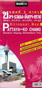
Pattaya - Ko Chang Bilingual Road Map. 1:350,000. Thinknet, Thailand. Bilingual. Map detail includes Highways, Main Roads, Main Soi, Airports, Railways, Political Boundaries, Ports, Temples, Churches, Mosques, Schools, Hospitals, Health Centers, Police Stations, Post Offices, Banks, Gas Stations including LPG and NGV stations, Shopping Centers, Minimarts, Golf Courses, Hotels, Resorts, Villages, Apartments, Waterfalls, Reservoirs, National Parks, Islands, Beaches, Tourist Spots, Spas, Karaoke spots, etc. Map size is 100 x 69 cm.
$22.95
65-4271-PA
1 sheet, folded.
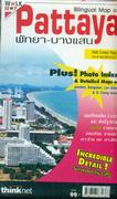
Pattaya Walk Map. Thinknet, Thailand. This map, surveyed by GPS offers incredible detail of the Ayutthaya beach area. Also includes detailed maps of Jomtien, Bangsaen, Lan Island, and Si Chang Island. ISBN 9789743831386.
Sample detail of the Pattaya walking map
$22.95
65-4271-PB
1 sheet, folded.
Islands in Thailand Road Map. Thinknet, Thailand, 3rd ed., 2010. Tourist Attraction Index. Includes a picture index, ferry time table, island and travel information, detailed maps of Samed Island, Lan Island, Chang Island, Kood Island, Mak Island, Phuket, PhiPhi Don Island, Phi Phi Islands, Yao Noi Island-Yao Yai Island, Lanta Island, Tao Island, Phangan Island and Samui Island. Map size is 71 x 49 cm.
$8.99
65-4271-IS
1 sheet, folded.
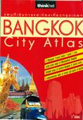
Bangkok Handy Atlas. Multiple scales. Thinknet, Thailand. Bilingual. The atlas includes an overview maps of Bangkok at 1:71,000 and detailed maps of the city center at 1:19,000. and tourist attractions, a comprehensive index with over 6,000 entries of streets, alleyways, hotels, temples, hospitals, embassies, buildings, department stores and other points of interest. Softcover, 6 x 8.25 inches.
Sample detail of the Bangkok Handy Atlas street maps Sample detail of the Bangkok Handy Atlas street maps
$19.99
65-4280BT
Atlas.
Bangkok & Southern Thailand Map. 1:10,000 & 1:900,000. ITMB.
Bangkok is a very interesting city, with many temples, pagodas, and historic buildings and hugely popular tourist destination. This updated edition includes the new airport, recently-completed transit lines, and additional information for embassies. This map has on the reverse a travel map for the southern half of the country, which means the peninsula connecting to Malaysia and including the most-visited parts of Thailand, the beach resorts located in the vicinity of Phuket.
Sample detail of the Bangkok city map Thumbnail of the front of the Bangkok city map Thumbnail of the reverse of the Bangkok city map
$11.95
65-4280BF
1 sheet, folded.
Includes CD map MapMagic Bangkok Street Map + CD Map. 1:82,000. Thinknet, Thailand, 2010. Bilingual. Includes paper map and a CD map.
Map details include highways, main roads, political boundaries, airports, gas stations, hotel & resorts, police stations, toll roads and toll gates, and tourist spots such as shopping stores, waterfalls, national parks, islands, etc. Map size is 100 x 69 cm.
CD map maximum zoom is 1:2,000.
Bilingual.
User manual included on the CD.
Paper map is 1:82,000 scale
Map size is 100 x 69 cm.
$19.99
65-4280MM
1 sheet, folded + CD.
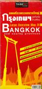
Large Overview Map of Bangkok and nearby provinces. 1:82,000. Thinknet, Thailand, 3rd ed., 2010. Map details include highways, Outer Ring Road, shortcuts, expressways, Soi, Railway, BTS Route, MRT Route, Future Road Project, Temple, Church, Mosque, School, University, Hospital, Police Station, Post Office, Bank, Shopping Center, 7-Eleven, Familymart, Lotus Express, Market, Gas Station, Bus station, Airport, Embassy, Building, Village, Hotel, Apartment, Condominium, Tourist Attraction, Golf Course, Industrial Estate, etc.
Newly Updated Data includes the Outer Ring Road, gas stations, 7-Elevens, restaurants, future road projects. Map size is 100 x 69 cm.
$10.99
65-4280BO
1 sheet, folded.
Bangkok Bilingual Street Map. Thinknet, Thailand. This detailed map is the most popular overview map of Bangkok. It includes shortcuts, expressways, future road projects, NGV and LPG stations, post offices, police stations, religious buildings, health centers, and much more. ISBN 8858583000090.
Sample detail of the Bangkok street map
$10.99
65-4280BN
1 sheet, folded.
Bangkok Walk Map. Thinknet, Thailand, 6th ed., 2010. Zoom detailed maps of Khaosan Road, Chatuchak Weekend Market, Chinatown, Siam, Silom, Sukhumvit & Historcal Rattanakosin. Transportation Detail of BTS, MRT, Boat and Bus Information. Ideal for the adventurous tourist wanting to explore Bangkok on foot. Map size is 71 x 49 cm.
Sample of the Bangkok Walking Map detail
$8.99
65-4280BW
1 sheet, folded.
Bangkok Bus Guide Map. Multiple scales. Thinknet, Thailand, 2010. Detailed maps showing the bus routes throughout Bangkok. The map uses color-coding to show information about each route - the type of bus on the route, the frequency, airport shuttles, etc. The map does not show all of the streets, but offers superb detail of the bus routes. Bilingual. Map detail includes transportation around Bangkok Metropolitan Area and Vicinity, including detailed map of bus routes in Bangkok including BTS, MRT and Airport Links, details of serviced van stands in Bangkok, and details of boat transportation. Map size is
81 x 65 cm.
$8.99
65-4280BU
1 sheet, folded.
Bangkok Travel Atlas. PN Map, 2005. Very detailed full color maps showing streets, expressways, points of interest and more. Bilingual throughout. Fully indexed. Numerous businesses are listed along city streets,
Sample #1 of the maps Sample #2 of the maps
Map of Udon Thani & Udon Thani City (north-central Thailand). 1:260,000 and approx. 1:5,000. Hypsometric map of this region in north-central Thailand, with a street map of the main city on the reverse.
$9.95
65-4265-01
Province of Ayutthaya. 1:200,000. Insets of Ayutthaya Town and Bangpa-In District.
$9.95
65-4265-02
Province of Chanthaburi. 1:200,000. With inset of Chanthaburi City. ISBN 974-7675-18-8.
$9.95
65-4265-03
Chiang Mai. 1:14,000.
$9.95
65-4265-04
Province of Chiang Mai. 1:500,000. Province of Mae Hong Son, Lamphun, Sukhothai, Chiang Rai, Lampang, Phayao, Tak.
$9.95
65-4265-05
Province of Chiang Rai. 1:329,000. Inset of Chiang Rai Town.
$9.95
65-4265-06
Province of Chumphon & Ranong. 1:400,000. Insets of Chumporn and Ranong municipalities.
$9.95
65-4265-07
Hat Yai and Song Khla Province. 1:300,000. With inset maps of Hat Yai and Songkhla Towns.
$9.95
65-4265-08
Province of Kanchanaburi "The memorial of World War II". 1:380,000. Insets of Kanchanaburi municipality.
$9.95
65-4265-09
Ko Phi Phi and Krabi, Phang-Nga, Phuket, Tran Province. 1:300,000. With insets of Krabi City and Talat Kao Town, dive sites and coral reefs.
$9.95
65-4265-10
Ko Samui & Pa-Ngan and Suratthani Province. 1:300,000. Inset maps of Ko Samui, Ko Pha-Ngan, Ko Tao cities. ISBN 974-7675-59-5.
$9.95
65-4265-11
Province of Mae Hong Son. 1:180,000. With forest walking routes and inset map of Mae Hong Son Town.
$9.95
65-4265-12
Province of Pattaya and eastern Thailand. With insets of Pattaya City, Pattaya Beach, Ko Chang resort island, Lan Island.
$9.95
65-4265-13
Pattaya and Chonburi Province. 1:219,000. With insets of Ko Lan, Bang Saen, Sri Racha, Pattaya City, Pattaya Beach. With index of 185 accomodations.
$9.95
65-4265-14
Province of Phuket. Insets of popular beaches, attractions, etc.
$9.95
65-4265-15
Province of Rayong. 1:165,000. Insets of Rayong Town, Ban Chang, Ban Pe, Sa Met Island National Park.
$9.95
65-4265-16
Province of Trang. 1:200,000.
$9.95
65-4265-17
Province of Trat. 1:190,000.
$9.95
65-4265-26
Map of the Province of Nakhon Si Thammarat. 1:300,000. This map shows roads with distances, gas stations, etc. Includes city center map of Nakhon Si Thammarat City. Size is 50 x 75 cm.
$9.95
65-4265-25
Map of Hua Hin & Cha Am. 1:300,000. This map shows roads and highways with milestones and surface conditions; distance chart; and cities and tourist attractions such as gas stations, etc. Size is 50 x 75 cm.
$9.95
65-4265-21
Map of Khao Yai National Park (Nakhon Ratchasima). 1:400,000. This map shows roads and highways with milestones and surface conditions; distance chart; and cities and tourist attractions.
$9.95
65-4265-20
Map of Khon Kaen (north-central Thailand). This map shows roads and highways with milestones and surface conditions; distance chart; and cities and tourist attractions.
$9.95
65-4273-07
Map of Gulf of Thailand: Ko Kut to Hon Khoai. 1:580,000. Size is 50 x 75 cm.
$9.95
65-4273-06
Map of Gulf of Thailand: Singapore to Saigon. 1:1,730,000. Size is 50 x 75 cm.
$9.95
65-4273-05
Map of Western Shore Line of Thailand: Andaman Sea. 1:1,730,000. Size is 50 x 75 cm.
$9.95
65-4273-02
Map of Northeastern Thailand. 1:990,000. This map shows roads and highways with milestones and surface conditions; distance chart; and cities and tourist attractions. Size is 50 x 75 cm.
$9.95
65-4273-03
Map of Central Thailand. 1:990,000. This map shows roads and highways with milestones and surface conditions; distance chart; and cities and tourist attractions. Size is 50 x 75 cm.
$9.95
65-4273-04
Map of Southern Thailand. 1:990,000. This map shows roads and highways with milestones and surface conditions; distance chart; and cities and tourist attractions. Size is 50 x 75 cm.
$9.95
65-4265-18
Map of the Golden Triangle (Mae Sai, Chiang Saen, Keng Tung). 1:500,000. This map shows roads and highways with milestones and surface conditions; distance chart; and cities and tourist attractions.
Highway map of Northern Thailand. 1:1,000,000. 1993. Highway Dept. Club.
$15.00
65-42745
1 sheet, rolled
Waterproof! Thailand Travel Map. 1:1,000,000. ITMB. Detailed road map with elevation tinting to show elevation.
$12.95
65-42751
1 sheet, folded
Thailand Regional Travel Maps. Various scales. Periplus. A good series of travel maps by this Singapore-based publisher. Updated every 2-3 years.
Phuket & Southern Thailand. With area maps of Phuket Island, Southern Thailand, and Tarutao Island and city plans of Phuket Town, Krabi Town, and Hat Yai.
$8.95
65-42794
Ko Samui & Southern Thailand. With area maps of Samui & Phangan Islands, Southern Thailand, Ko Tao, and Tarutao Island and a city plan of Hat Yai (1:12,000).
Bangkok & Adjacencies. 1:500,000. Prannok Witthaya Maps. A double-sided wall map with roads, cities, and tourist attractions marked. Size is 75 x 100 cm.
$9.95
65-4280PA
1 sheet, folded
Central Bangkok. 1:25,000. Prannok Witthaya Maps. A wall map with bus routes, details on "High Streets" - Siam Square, Sukhumwit, etc. Covers the full metropolitan area. Size is 75 x 100 cm.
$9.95
65-4280PC
1 sheet, folded
Map of Bangkok. Various scales. Prannok Witthaya Maps, 2000. A good tourist map of Bangkok and some of its districts such as China Town, etc. Additional tourist information on the reverse.
$9.95
65-4280PB
1 sheet, folded
Waterproof! New edition.
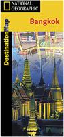
Bangkok Destination Map. Scale 1:14,300. National Geographic Maps. In addition to the easy-to-read map on the front, the back includes: - Regional map - Airport diagram - Skytrain map - Express boat service map - Information on transportation, shopping, tipping, and more - Multi-language legend. Size is 18 x 25".
Sample detail of the Bangkok travel map Front of the Bangkok travel map Rear of the Bangkok travel map
$7.95
65-4280BB
1 sheet, folded
Map of Surin and Srisaket Cities. 1:16,000 & 1:300,000. Prannok Witthaya Maps. This map covers two historic towns in eastern Thailand, with a regional map on the reverse.
$9.95
65-4280SU
1 sheet, folded
Bangkok City Map. 1:25,000. Nelles Verlag.
$13.95
65-4280
Bangkok.
Bangkok CityStreets Laminated city map. 1:14,000. Berndtson & Berndtson. Laminated.
$7.95
65-4280BC
1 sheet, folded
Thailand Topographic Quadrangle & Political Maps
Thailand Political Map. 1:1,200,000. Bilingual. Big, attractive political map of Thailand. Size is 4 x 5.5 ft. Thinly laminated.
$19.95
65-42490
1 sheet, folded
Thailand Political Map. 1:1,600,000. Prannok Witthaya Maps, 2000. A decent bilingual (Thai-English) political map of Thailand. Includes main roads and highway numbers, towns, villages, and more.
Bangkok Topographic Maps. 1:20,000. RTSD. There are 20 sheets in this set, offering complete coverage of Bangkok metropolitan area. Bilingual.
$160.00
65-4281
Set of 20 sheets
Thailand Nautical Charts
Thailand Nautical Chart Set. Royal Thai Navy. 1996 - 2009. Detailed nautical charts of Thailand. The charts range from 1:6,000 harbor charts to 1:240,000 coastal charts. 65 of 71 sheets are currently available. Bilingual English-Thai.
Thailand Resources Atlas. 1:2,500,000 - 1:15,000,000. 1976-1983. RTSD. This loose-leaf atlas contains 37 sheets covering the occurrence of numerous natural and cultural resources. Bilingual.
$149.95
65-4248
Set
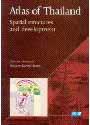
Atlas of Thailand: Spatial Structures and Development. IRD, 2004, English version published by Silkworm Books. Very detailed socio-economic atlas divided into nine chapters: Situations of the Territory, Population, The state of the construction of the country, Agriculture, Industry, Tertiary section, Bangkok and metro area, Two peripheral regions, Social imbalances and Spatial Organization. ISBN 974-9575-43-1. Paperback 8½ x 12". 209 pages.

 Sample detail of the Thailand Handy Atlas road maps
 Sample detail of the Thailand Handy Atlas city maps
 Sample detail of the Thailand Deluxe Atlas road maps
 Sample detail of the Thailand Deluxe Atlas city maps
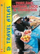
 Sample detail of the Indochina Travel Atlas
 Waterproof!
 Sample detail of the Thailand travel map
 Front of the Thailand travel map
 Rear of the Thailand travel map
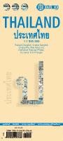 Laminated!
 Sample of the Thailand map detail.
 Thumbnail image of the front of the Thailand map.
 Thumbnail image of the back of the Thailand map
 Sample detail of the Thailand Travel Map
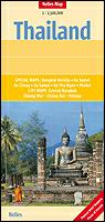
 Skeetch map showing coverage of the map sheets.
 Sample detail of the northern Thailand Travel Map
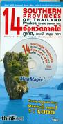 Includes CD map
 Sample detail of the Golden Triangle travel map
 Sample detail of the Golden Triangle travel map
 Sample detail of the Ayutthaya walking map
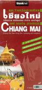
 Sample detail of the Pattaya walking map
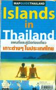
 Sample detail of the Bangkok Handy Atlas street maps
 Sample detail of the Bangkok Handy Atlas street maps
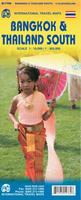
 Sample detail of the Bangkok city map
 Thumbnail of the front of the Bangkok city map
 Thumbnail of the reverse of the Bangkok city map
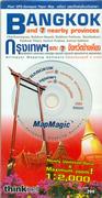 Includes CD map
 Sample detail of the Bangkok street map
 Sample of the Bangkok Walking Map detail
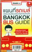
 Sample #1 of the maps
 Sample #2 of the maps
 Sample of Ko Samui Provincial Map - 65-4265-10
 Sample of Ayutthaya City Map - 65-4265-01
 Sample of Ayutthaya Province Map - 65-4265-01


 Waterproof!


 Front side of the map.
 Reverse side of the map.
 Sample detail of the map.
 Cover of the map.

 Waterproof! New edition.
 Sample detail of the Bangkok travel map
 Front of the Bangkok travel map
 Rear of the Bangkok travel map

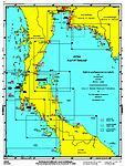
 Sample of Thailand nautical chart 206
 Sample of Thailand nautical chart 223