Syria & Lebanon Travel Map. 1:750,000. Gizimap, 2013. The map shows its internationally recognized borders. Also marked are internal administrative borders within these states/regions and names of the provinces. All place names are given in the Latin alphabet with alternative names or transliterations as appropriate.
Topography is vividly presented with altitude coloring; graphics for swamps, salt flats and deserts; numerous names of mountain ranges and other geographical features; spot heights; water wells, oil and gas wells and pipelines; mosques and monasteries; World Heritage sites; and much more.
The road network includes country tracks and gives distances on main routes. Local airports and seaports are marked and a range of symbols indicate various places of interest, including locations with hotel accommodation, historical sites, etc. Latitude and longitude lines are drawn at 30 minute intervals. Map size is 39 x 34 inches.
Inset city maps (6 x 6 inches to 9 x 8 inches) include Aleppo, Aleppo Old City, Environs of Aleppo, Damascus, Damascus Old City, Environs of Damascus, and Palmyra.
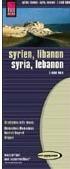
Waterproof! Syria and Lebanon Travel Map. 1:600,000. Reise Know-How. This map covers both Syria and Lebanon. The map uses contour lines, spot heights (mountaintops), and shaded relief to show elevation. The road network is overprinted on the relief, with route numbers and distances between major junctions noted. Symbols highlight other information such as the locations of mines, mosques, historic ruins, and much more. Names are on the map in both Roman and Arabic script; legend is bilingual English/German. Printed on waterproof, tear-resistant synthetic paper.
Sample of the Syria map
65-40271
1 sheet, folded.
$15.99
Syria and Damascus Travel Map. 1:1,000,000. GeoProjects, 4th ed., 2011. This new edition includes better detail and general updating from the previous edition. The map has general road map on one side, with color tinting to show elevation. The reverse side has a large map of Damascus, and small maps of central Aleppo and Palmyra (Tadmor). In English.
Sample detail of the Syria Road Map Sample detail of the Damascus city Map
65-4040
1 sheet, folded.
$16.99
Syria Travel Map & Damascus City Map. 1:800,000 & 1:10,870. Freytag & Berndt. The map uses a physical map as a base map and overlays road information. The mountain ranges are shown by shaded relief; administrative boundaries are marked as are settlements, airports, wadis, hotels and historic ruins (such as Crac des Chevaliers). The map includes an inset plan of the Valley of Tombs outside Palmyra (Tadmur), a street map of Aleppo and a distance chart. The reverse side of the map contains a full-sized street map of Damascus at the scale of 1:10,870. Multilingual legend. Size is 122 x 84 cm.
Sample of the Syria map Sample of the Damascus map
65-40401
1 sheet, folded.
$14.99
Syria Travel Map. 1:850,000. ITMB. A road map with an inset plan of central Damascus. The general map has more detailed graphics than the Freytag & Berndt map and indicates topography through elevation tinting but shows slightly fewer place names; Freytag's Damascus map is also much better than the ITMB inset map. Salt flats, deserts and seasonal rivers are distinguished and gas stations, airports, points of interest, railroads, mosques and ruins are indicated by symbols. Latitude and longitude lines are drawn at 1° intervals. The Damascus map shows points of interest, major buildings, accommodation and medical facilities.
Damascus 1:50,000 Topographic Maps. Syria. This map is part of the 1:50,000 national series. This is a standard topographic maps with good detail. In Arabic.
 Syria Maps
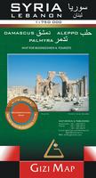
 Sample of the Syria map detail.
 Sketch map showing the area covered by the Gizimap Syria Travel Map
 Waterproof!
 Sample of the Syria map
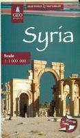
 Sample detail of the Syria Road Map
 Sample detail of the Damascus city Map
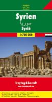
 Sample of the Syria map
 Sample of the Damascus map


 Syria Flags