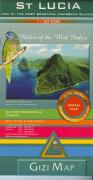
Recommended St. Lucia Road Map. 1:50,000. GiziMap. A detailed physical and road map of St. Lucia. The map uses hill shading, elevation coloring, and spot heights to show elevation. There are five levels of roads shown, ranging from tracks to multilane highways/motorways as well as tracks and hiking trails. Symbols are shown to show a variety of physical features and tourist sites, ranging from golf courses, diving centers, churches and fortresses to caves, coral reefs, diving sites and mangrove swamps. The legend is in four languages including English, and the map is in English. Indexed. ISBN 978-963-87465-4-2.
Sample of the map detail
$14.99
66-33923
1 sheet, folded
St. Lucia Travel Map. 1:45,000. Michal Kasprowski.
This complete road map of Saint Lucia includes a street index. The index renders all the island's known roads and streets with their names, locates hiking trails and diving sites, and lists street indexes for the major urban areas. Map size is 26 x 38 inches unfolded.
Attractive full color layout.
Rich topographic detail.
Symbol key, scale, and street index.
Insets of 4 main cities - including the capital, main and secondary roads, hiking trails, diving, sites, airports, geological formations, marine, parks, churches, cemeteries, beaches, protected zones, ports, and other points of interest.
St. Lucia & Dominica Travel Map. 1:10,000 & 1:600,000. ITMB.
Dominica is a popular holiday vacation destination and cruise ship stopover port. We have in reality placed two maps on the sheet, by adding St. Lucia, another popular Caribbean destination, to the reverse side. Each country is placed on one side of the paper, with insets of their respective capitals, Roseau and Castries. Dominica, with its rugged volcanic terrain, its dominating mountains, and its lush pristine rainforests, has a natural beauty that is a prime reason to visit and enjoy the island's attractions. ISBN 9781553411642.
Sample detail of the Dominica Travel Map
$12.95
66-337175
1 sheet, folded.
St. Lucia Road Map & Guide. Approx. 1:100,000. Skyviews. 20th ed., 2010/2011.
The map is a pocket tourist map, not a topographic or detailed physical map, but it is excellent at what it does. The map shows St. Lucia on the front with inset maps of Soufriere, Vieux Fort and Gros Inlet. The reverse has an inset map of Castries as well as extensive tourist information ranging from accomodations to car/taxi rental to shopping and services. A folded pocket version and a laminated flat version are available; the laminated version is ideal as a souvenir placemat. Size is 20 x 14 inches.
Sample detail from the St. Lucia road map. Image of the entire St. Lucia road map.
$6.99
66-33924
1 sheet, folded.
$10.99
66-33924L
1 sheet, laminated.
St. Lucia Topographic Map. 1:50,000. DOS, GB. Single-sheet topographic map of St. Lucia, with excellent road detail. This is a high quality color plot as the printed map is no longer available.
$34.95
66-33915
1 sheet, color plot
St. Lucia Topographic Map. 1:25,000. 1981-1988. DOS (345). This 3-sheet set offers good coverage of St. Lucia. This 3-sheet set is out of print, but available as either digital raster (.tif) files or as color plots from the raster files.


 Recommended
 Sample of the map detail
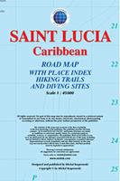
 Sample detail of the St. Lucia Street Map
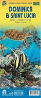
 Sample detail of the Dominica Travel Map
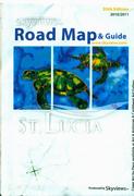
 Sample detail from the St. Lucia road map.
 Image of the entire St. Lucia road map.