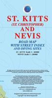
Recommended! St. Kitts and Nevis Travel Map. 1:30,000 (St. Kitts) and 1:20,000 (Nevis). Michal Kasprowski.
This road and street map with a street index of the twin-island nation of St. Kitts and Nevis offers roads and streets with their names, traces hiking trails, diving sites, and parish boundaries, and presents inset maps of the islands respective capitals Basseterre and St.Charles.
Covers all roads and streets in detail and is updated on a regular basis.
Airports, beaches, cemeteries, churches, diving sites, ferries, fortresses (old sites), gas stations, geological formations, hills, hospitals, hotels, hot spring, lighthouses, marinas, moorings, museums, parish boundaries, plantations (old sites), police stations, ports, post offices, reefs, scenic railway, shipwrecks, sugar mills (old sites), synagogue (old site), and other points of interest;
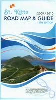
St. Kitts & Nevis Road Map & Guide. St. Kitts approx. 1:62,500 and Nevis approx. 1:55,000. Skyviews. 15th ed., 2009/2010.
The map is a pocket tourist map, not a topographic or detailed physical map, but it is excellent at what it does. The map covers St. Kitts on the front with an inset map of Basseterre. The reverse has a map of Nevis and an inset map of Charlestown. Both sides have extensive tourist information ranging from accomodations to car/taxi rental to shopping and services. A folded pocket version and a laminated flat version are available; the laminated version is ideal as a souvenir placemat. Size is 24 x 18 inches.
Sample detail from the St. Kitts road map. Image of the entire St. Kitts road map.
St. Kitts (St. Christopher) & Nevis. 1:25,000. DOS (343). 1984.
The St. Kitts maps are out of print and only available as color plots. The Nevis map is still available as a paper map.


 Recommended!
 Sample detail #1 from the St. Kitts map
 Sample detail #2 from the St. Kitts map
 Sample detail from the St. Kitts road map.
 Image of the entire St. Kitts road map.
 Thumbnail of the front of the map.
 Image of the detail of the map.