This listing includes those maps that cover just the Slovak Republic; maps covering the former Czechoslovakia are listed under the Czech Republic and Czechoslovakia heading.
Autoatlas of the Slovenska Republika (Podrobny Auto Atlas Slovenská Republika). 1:100,000. Vokensky Kartograficky Ustav. An excellent spiral-bound road atlas produced from the military mapping of the country. The maps are shaded relief maps with road and tourist information, distances between intersections, and more. A multilingual legend and detailed index is included. In Slovak. Size is 12-3/;4 x 9-1/2". ISBN 80-85510-57-X.
65-9588
Atlas
$34.95
New expanded edition.Slovakia Road Atlas (Slovenská republika superatlas). 1:150,000. Freytag & Berndt, 2009. Excellent spiral-bound road atlas. Includes tourist information, city maps, and an index with postal codes. 323 pages, spiralbound. 9.25 x 11.8" in size.
65-95881
Atlas.
$25.99
Autoatlas of the Slovenska Republika. 1:250,000. Vokensky Kartograficky Ustav. An excellent smaller-sized spiral-bound road atlas. The maps are shaded relief maps with road and tourist information, distances between intersections, and more. A multilingual legend and detailed index is included. In Slovak.
65-95882
Atlas
$14.95
Slovakia Travel Map. 1:250,000. Vojensky Kartograficky. The most detailed single-sheet road map of Slovakia.
65-95906
1 sheet, folded.
$16.95
Slovakia Road Map. 1:500,000. Shocart. An excellent road map although not as detailed as the map above. Multilingual.
65-95905
1 sheet, folded.
$9.99
Slovakia Travel Map. 1:250,000 and 1:400,000. Freytag & Berndt. Freytag & Berndt make two excellent road maps of Slovakia; a detailed map at 1:200,000 for use when driving along the backroads or for planning cycling trips, and one slightly more generalized map at 1:400,000 for tourists etc. Both have mulitlingual legends, excellent road network detail, etc.
65-95904
Slovakia - 1:400,000. 1 sheet, folded.
$14.99
65-95909
Slovakia - 1:200,000. 1 sheet, folded.
$14.99
Slovakia Travel Map. 1:300,000. ITMB, Canada. A decent road map, with roads overprinted on a base map colored to show vegetation zones (forests, etc.). In English.
65-95907
1 sheet, folded.
$11.95
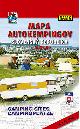
Slovakia Autocamping Road Map (Mapa Autokempingov Slovenská republika). 1:500,000. Vokensky Kartograficky Ustav. 2003. A very detailed double-sided map showing the car-camp locations in Slovakia. One side has a shaded relief road map with distances, tourist information, gas stations, etc. Campgrounds are marked on the map. The reverse side of the map lists each of the campgrounds and give contact information (telephone, fax, address, name) plus information on the nearest facilities,. such as restaurants, hospitals, gas stations, train stations, etc. One of the few VKU maps that is only partially multilingual. ISBN 80-8042-051-3.
65-95901
1 sheet, folded
$10.99
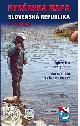
Slovakia Fishing Map (Rybárska Mapa Slovenská Republika). 1:250,000. VKU, 2004. A shaded relief map of Slovakia with hundreds of fishing locations marked. The separate 45-page booklet lists information for each locality marked on the map.
Sample #1 Sample #2
65-9565
1 sheet, folded.
$12.95
Slovakia Old Castles, Castles, and Manor Houses Map. 1:500,000. VKU, 2002. This map uses the 1:500,000 shaded relief road map as the base map, then uses small drawings of each castle to locate it on the map. The map includes a 75-page text describing each place noted on the map; the text is in three languages including English.
65-9575
1 sheet, folded.
$10.95
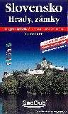
Slovakia Castles Map. 1:500,000. Shocart/Geoclub. This map uses a shaded relief road map as a base map with small drawings of the castle locating it on the map. On the back of the map are details for each castle, in three languages including English.
65-95751
1 sheet, folded.
$9.95
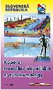
Slovakia Spas, Thermal Waters, and Autocamping map.
65-9576
1 sheet, folded.
$10.95
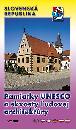
Slovakia UNESCO map. 1:500,000. VKU, 2005. This map uses the 1:500,000 shaded relief road map as the base map, then overprints small drawings of "UNESCO monuments and jewels of Folk Architecture." The map includes a 43-page text describing each place noted on the map; the text is in six languages including English.
65-9577
1 sheet, folded.
$10.95
Slovakia Ski Centres Map (Slovenská Republika lyziarske strediská). 1:500,000 + inset maps. Vokensky Kartograficky Ustav. 1996. The map is a shaded relief map covering the whole country. The map includes distances between intersections, gradients on steep roads, etc. The map locates 80 different ski centers and has detailed inset maps for 18 of the most popular centers. The separate text booklet has 1-2 page descriptions for each of the 80 ski centers. Packaged in a plastic folder. Size is 34 x 45". ISBN 80-8042-052-1.
65-95902
Set, folded
$11.95
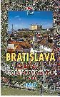
Slovakia City Orthophotomap Atlases. 1:6,000. VKU & Geodis. This series of three atlases offers very detailed 1:6,000 scale orthophotography for three cities in Slovakia. The Bratislava map is in print and we have good stock. The Banska Bystrica and Kosice atlases are out of print and we have very limited stock.
65-9592BA
Banská Bystrica Orthophoto Atlas. 2000. ISBN 80-8042-217-6.
$39.95
65-9592BT
Bratislava Orthophoto Atlas. 2002. EAN 858 600 332 2315.
$37.95
65-9592KR
Kosice Orthophoto Atlas. 2000. ISBN 80-8042-218-4.
$39.95
Bratislava Orthophotomap. 1:10,000. VKU, 2004. This is a single-sheet summary map of the atlas listed above, using the same orthophotos, at a slightly reduced scale. In Czech/Slovak.
65-9592BU
Atlas.
$11.95
Bratislava City Street Atlas (Bratislava Mapa Mesta). 1:10,000. Vokensky Kartograficky Ustav. A good quality, detailed street atlas of the capital city of Slovakia. Additional information includes bus lines and bus stops, tourist sites and information, restaurants, a detailed street index, etc. Multilingual.
65-9592BS
Atlas
$14.95
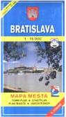
Bratislava street map. 1:15,000. Vokensky Kartograficky Ustav. A good quality, detailed street map of Bratislava. Additional information includes bus lines and bus stops, tourist sites and information, restaurants, a detailed street index, etc. Multilingual.
Sample #1 of the map detail Sample #2 of the map detail
65-9592BR
Atlas
$9.95
Slovakia City Street Maps (Plán Mesta). Vokensky Kartograficky Ustav. These are double-sided maps with a detailed city street map on one side and a 1:50,000 topographic regional map on the reverse. The maps are fully indexed, with multilingual legend and list of tourist sites (restaurants, gas stations, etc.) and often have a 1:5,000 city center inset map. All are either in English or multilingual.
Sample of the Banská Bystrica map detail Sample of the Banská Stiavnica map detail Sample #1 of the map detail Sample #2 of the map detail
65-9592BB
Banská Bystrica. 1:10,000.
$9.95
65-9592BC
Banska Stiavnica. 1:10,000. 2nd ed., 2003.
$9.95
65-9592BD
Bardejov. 1:10,000. 2000.
$9.95
65-9592BR
Bratislava. 1:15,000.
$9.95
65-9592BV
Brezno. 1:10,000. 2003.
$9.95
65-9592BY
Bytca. 1:10,000. 2004.
$9.95
65-9592CB
Cadca. 1:10,000. 2001.
$9.95
65-9592DU
Dunajska Streda. 1:10,000.
$9.95
65-9592HL
Hlohovec. 1:10,000. 2002.
$9.95
65-9592HO
Holic. 1:10,000. 2002.
$9.95
65-9592HU
Humenné. 1:10,000. 2003.
$9.95
65-9592IL
Ilava. 1:10,000. 2004.
$9.95
65-9592KE
Kezmarok. 1:10,000. 2004.
$9.95
65-9592KN
Komárno. 1:10,000. 2007.
$9.95
65-9592KO
Kosice. 1:15,000.
$9.95
65-9592KS
Kremnica. 1:10,000. 2003.
$9.95
65-9592LD
Levice. 1:10,000.
$9.95
65-9592LE
Levoca.
$9.95
65-9592LI
Liptovsky Mikulas. 1:10,000. 2006.
$9.95
65-9592LU
Lucenec. 1:10,000.
$9.95
65-9592MA
Malacky. 1:10,000. 2001.
$9.95
65-9592MB
Martin & Vrútky. 1:10,000.
$9.95
65-9592MI
Michalovce. 1:10,000. 2006.
$9.95
65-9592NA
Námestovo. 1:10,000.
$9.95
65-9592NI
Nitra. 1:10,000. 4th ed., 2004.
$9.95
65-9592NO
Nové Zámky. 1:10,000. 2007.
$9.95
65-9592PA
Partizánske. 1:10,000. 2000. Multilingual.
$9.95
65-9592PI
Piestany. 1:10,000.
$9.95
65-9592PN
Poprad & Stary Smokovec. 1:10,000.
$9.95
65-9592PO
Povazska Bystrica. 1:10,000. 2006.
$9.95
65-9592PR
Presov. 1:10,000. 3rd ed., 2001.
$9.95
65-9592PS
Prievidza & Bojnice. 1:10,000. (Same map as Bojnice above).
$9.95
65-9592PU
Púchov. 1:10,000. 2006.
$9.95
65-9592RE
Revúca. 1:10,000. 2003.
$9.95
65-9592RI
Rimavská Sobota. 1:10,000. 2006.
$9.95
65-9592RU
Ruzomberok. 1:10,000. 2nd ed., 2002.
$9.95
65-9592SA
Sabinov. 1:10,000. 2006.
$9.95
65-9592SD
Senec. 1:10,000. 2000.
$9.95
65-9592SE
Sered. 1:10,000.
$9.95
65-9592SP
Spisska Nová Ves. 1:10,000.
$9.95
65-9592ST
Stará Lubovna. 1:10,000. 2004.
$9.95
65-9592SU
Stúrovo - Esztergom. 1:10,000. 2001.
$9.95
65-9592TO
Topolcany. 1:10,000.
$9.95
65-9592TP
Trebisov. 1:10,000. 2nd ed., 2006.
$9.95
65-9592TR
Trencín & Trencianske Teplice. 1:10,000.
$9.95
65-9592TS
Trnava. 1:10,000.
$9.95
65-9592TV
Tvrdosin. 1:10,000. 2003.
$9.95
65-9592VR
Vranov nad Topl'ou. 1:10,000. 2003.
$9.95
65-9592MB
Vrutky & Martin. 1:10,000. (Same as Martin map above).
$9.95
65-9592ZA
Zarnovica. 1:10,000. 2007.
$9.95
65-9592ZH
Ziar nad Hronom, Banská Stiavnica, & Kremnica. 1:10,000.
This is a very detailed tourist atlas of the Slovak Republic at 1:50,000, presented in an A4 ring binder with a hard slipcase, allowing use of single sheets if needed and making it perfect for walking. The atlas comes with a plastic map case with neck-string to carry the looseleaf maps.
The cartography is superb with hill shading, contours and peak heights to show relief.
Road detail shows five classes of roads plus dirt roads and three kinds of paths, with numbers on motorways and major roads. Bike paths and tourist routes are indicated, with all the relevant signposts and markings, plus parking places, gas stations, garages and bicycles repair and rental shops.
Railways - active and inactive, tramways, cable-cars and chair lifts, airports, shipping lines and ports are marked, also national and regional boundaries with border crossings, military reserves and national parks, reserves and protected areas.
Geographical details include swamps and peat-bogs, brooks, canals and subterranean watercourses, springs, reservoirs, waterfalls and mill-races, caves and abysses, forests, cultivated lands, rock formations and protected trees.
A series of symbols also mark places of interest and viewpoints, information points, religious buildings, museums, ruins and antiquities, notable buildings, restaurants, pubs and accommodation including campsites, UNESCO heritage sites , leisure and sport facilities, such as golf courses, horse-riding and natural swimming places. Also indicated are GPS coordinates and a 1' lat-long grid.
At the beginning of the atlas there are sections on planning preparations and equipment for walking and cycling and various notes on recommended scenic areas, national parks and famous sites.
At the end of the atlas there is a comprehensive index, and a hard plastic bookmark with mm and km measures is included. In Czech/Slovak with the map legend including English and German.
65-9570
Atlas.
$89.95
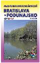
Recommended Slovakia Tourist Maps & Atlases of Interesting Places (Mapa turistickych zaujimavosti). 1:100,000. Vokensky Kartograficky Ustav. These are superb maps of Slovakia and are ideal for driving vacations in the country. Ten maps offer complete coverage of Slovakia. This series of very detailed 1:100,000 shaded relief maps highlight places of interest. Each map shows the typical VKU road map information (gas stations, distances, tourist information, etc.) plus locates numerous points of special interest.
Each map has an accompanying text that describes each of the located points on interest. Multilingual throughout. Size is typically 31 x 45". Unfortunately this series has been discontinued and is being replaced by tourist atlases at the same scale. So far only three are available with more planned. The listing below includes both the new atlases and the remaining tourist maps that we still have in stock.
Sample from the original map series Sample from the new atlas series
65-95914-01
Atlas 1, Bratislava, Podunajsko tourist atlas.
$14.95
65-95914-02
Sheet 2, Záhorie, Povazie.
$14.95
65-95914-04
Sheet 4, Pohronie.
$14.95
65-95914-06
Sheet 6, Kysuce, Horné Povazie, Turiec.
$14.95
65-95914-07
Sheet 7, Orava, Liptov, Horehronie.
$14.95
65-95914-08
Sheet 8, Tatry (Tatras), Spis, Zamagurie.
$14.95
Slovakia 1:50,000 Hiking/Cycling/Topographic Maps. 1:50,000. Shocart. This series offers complete coverage of Slovakia in 47 sheets, of which 34 are published and 13 will be published in the coming year or so.
Index for this series. Sample of the map detail.
65-95516-1073
Sheet #1073. Zahorie, Senica.
$12.99
65-95516-1074
Sheet #1074. Biele Karpaty, Povazsky Inovec.
$12.99
65-95516-1075
Sheet #1075. Strazovske vrchy, Trencin.
$12.99
65-95516-1076
Sheet #1076. Vrsatec, Sulovske vrchy.
$12.99
65-95516-1077
Sheet #1077. Kysucké Beskydy, Kysuce.
$12.99
65-95516-1078
Sheet #1078. Malé Karpaty, Bratislava.
$12.99
65-95516-1079
Sheet #1079. Malé Karpaty, Cerveny Kamen.
$12.99
65-95516-1080
Sheet #1080. Povazie Hlohovec.
$12.99
65-95516-1081
Sheet #1081. Tribec.
$12.99
65-95516-1082
Sheet #1082. Vtacnik.
$12.99
65-95516-1083
Sheet #1083. Prievidza, Ziar.
$12.99
65-95516-1084
Sheet #1084. Vel'ka Fatra.
$12.99
65-95516-1085
Sheet #1085. Malá Fatra.
$12.99
65-95516-1086
Sheet #1086. Oravská magura.
$12.99
65-95516-1087
Sheet #1087. Bratislava Senec.
$12.99
65-95516-1088
Sheet #1088. Not yet published.
65-95516-1089
Sheet #1089. Not yet published.
65-95516-1090
Sheet #1090. Not yet published.
65-95516-1091
Sheet #1091. Not yet published.
65-95516-1092
Sheet #1092. Stiavnicke Vrchy Javorie.
$12.99
65-95516-1093
Sheet #1093. Kremnické vrchy, Pol'ana.
$12.99
65-95516-1094
Sheet #1094. Nizké Tatry - Chopok.
$12.99
65-95516-1095
Sheet #1095. Not yet published.
65-95516-1096
Sheet #1096. Západné Tatry.
$12.99
65-95516-1097
Sheet #1097. Vysoké Tatry.
$12.99
65-95516-1098
Sheet #1098. Not yet published.
65-95516-1099
Sheet #1099. Not yet published.
65-95516-1100
Sheet #1100. Not yet published.
65-95516-1101
Sheet #1101. Polana.
$12.99
65-95516-1102
Sheet #1102. Nizke Tatry - Králova Hola.
$12.99
65-95516-1103
Sheet #1103. Not yet published.
65-95516-1104
Sheet #1104. Not yet published.
65-95516-1105
Sheet #1105. Muránska Planina.
$12.99
65-95516-1106
Sheet #1106. Slovensky Raj.
$12.99
65-95516-1107
Sheet #1107. Spisská Magura.
$12.99
65-95516-1108
Sheet #1108. Slovensky Kras.
$12.99
65-95516-1109
Sheet #1109. Spis, Levocske vrchy.
$12.99
65-95516-1110
Sheet #1110. Kosice south.
$12.99
65-95516-1111
Sheet #1111. Kosice north.
$12.99
65-95516-1112
Sheet #1112. Presov a okolie.
$12.99
65-95516-1113
Sheet #1113. Bardejov a Okolie.
$12.99
65-95516-1114
Sheet #1114. Not yet published.
65-95516-1115
Sheet #1115. Domasa Humenne.
$12.99
65-95516-1116
Sheet #1116. Dukla Medzilaborce.
$12.99
65-95516-1117
Sheet #1117. Not yet published.
65-95516-1118
Sheet #1118. Not yet published.
65-95516-1119
Sheet #1119. Bukovske Vrchy.
$12.99
65-95516Z
Set of 47 sheets. Price includes a 20% discount. You will be charged only for sheets in print, backordered sheets will be sent when available and charged at that time.
$374.12
Slovakia Topographic Maps
Slovakia 1:50,000 and 1:25,000 Topographic Quadrangle Maps. These maps were produced prior to the breakup and cover both the Czech Republic and Slovakia. In Czech.
Czechoslovakia 1:50,000 (30K)
65-9551
1:50,000. Specify area
$14.95
65-9550
1:25,000. Specify area
$14.95
Slovakia 1:100,000 Topographic Quadrangle Maps. GKP. Coverage of most of the country is available. In Czech.
Czeckoslovakia 1:100,000 (30K)
65-9552
1:100,000. Specify area
$14.95
Slovakia 1:200,000 Topographic Quadrangle Maps. GKP. These maps are newly released by the Czech & Slovakian governments. Coverage of most of the country is available. In Czech.
Czeckoslovakia 1:200,000 (30K)
65-9553
1:200,000. Specify area
$14.95
Slovak Republic 1:50,000 Topographic Quadrangle Map Series. 1:50,000. Soviet government. High quality, non-copyrighted topographic maps with excellent detail. The set of 160 sheets gives complete coverage of the Slovak Republic (see Czech Republic also). In Russian.
65-95513
Set of 160 sheets, rolled
$1440.00
Slovak Republic 1:100,000 Topographic Quadrangle Map Set. 1:100,000. Soviet government. High quality, non-copyrighted topographic maps with excellent detail. The set of 53 sheets gives complete coverage of the Slovak Republic (see Czech Republic also). In Russian.
Slovak Republic City Topographic Maps. 1:10,000. Soviet government. These maps are regular topographic maps that include contour lines, power lines, rail/trolley lines, etc. In Russian.
65-9593BA
Banska Bystrica. 1986.
$20.00
65-9593BR
Bratislava. 1981. 2 sheets.
$40.00
65-9593KO
Komarno. 1970.
$20.00
65-9593KP
Kosice. 1982. 2 sheets.
$40.00
65-9593MA
Martin. 1987.
$20.00
65-9593NI
Nitra. 1986.
$20.00
65-9593NO
Nova Zamky. 1971.
$20.00
65-9593PR
Presov. 1987.
$20.00
65-9593TR
Trnava. 1986.
$20.00
65-9593ZI
Zilina. 1987.
$20.00
Slovakia Thematic Maps & Atlases
Slovakia administrative map. 1:400,000. VKU, 1996. Shows excellent detail of the administrative boundaries, including "Krai" and "Okres". In Slovakian.
Sample #1


 New expanded edition.
Slovakia Road Atlas (Slovenská republika superatlas). 1:150,000. Freytag & Berndt, 2009. Excellent spiral-bound road atlas. Includes tourist information, city maps, and an index with postal codes. 323 pages, spiralbound. 9.25 x 11.8" in size.
New expanded edition.
Slovakia Road Atlas (Slovenská republika superatlas). 1:150,000. Freytag & Berndt, 2009. Excellent spiral-bound road atlas. Includes tourist information, city maps, and an index with postal codes. 323 pages, spiralbound. 9.25 x 11.8" in size.


 Slovakia Travel Map. 1:250,000. Vojensky Kartograficky. The most detailed single-sheet road map of Slovakia.


 Sample #1
 Sample #2


 Sample #1 of the map detail
 Sample #2 of the map detail
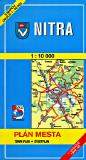
 Sample of the Banská Bystrica map detail
 Sample of the Banská Stiavnica map detail
 Sample #2 of the map detail
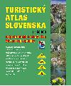

 Recommended
 Sample from the original map series
 Sample from the new atlas series
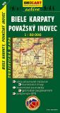
 Index for this series.
 Sample of the map detail.
 Czechoslovakia 1:50,000 (30K)
 Czeckoslovakia 1:100,000 (30K)

 Sample #1
 Slovakia Flags