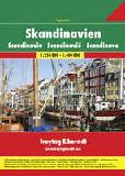
Scandinavia Superatlas. Freytag & Berndt. An excellent spiral-bound road atlas covering all of Scandinavia. Multilingual legend.
66-22933
Atlas
$44.99
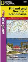
Waterproof! Finland and Northern Scandinavia Adventure Map. 1:975,000. National Geographic Maps. National Geographic's Finland and Northern Scandinavia AdventureMap is designed to meet the unique needs of adventure travelers-detailed, durable, and accurate. Scandinavia North includes the locations of thousands of cities and towns with an index for easily locating them, plus a clearly marked road network complete with distances and designations for expressways, motorways, and more. ISBN 9781566955324.
Sample detail of the Finland adventure map Image of the front of the Finland adventure map Image of the back of the Finland adventure map
64-55906
1 sheet, folded
$11.95
Waterproof! Southern Sweden and Southern Norway (southern Scandinavia) Adventure Map. 1:975,000. National Geographic Maps, 2011. National Geographic's Southern Sweden and Norway AdventureMap is designed to meet the unique needs of adventure travelers-detailed, durable, and accurate. Southern Sweden and Norway includes the locations of thousands of cities and towns with an index for easily locating them, plus a clearly marked road network complete with distances and designations for expressways, motorways, and more. ISBN 9781566955331.
Sample detail of the south Scandinavia adventure map Image of the front of the south Scandinavia adventure map Image of the back of the south Scandinavia adventure map
66-22939
1 sheet, folded
$11.95
Scandinavia Travel Map. 1:1,500,000. Michelin (#711). Detailed road map of Scandinavia by this popular publisher.
66-22931
1 sheet, folded
$12.95
Scandinavia Travel Map. 1:2,000,000. Freytag & Berndt. Detailed road map of all of Scandinavia - ideal if you want a single map to cover all of Denmark, Norway, Sweden, and Finland. Also covers all of Estonia, Latvia, nearly all of Lithuania, and the northern coastal regions of Poland and Germany. Thus this map allows the circuit route from Copenhagen around the Baltic Sea and back to Copenhagen. Multilingual legend.
Sketch map showing map coverage
66-22933F
1 sheet, folded
$15.99
Scandinavia Bouguer Gravity Map. 1:2,000,000. 1985. SGU, Sweden. This map covers the Scandinavian Caledonides of Sweden and Norway. Compiled for the IGCP Caledonide Orogen Project. Sheet size 52 x 84 cm.
66-2286
1 sheet, flat
$14.95
Scandinavia Atlas of Historical Cities. Odense University Press. These excellent atlases are part of the European Historical City Atlas series. Nine are currently available, with more in development.
NOTE: We are discontinuing these atlases and have in stock only the single atlas listed below.


 Waterproof!
 Sample detail of the Finland adventure map
 Image of the front of the Finland adventure map
 Image of the back of the Finland adventure map
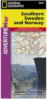 Waterproof!
 Sample detail of the south Scandinavia adventure map
 Image of the front of the south Scandinavia adventure map
 Image of the back of the south Scandinavia adventure map
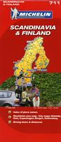
 Sketch map showing map coverage