|
|
Saudi Arabia Wall Map. 1990. Farsi. The 1:2,000,000 map, when framed, makes an attractive wall map. Bilingual.
Saudi Arabia 1:100,000 Topographic Quadrangle Map Set. 1:100,000. Soviet government. High quality topographic maps for a country where little else is available. This set covers the coastal areas only; the central part of the country is not available. In Russian.
For ordering individual sheets or digital quads, please look at the index to figure out which sheet(s) you need and then order them using the
"Each, specify area" order button below. On the order form, specify the sheet number in the "Comments" section.
TPC 1:500,000 Charts
|
||||||||||||||||||||||||||||||||||||||||||||||||||||||||||||||||||||||||||||||||||||||||||||||||||||||||||||||||||||||||||||||||||||||||||||||||||||||||||||||||||||||||||||||||||||||||||||||||||||||||||||||||||||||||||||||||||||||||||
 Saudi Arabia Maps
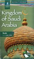
 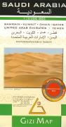 Recommended
 Sketch showing area covered by the map.
 Sample of the map detail
 Sample detail of the Saudi Arabia travel map
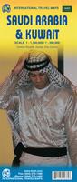
 Sample of the map detail
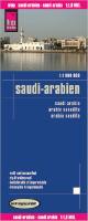 Waterproof!
 Sample detail of the Saudi Arabia travel map
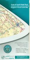 Limited stock left
 Sample detail from the Saudi Arabia road map.
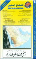 Limited stock left!
 Sketch map showing sheet coverage.
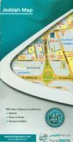 Limited stock left!
 Sample detail from the Jeddah city map.
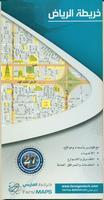 In Arabic only
 Sample detail from the Jeddah city map.
 Index showing sheet coverage
 Sample from this series (image is from a sheet covering Korea)
 Saudi Arabia Flags