Sahara Travel Map. 1:3,400,000. ITMB.
The map covers the northern portion of Africa, from southern Morocco and Mauritania in the west to Egypt in the east, and from the Mediterranean coast south to partway through Niger, Chad, and Sudan. Indexed, with a glossary of arabic terms, and with short paragraphs on points of interest. Printed on both sides. Map size is 27 x 39 inches.
Image of the front of the Sahara map Image of the reverse of the Sahara map
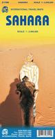
 Image of the front of the Sahara map
 Image of the reverse of the Sahara map