|
|
Romania & Moldova road map. 1:500,000. Freytag & Berndt. This is a large, double-sided map dividing the region east/west. Hill-shading depicts the general relief. Road classification ranges from motorways to secondary roads, with toll roads and scenic routes highlighted. Map detail includes motorway services and filling stations, intermediate driving distances on most routes, gradients, railways, cablecars and airports. Military reservations, nature reserves and administrative boundaries are included and symbols denote various landmarks and sites of interest eg, antiquities, campsites, spas, border crossings, telecom towers, churches etc. A grid in steps of 30' indicates latitude and longitude. Map legend includes English. A separate index is attached to the map cover. Map legend includes English.
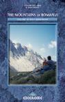
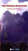
The author, James Roberts, was an enthusiastic walker and explorer from an early age. As a leading authority on walking in Romania, he guided walking groups there for several years. Sadly, although quite young, he died while this book was in the final stages of preparation.  Map showing the trail route Map showing the trail route
 Sample of a trail description and strip map Sample of a trail description and strip map
Romania Regional and Hiking Maps
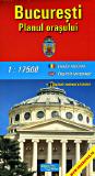
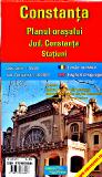
City Maps
Romania 1:10,000 City Topographic Maps by the Soviet military - click here.
Romania Physical and Political MapsRomania--Road and Administrative Map (Harta Rutiera) 1:650,000. Amco, Bucarest, 1999. A large map showing county administrative borders, roads, distances, etc. Bilingual. Size is 85 x 118 cm.
Romania--Physical Map (Harta Fizica) 1:650,000. Amco, Bucarest, 2000. A hypsometric physical map with roads, towns, glacial circs, caves, gorges, etc. Bilingual. Size is 51 z 70 cm.
Romania Topographic MapsRomania Topographic Maps - click here.
Romania Flags
|
|||||||||||||||||||||||||||||||||||||||||||||||||||||||||||||||||||||||||||||||||||||||||||||||||||||||||||||||||||||||||||||||||||||||||||||||||||||||||||||||||||||||||||||||||||||||||||||||||||||||||||||||||||||||||||||
 Romania Maps
 Sample detail #1 of the Romania Travel Map
 Sample detail #2 of the Romania Travel Map


 Index map showing map coverage
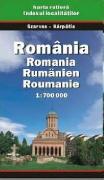

 Sample of the map detail

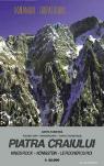
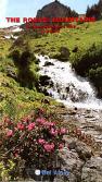
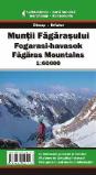 Romania Topographic Hiking Maps. 1:30,000 - 1:50,000. Dimap and Erfatur. These detailed topographic hiking maps show hiking trails, huts, roads, villages, and much more. Ideal for hiking through the national parks and other spectacular mountain scenery of Romania. The maps typically have extensive hiking and tourist information on the reverse of the maps. The descriptive text and map legends are in three languages (English, Hungarian, Romanian). The index map shows the locations of the hiking maps by a numbering system - the numbers are in parentheses next to each map title, such as Rodnei Mountains (#15). Numbers 22, 23, and 24 are in italics on the map and relatively hard to see.
 Index of the hiking maps below
 Sample from the Rodnei Mountains map.
 Sample from the Harghita Mountains map.
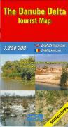

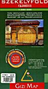
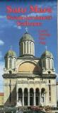
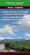 Romania Tourist & Hiking Maps. Various publishers. These cover various cities and popular tourist areas in Romania. Each map typically has extensive descriptive text on the reverse in Romanian and one additional language; either German or Hungarian.


 Sample of the detail of the map
 Sample of the detail of the map
 Romania Flags