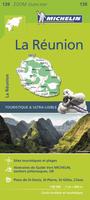
New map Reunion Travel Map. 1:80,000. Michelin, 2016.
The map for this French-speaking island in the Indian Ocean includes an index, distance chart, and legend in English for easy reference. Travelers adventuring on their own will appreciate Michelin's high standard of clear, accurate mapping of the main, secondary and back roads as they navigate around Reunion. The information on scenic drives and sites, recreational activities, points of interest and walking paths will add to the enjoyment of the visit. ZOOM #139.
$12.95
66-11726
1 sheet, folded.
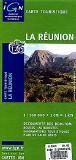
Réunion Travel/Physical Map. 1:100,000. IGN (512), France. This shaded relief map shows extensive tourist information such as museums, religious monuments, and swimming pools. Bilingual; 87 x 67 cm.
$16.99
66-1169
1 sheet, folded
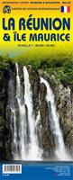
Reunion & Mauritius (Ile Maurice) Travel Map. 1:80,000. ITMB. 1st edition, May, 2013. The Indian Ocean island of La Reunion is a colonial remnant of the former French empire that still occupies bits and pieces of the Caribbean and the Indian Ocean. The main town and only airport is at St-Denis, on the north coast; however, the island's main harbour is simply called Le Port, on the west coast. Most of the beaches are along the south coast. The road network is well-developed, with a circular highway more-or-less following the coastline around the edge of the island and a cross-island route bisecting the eastern third, between the towns of Sainte-Pierre and Saint-Benoit. Tourism is now the island's major source of revenue after sugar exports, and hotels, resorts, and Oceanside resorts, hotels, and B&Bs abound.
Sample detail of the Reunion road map
Réunion Topographic Map (Carte Topographie Ile de la Réunion). 1:25,000. IGN, France. The set of six sheets provides complete coverage of Réunion. In French.
Sample of the map detail Index of sheet coverage
$16.99
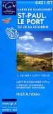
66-1170-4401
NW sheet - St. Paul/LePort.
$16.99
66-1170-4402
N-C sheet - St-Denis.
$16.99
66-1170-4403
NE sheet - St-André - La Plaine.
$16.99
66-1170-4404
SW sheet - St-Leu.
$16.99
66-1170-4405
S-C sheet - St-Pierre.
$16.99
66-1170-4406
SE sheet - St-Joseph.
$80.73
66-1171
Set of 6 sheets.
Reunion CartoExplorer 1:25,000 Digital Topographic Maps. France IGN.
1:25,000 topographic maps
Points of interest are marked
Points of interest include additional information; telephone numbers, hours of operation, etc.
Calculate itinerary
Automatically survey your last route with an elevation profile


 New map


 Sample detail of the Reunion road map

 Sample of the map detail
 Index of sheet coverage
 Reunion CartoExplorer 1:25,000 Digital Topographic Maps. France IGN.
 Sample from the France set, Puy de Sancy 3D view.
 Sample from the France set, Briançon 3D view.
 Sample from the France set, Lac Pavin 3D showing points of interest tags.
 Sample from the France set, Points of interest for Nice.