Rail Map of Europe. 1:1,500,000; 1:4,000,000; 1:6,000,000. Thomas Cook, 18th edition, 2011. This railway map shows passenger rail routes, other than those of suburban networks of major cities. The map covers the whole of Europe east to Moscow and the Crimea, with Scandinavia shown as an inset at 1:6,000,000. The map detail distinguishes high speed lines, main lines, secondary lines, rack railways, tourist railways and scenic routes. Also shows major bus routes where rail connections are not available, and ferry routes.
On the reverse, the central part of Europe, Paris to Warsaw and Amsterdan to Belgrade, is shown at a more detailed scale of 1:1,500,000. Some people prefer this map as the rail lines are easy to read on the plain white base map.
Front side of the Europe rail map. Reverse side of the Europe rail map. Detail from the Europe rail map.
$16.95
66-2291L
1 sheet, folded
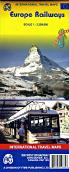
Europe Railways Map. 1:3,350,000. ITMB. This new edition combines main roads and main railway lines from Scandinavia to Turkey and from western Ireland to east of the Urals. This second edition adds more secondary rail lines and corrects a number of spelling errors, particularly in Russia. Printed on waterproof synthetic paper. ouble-sided and indexed.
Sample of the Europe rail map detail.

 Front side of the Europe rail map.
 Reverse side of the Europe rail map.
 Detail from the Europe rail map.
 Sample of the Europe rail map detail.