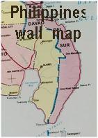
Administrative Map Republic of the Philippines. 1:1,700,000. NAMRIA, 2006. A good summary administrative map of the Philippines. It lacks road detail, but includes the division boundaries. Size is 25 x 36".
Sample detail from the Philippine wall map.
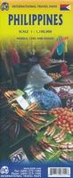
Philippines and Manila Travel Map. 1:1,500,000. Nelles Verlag.
An excellent map with shaded relief, travel and geographic information. The reverse side has a detailed street map of central Manila.
65-1890
1 sheet, folded
$13.95
Manila, Luzon & Cavite road maps. Asiatype. Two road maps covering the most popular parts of Luzon Island, including street maps for Manila, Makati & Ortigas business districts of Manila.
Cavite map includes entire province of Cavite, just south of Manila.
Central Luzon includes Zambales, Tarlac, Nueva Ecija, Pampanaga, Bulacan, Bataan, Manila & Northern Rizal.
Southwest Luzon includes Cavite, Laguna, Batangas, Western Quezon and Southern Rizal
Features exceptionally detailed mapping with all the latest updates for precise route planning View sample map
Comprehensive index to cities, towns & municipalities
All major highways and national roads including North and South Luzon Expressways (SLEX and NLEX) and Southern Tagalog Arterial Road (STAR) and many minor roads
Distances between intersection/towns shown in kilometers
Makati & Ortigas street map. 1:4,300 to 1:8,500. 2007.
$9.99
65-1892SW
Subic Bay & Olongapo street map. 1:8,000 to 1:16,000. 2007. 27 x 35".
$12.99
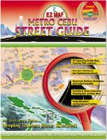
Metro Cebu Street Guide/Atlas. EZ Map/UTP, 2007. 116 pages of maps, including over 1400 streets and nearly 1600 landmarks. Fully indexed with alphanumeric grid overlay.
An alphanumeric grid system overlay on all maps
A comprehensive alphabetical street index
Major roads, streets, and traffic flows
Distances between intersections
Government buildings, hotels, landmarks and tourist attractions
65-1892CF
Atlas.
$19.95
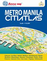
Metro Manila CitiAtlas. 1:10,000. Asiatype, 2007. 196 pages, softcover.
125 pages of full color maps of Metro Manila View sample page
64 pages of comprehensive index to quickly show you how to get to your destination
GPS referenced
Highly detailed to easily navigate Metro Manila's 17 cities and municipalities (Caloocan, Las Pinas, Makati, Malabon, Mandaluyong, Manila, Marikina, Muntinlupa, Navotas, Paranaque, Pasay, Pasig, Pateros, Quezon City, San Juan, Taguig, Valenzuela)
Over 20,000 streets
Exact location of more than 25,000 entries including subdivisions, buildings, bridges, churches, hospitals, hotels, schools, malls
Color-coded city and municipal boundaries
One-way street indicators
Contains Makati & Ortigas business districts with complete building directories
Manila Street Map. 1:12,000. ITMB. This is a double-sided map of the city, divided north/south, from Quezon City in the north to the new Alaya shopping centre and the world trading centre in the south. The heart of Manila is the area just north of the Pasig River, with its bustling streets and many shops. The hotel region is south of the river, close to the ocean. ISBN 9781553416739.
Manila map sample
65-1892MG
1 sheet, folded
$10.95
Boracay Island street map. 1:2,200 to 1:20,000. Asiatype. Detailed street atlas of this popular tourist destination island. 1 sheet, folded, in English.
Exact location of over 200 hotels, resorts and places of interest and over 600 establishments, sights and beaches.
Detailed maps of White Beach (1:5,200) and D'Mali shopping district (1:2,200).
Makati & Ortigas Business Districts Building Map. 1:4,000 & 1:8,000. AsiaType. A very detailed double-sided map of the central business districts of Makati and Ortigas districts of Manila. Includes building footprints, names of businesses and more. In English. ISBN 97191719-8-7.
65-1892MF
1 sheet, folded.
$9.99
Philppines City Maps. Tourist city maps for the main cities and tourist areas of the Philippines. Each map employs symbols to show the locations of tourist sites and services. United Tourist Promotions.
NOTE: These maps are now out of print and no longer available once our current inventory is sold.
Sample from the Panay map. Thumbnail of the Visayas map.
65-1892AL
Albay street map. Includes city maps of Legazpi, Ligao, and Tabaco.
$5.95
65-1892AN
Angeles/Clark street map. United Tourist Promotions.
$5.95
65-1892BA
Baguio street map. Featuring La Union, North & Central Luzon.
$5.95
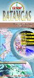
65-1892BB
Batangas street map. Features maps of the port and city of Batangas, and the cities of Tanuan and Lipa.
$5.95
65-1892BI
Bicol street map. Includes Legazpi city map.
$5.95
65-1892BN
Bohol street map. Featuring Tagbilaran, Panglao Island, and Alona Beach.
$5.95
65-1892BO
Boracay street map. Featuring Panay Island and Boracay diving sites. United Tourist Promotions.
$5.95
65-1892CAG
Cagayan Valley street map. Includes Cagayan, Santiago and Tuguegarao city maps.
$5.95
65-1892CAR
Caraga street map. Includes maps of Butuan and Surigao cities.
$5.95
65-1892CB
Cavite street map.
$5.95
65-1892C
Cebu street map. 1:15,000. United Tourist Promotions.
$5.95
65-1892DB
Davao street map. Featured are the Island Garden City of Samal, Mt Apo National Park and the sanctuary for the endangered Philippine Eagle. United Tourist Promotions.
$5.95
65-1892LA
Laguna street map. Featuring Sta. Cruz, Sta. Rosa, Calamba, and San Pablo cities.
$5.95
65-1892LE
Leyte street map. Includes city maps of Ormoc, Tacloban and Maasin.
$5.95
65-1892LU
Luzon street map. Featuring tourist attractions, travel distances, and more.
$5.99
65-1892ME
Makati street map. United Tourist Promotions.
$5.95
65-1892MC
Metro Manila street map. United Tourist Promotions.
$5.95
65-1892M
Manila and Philippines map. 1:23,000. Covers central Manila. Includes a road map of the Philippines. Nelles Verlag.
$13.95
65-1892MD
Manila street map. Variable scale. Periplus.
$8.95
65-1892MI
Mindanao street map. Featuring Cagayan de Oro, General Santos, Zamboanga and Camiguin Island.
$5.95
65-1892MJ
Mindoro street map. Includes inset maps of Calapan City, Mamburao and Sablayan.
$5.95
65-1892NE
Negros/Siquijor street map. Includes maps of Siquijor Island, and city maps of Bacolod and Dumaguete.
$5.95
65-1892PB
Palawan street map. Featuring Puerto Princesa City, Coron Town & Busuanga Island.
$5.95
65-1892PAM
Pampanga street map. Includes a city map of San Fernando. Situated in the central plains of Luzon, this sprawling province north of Manila is poised to be the next growth area of the Philippines.
$5.95
65-1892PC
Panay street map. Featuring Iloilo City, Roxas City, Kalibo, San Jose de Buenavista and Guimaras Island.
$5.95
65-1892PD
Pangasinan street map. Includes city maps of Urdaneta, Lingayen as well as regional attractions, landmarks, and hotels and resorts.
$5.95
65-1892QU
Quezon City & Ortigas street map. Featuring Ortigas business district, gov't buildings and UP main campus.
$5.95
65-1892SA
Samar street map. Featuring Tacloban, Ormoc, and Calbayog.
$5.95
65-1892SF
San Fernando, La Union, Vigan and Laoag street map. Featuring San Fernando and the coastal area.
$5.95
65-1892ST
Strong Republic Nautical Highway map. Drive your vehicle from Manila to Mindanao on the Roll-on Roll-off (RORO) highway and ferry system. Travel through major ports at Batangas, Calapan, Caticlan, Roxas, Iloilo, Bacolod, Dumaguete and Dapitan. There are detailed maps of each port city showing your where to locate hotels, restaurants, gas stations and other points of interest along your journey.
$5.95
65-1892SU
Subic Bay & Olongapo street map. Featuring Subic Bay Freeport Zone, Barreto & Baloy Beach.
$5.95
65-1892TA
Tarlac street map.
$5.95
65-1892VI
Visayas street map. A road map of the province.
$5.95
65-1892ZA
Zambales street map.
$5.95
Philippines Geologic and Thematic Maps
Geological Map of the Sunda and Philippine Archipelago and Adjacent Territories. 1:2,500,000. VNIIzar. 1978 (1983). Four sheets, in Russian/English. Temp. Out of Stock.
65-1800
4 sheets, rolled
$150.00
Philippines Geological Map. 1:2,500,000. Bureau of Mines and Geosciences. One sheet, in color.
65-1801
1 sheet, rolled
$20.00
Philippines Geological Quadrangle Maps. 1:50,000. Bureau of Mines and Geosciences. These maps illustrate the geology of various regions and islands in the Philippine island group. Each map comes with a separate explanatory text of 10-45 pages. About one-quarter of the land area is covered and many are out of print.


 Administrative Map Republic of the Philippines. 1:1,700,000. NAMRIA, 2006. A good summary administrative map of the Philippines. It lacks road detail, but includes the division boundaries. Size is 25 x 36".
 Sample detail from the Philippine wall map.
 Sample detail from the Philippine travel map.
 Sample detail from the Manila city map.
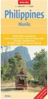

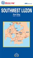
 Sample from the Southwest Luzon map
 Sample from the Metro Manila map
 Sample from the Subic Bay map
 Sample of the map detail
 Manila map sample
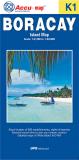
 Sample of the map detail
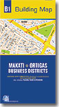

 Philppines City Maps. Tourist city maps for the main cities and tourist areas of the Philippines. Each map employs symbols to show the locations of tourist sites and services. United Tourist Promotions.
 Sample from the Panay map.
 Thumbnail of the Visayas map.