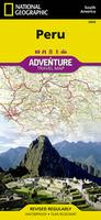
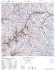
Waterproof! Peru Travel Map. 1:1,650,000. National Geographic Maps. A good road map of Peru, with elevation shown by contour lines and some spot heights (mountain tops). A double-sided map the north on one side and the south on the reverse. The map combines clear road and tourist detail with relief indicated by contours, altitude and bathymetric tinting, and peak heights. Salt pans, swamps and ice-caps are indicated. Road detail distinguishes dirt roads and selected tracks and also shows intermediate driving distances on main roads.
Main railways, ferries, airports, airfields and harbors are indicated and symbols depict a variety of features such as various antiquities and places of interest, lighthouses, notable churches, viewpoints, and spas. National parks and regional boundaries are also marked. Includes extensive index of place names. With a 1° longitude and latitude grid. Printed on waterproof, tear-resistent synthetic paper. Size is 38 x 25 inches.
Sample detail from the Peru travel map. Image of the front of the Peru travel map. Image of the back of the Peru travel map.
65-17910
1 sheet, folded
$11.95
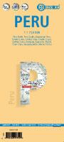
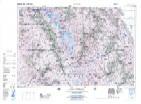
Waterproof! Peru Travel Map. 1:1,500,000. ITMB. A good road map of Peru, with elevation shown by color tinting and some spot heights (mountain tops). Printed on waterproof, tear-resistent synthetic paper. With a small inset map of central Lima at 1:13,000.
65-17906
1 sheet, folded
$12.95
Laminated!
Peru Travel Map. 1:1,750,000. Borch. A soft-laminated folded map of Peru shows: Peru North 1:1,750,000, Peru South 1:1,750,000, Amazonian Peru 1:2,500,000, Central Lima 1:18,000, Greater Lima 1:150,000, Central Cuzco 1:12,000, Greater Cuzco 1:50,000, Ayacucho 1:20,000, Arequipa 1:17,000, Chan Chan 1:40,000, Trujillo 1:20,000, Sacsayhuaman 1:10,000, Machu Picchu 1:44,000, Peru administrative & time zones. Borch Maps are easy to fold, durable and water-repellent with a wipeable surface. Borch Maps show hotels, museums, monuments, markets, public transport, top sights and points of interest, useful statistics, conversion charts for temperatures, weights and measurements, climate charts showing temperatures, sunshine hours, precipitation and humidity, overview maps, time zones, and much more.
Sample detail from the Peru travel map. Image of the front of the Peru travel map. Image of the back of the Peru travel map.
65-17903
1 sheet, folded
$11.95
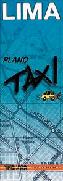
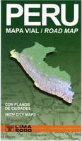
Lima Laminated Pocket Map (Lima 'Taxi'). 1:60,000. 'Lima 2000'. Laminated tri-fold pocket map. General map of Metropolitan Lima (with highways, main avenues and other important streets; districts, principal neighborhoods; points of interest; 1 km grid, detailed maps of downtown Lima, San Isidro and Miraflores, panoramic view of provinces of Lima and Callao). The whole city at a glance, for planning routes etc. Size is A3, folded to 10 x 30cm. In Spanish.
65-1792LL
1 sheet, folded.
$9.99
Peru Travel Maps & Peru City Maps - Paper
Peru Mini Road Map (Peru Mini Mapa Vial). 1:2,000,000. 'Lima 2000'. A handy double-sided pocket road map of Peru. Bilingual.
65-17904
1 sheet, folded.
$10.95
Peru Travel Map. 1:1,500,000. 'Lima 2000'. Excellent road map with cultural information. With inset of Lima and Arequipa. Bilingual.
Detail from the map.
65-1790
1 sheet, folded
$14.99
Peru Travel Map. 1:1,000,000. Freytag/Berndt. A clear and easy-to-read road map at 1:1M scale. The map has numerous symbols to locate tourist sites and services. The map uses shaded relief to show elevation and has distances along major roads. Multilingual legend.
Sample detail from the Peru travel map.
65-17911
1 sheet, folded.
$14.99
Peru Travel Map. 1:1,500,000. Michelin #763. A good travel map of Peru from this world-famous map-maker. The map includes an index of place names, an inset map of Lima, etc.
65-17909
1 sheet, folded
$12.95
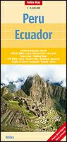
Peru & Ecuador Road Map. 1:2,500,000. Nelles Verlag. A folded travel map that covers both Peru and Ecuador. The map has several inset maps covering the Inca Trail, Cusco and Machu Picchu, Nasca Lines, etc. There are also nine small city inset maps. Multilingual legend.
65-17901
1 sheet, folded.
$13.95
Peru City Maps
Arequipa City Maps. 'Lima 2000'. Two new city maps for Arequipa.
Sample #1. Sample #2.
65-1792AS
Arequipa city map (Arequipa Plano Metro). This is a detailed map that covers entire city. The reverse has a map of Cono Norte and a street index. In Spanish.
$16.99
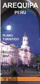
65-1792AR
Arequipa Tourist Map. Metro Arequipa plus an inset map of the downtown area; textual information on history, places to visit, lodging, restaurants, useful addresses, excursions. Bilingual English/Spanish.
$14.99
Cuzco City Maps. 'Lima 2000'. Includes both a detailed city street map and a less detailed tourist map.
65-1792C
Cuzco tourist map. Useful for someone going on a package tour of Cusco and up to Machu Picchu. This pocket map has a general street map on one side, accompanied by a map of downtown Cuzco, indexed information on places to visit, hotels, restaurants, etc. The reverse side has a general shaded relief map of the Sacred Valley, with tourist information in the margins. Bilingual. Size 17 x 24".
$14.99
65-1792CU
Cuzco Plano Metro map. This map is a detailed city street map of Cusco, with an inset map of the central city, useful for anyone spending extended time in the city. Fully indexed, including streets and places of interest. In Spanish only, size is 50 x 70cm.
$13.99
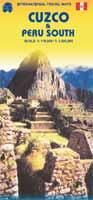
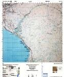
New edition Cuzco and Southern Peru Travel Map. 1:110,000 and 1:1,500,000 (Southern Peru). ITMB, 3rd ed., Aug. 2009. This new edition now has excellent inset maps of Machu Picchu (schema), Inca Trail (1:50,000), Cuzco (1:11,000) and Lima (1:13,500) to assist visitors, as well as a detailed map of the southern portion of Peru. Now, one map will cover all the routes to Cuzco, as well as the gem of South America - Machu Picchu! ISBN 9781553415473.
Peru map sample
65-17778
1 sheet, folded
$12.95
Lima & Central Peru Map. 1:13,500 & 1:1,500,000. ITMB. A good tourist street map of Lima, noting the locations of tourist sites and services, with a full index. This is a great map for tourists, since it combines the regional map on the reverse. The Lima 2000 map of Lima listed above is a better map for libraries wanting a map of Lima only, as it shows all of the minor streets and covers the entire city, which the ITMB map does not. Lima is not blessed with a good rapid transit system, but we show the two lines and the busway, embassies, hotels, shopping areas, historic sites etc. the new part of the map is a detailed travel map of the central portion of Peru on the other side. This side would be particularly useful for those visitors planning to travel from Lima to Cuzco, or Pisco, or north to Cajamarca, or even into the upper reaches of the Amazon. It has excellent road information, and hundreds of touristic points of interest are noted on the map.
Sample detail of the Lima map.
65-1792LI
1 sheet, folded
$11.95
Lima City Maps. 'Lima 2000'. Very detailed city maps with complete street indexes; in Spanish. The city guide is a small booklet in English with information on hotels, restaurants, stores, tourist sites, etc.
Lima Tourist Map. 1:12,500 for downtown maps. 'Lima 2000'. 3D map of Metropolitan Lima plus detail maps of downtown section, San Isidro and Miraflores; textual information on history and urban development, places to visit, lodging, restaurants, useful addresses, excursions. Size 42 x 60 cm, folded. Bilingual.
$13.99
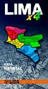
Lima x4 District Guide (Lima x 4 Guia Distrital). 1:15,500 - 1:20,000. Lima 2000, 2nd ed. 2002. Very detailed small spiral-bound street atlas of Lima. Size is 12 x 21 cm, with A4 maps, spiral-bound, with 112 page street and building index.
65-1792LJ
Atlas.
$39.99
Peru & Lima Wall Maps
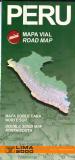
Peru Road Map (Mapa Vial). 1:2,000,000. Peru IGN. This is the official road map of Peru, produced by the government. Includes highway numbers, distances between road junctions, department boundaries, etc. In Spanish.
Lima Metropolitan Map. 1:17,860. Lima 2000, 1997. Shaded relief map, 4 sheets.
65-17921
r sheets, rolled.
$224.95
Lima Metropolitan Map. 1:25,000. Lima 2000, 1997. Full color shaded relief map, 2 sheets with separate street index booklet.
65-17922
2 sheets, rolled + booklet.
$124.95
Peru Hiking Maps and Peru Hiking Guides
Machu Picchu Maps
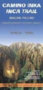
Recommended! Inca Trail and Sacred Valley Topographic Map (Machu Picchu). 1:50,000. 'Lima 2000'. This is a topographic map of the Sacred Valley and Machu Picchu. The map has tourist information along the bottom edge and symbols locating tourist sites and services along the trail. Bilingual; printed on water and tear-resistent synthetic paper.
Detail from the map. Image of the entire map.
65-1778
1 sheet, folded
$14.95
Camino del Inca Hiking Maps. Pixmaps. These two maps cover the same area - Camino del Inca and Machu Picchu - at two scales of 1:50,000 and 1:100,000. These are two high quality topographic maps with roads and hiking trails overprinted, along with symbols locating tourist sites and services such as hiking huts, climbers camps, lodges, mines, etc. Bilingual. These are print-on-demand maps.
Image of the Camino del Inca 1:50,000 hiking map Image of the Camino del Inca 1:100,000 hiking map
Archaeological Map of Machu Picchu. 1:1,000. Wright Water Engineers, 2008. This is a site plan of the ancient Inca city of Machu Picchu that contains archaeological details of Machu Picchu. With inset map of the summit of Huayna Picchu. Map legend includes shrines, temples, subterranean caves, archaeological points of interest, tourist routes, principal Inca routes, corral, structural walls, rock outcrops, stairs, fountains, mortars, conjunto numbers, room numbers, roofless areas, peripheral areas, agricultural areas, garden areas, Inca canal. Main points of interest are highlighted with photo/info on reverse side.
Sample of the Machu Picchu map detail.
65-17779
1 sheet, folded.
$8.99
Machu Picchu benchmark paperweight. Geo-Situ. Whether you're a climber, hiker, geography buff, or armchair traveler, you'll love to collect or give these unique location paperweights that celebrate the spirit of exploration, athletic challenge, and personal achievement. Cast in pewter these summit marker paperweights are the same diameter as official USGS benchmark markers and have an image of this World Heritage Site. Please click the "sample" button below to see an enlargement of the paperweight. Each marker has a soft felt pad on the bottom so these can be used on glass, wood, or any surface. Supplied in a soft fleece drawstring pouch, 3¼" diameter.
Larger image of the Machu Picchu paperweight.
65-1797MP
Paperweight.
$59.95
Machu Picchu benchmark magnet. Geo-Situ. Whether you're a climber, hiker, geography buff, or armchair traveler, you'll love to collect or give these unique bench mark magnets that celebrate the spirit of exploration, athletic challenge, and personal achievement. These smaller replicas of the benchmark paperweights are ideal as inexpensive gifts or as refrigerator magnets or office note magnets for yourself.
65-1797MPM
Magnet.
$12.95
Cordillera Blanca, Cordillera Huayhuash, and Cañon del Colca - Cotahuasi Hiking Maps & Guides
The Cordillera Blanca Guide - A Unique Landscape Explained + Suggested Trips. Jan Sevink, the Mountain Institute. The Cordillera Blanca Guide introduces the traveller to the climate, geology, and geography of this magnificent mountain range in the Peruvian Andes. It is the largest snow covered mountain range of the tropics, with a unique landscape and this is the only book in the English language which provides detailed information to the traveller on the natural history and geography of the landscape.
The guidebook includes chapters covering climate and hydrology; the Andes; geology; mines, minerals and environmental pollution; natural hazards and disasters.
Approximately half the guide covers eight detailed suggested trips going into the Cordillera Blanca, with information on logistics, main features, its geology and landscapes.
65-1776
214 pages, numerous color photos, flapped paperback, in English.
$32.99
Cordillera Blanca Topographic Hiking Maps. 1:100,000. Alpenverien. Detailed topographic maps with hiking routes marked. In German.
Cañon del Colca - Cotahuasi. 'Lima 2000'. Maps of Colca and Cotahuasi canyons (scale 1:225,000), with trekking routes and tourist services; Panoramic map of the region; textual information on history, excursions, places to visit, lodging, restaurants, typical food, calendar of holidays and events. Bilingual, size is 40 x 60cm.
Thumbnail of the map
65-17789
1 sheet, folded.
$14.99
Cordillera Blanca - Huayhuash - Huaraz hiking map. 1:250,000. 'Lima 2000'. Double-sided shaded relief map road map. Includes the main trekking trails in the region, inset map of Huaraz, and descriptive text. Bilingual, map size is 42 x 60cm.
Sample of the map detail Thumbnail of the map
Cordillera Huayhuash hiking map. 1:50,000. Macarena Perez Correa/Aonek'er. Detailed topographic map of the central Cordillera Huayhuash region. In Spanish.
Sample of the map detail
65-17784
1 sheet, folded.
$13.99
Peru Atlases, Political, and Physical Maps
Peru National Atlas and Supplement. Instituto Geografico Nacional, 1989 & 1999. Information organized into five chapters: Peru, oferta ambiental, poblacion, impacto ambiental, economic activity. The atlas was published in 1989. There is a 58-page supplement published in 1999 that is available separately. In Spanish.
65-1745
Atlas, 1989.
$450
65-1745A
1999 supplement of 58 pages.
$139.95
Peru Political Map (Mapa Político). 1:2,000,000. IGN. Shows administrative boundaries and political information. Includes major roads, rivers, towns, airports, and railroads. Size 30 x 41" (76 x 104 cm). In Spanish. Printed on tear-resistent, waterproof synthetic paper.
Sample of 4 x 4" section of the map.
Sample of 10 x 10" section of the map.
65-1749
1 sheet, rolled
$47.99
Peru Physical/Political Map (Mapa Físico - Político del Peru). 1:1,000,000. IGN. A detailed map of Peru showing topographical, political, and cultural information. An excellent wall map. Size is 60" x 82" (152 x 208 cm). Four sheets, in Spanish.
Sample of 4 x 4" section of the map. 99 kb file.
Sample of 11 x 18" section of the map. 630 kb file.
65-1751
4 sheets, rolled
$119.99
Peru Department Physical Maps (Departamento de ...). Scale varies. IGN. These maps cover all 24 "departments" in Peru. Good quality physical/relief maps. NOTE: Many of these, especially the Cuzco map, are often out of stock at the publisher in Peru and it can be 6 months or more before we get new stock. In Spanish.
65-1772-01
Amazonas. 1:600,000. 1986.
$14.95
65-1772-02
Ancash. 1:400,000. 1985.
$14.95
65-1772-03
Apurimac. 1:350,000. 1973.
$14.95
65-1772-04
Arequipa. 1:576,000. 1986.
$14.95
65-1772-05
Ayacucho. 1:520,000. 1985.
$14.95
65-1772-06
Cajamarca. 1:1,480,000. 1986.
$14.95
65-1772-07
Cuzco. 1:747,000. 1986. Out of stock and probably out of print.
Peru Geologic Quadrangle Maps. 1:100,000. 1984-1989. INGEMMET. Numerous sheets cover northwestern Peru. The maps are well-made with good detail. In Spanish. Specify sheet numbers wanted in the "Comments" section of the check-out order form.
Index map for the geology quadrangle maps


 Waterproof!
 Sample detail from the Peru travel map.
 Image of the front of the Peru travel map.
 Image of the back of the Peru travel map.
 Waterproof!

 Laminated!


 Detail from the map.
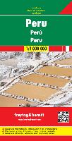 Peru Travel Map. 1:1,000,000. Freytag/Berndt. A clear and easy-to-read road map at 1:1M scale. The map has numerous symbols to locate tourist sites and services. The map uses shaded relief to show elevation and has distances along major roads. Multilingual legend.
 Sample detail from the Peru travel map.
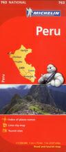
 Peru & Ecuador Road Map. 1:2,500,000. Nelles Verlag. A folded travel map that covers both Peru and Ecuador. The map has several inset maps covering the Inca Trail, Cusco and Machu Picchu, Nasca Lines, etc. There are also nine small city inset maps. Multilingual legend.
 Sample #1.
 Sample #2.
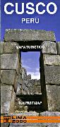


 New edition
 Peru map sample
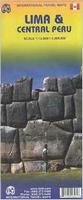
 Sample detail of the Lima map.
 Sample of the detail.
 Thumbnail of the whole map.

 Peru Road Map (Mapa Vial). 1:2,000,000. Peru IGN. This is the official road map of Peru, produced by the government. Includes highway numbers, distances between road junctions, department boundaries, etc. In Spanish.

 Detail #1 from the Lima map
 Detail #2 from the Lima map
 Image of the Lima map

 Recommended!
 Detail from the map.
 Image of the entire map.
 Image of the Camino del Inca 1:50,000 hiking map
 Image of the Camino del Inca 1:100,000 hiking map
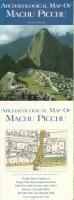
 Sample of the Machu Picchu map detail.
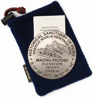
 Larger image of the Machu Picchu paperweight.
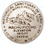
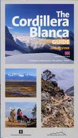
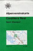

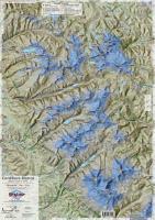
 Image of the whole Northern Cordillera Blanca map.
 Image of the whole Southern Cordillera Blanca map.
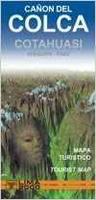 Cañon del Colca - Cotahuasi. 'Lima 2000'. Maps of Colca and Cotahuasi canyons (scale 1:225,000), with trekking routes and tourist services; Panoramic map of the region; textual information on history, excursions, places to visit, lodging, restaurants, typical food, calendar of holidays and events. Bilingual, size is 40 x 60cm.
 Thumbnail of the map
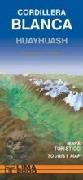
 Sample of the map detail
 Thumbnail of the map
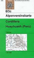
 Sketch map showing area covered by the Cordillera Huayhuash hiking map
 Sample of the map detail
 Sample of the map detail


 Index map for the geology quadrangle maps