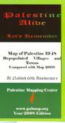
Map of Palestine 1948 - Depopulated Villages and Towns Compared with 2008. 1:500,000. Palmap, Palestine, 2008. This map, which covers current-day Israel and the Palestinian territories, shows the villages that have been depopulated during and since 1948. The map has a grid and tick marks showing the Palestinian National Grid 1923. On the reverse is a list of each village and town depopulated and/or occupied by the Israelis, with the date and with the grid reference.
Villages & towns depopulated in 1948
Villages & towns depopulated between 1948 and 2008
Palestinian urban areas as of 2008
Palestinian refugee camps as of 2008
Israeli urban areas as of 2008
Jewish settlements as of 2008.
Armistice Line 1949
65-9245
1 sheet, folded
$13.95
65-9245R
1 sheet, flat/rolled
$15.95
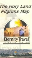
The Holy Land Pilgrims Map. 1:500,000. Palmap. This double-sided map gives a good overview of the pilgrim locations in Israel and Palestine. Side one has a 1:500,000 road map of Israel and Palestine. Side two has an "In the Footsteps of Jesus" map that shows biblical locations with their historic names, plus a detailed map of the Old City in Jerusalem.
65-92901
1 sheet, folded.
$13.95
65-92901R
1 sheet, flat/rolled.
$15.95
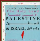
Tourist Map of the Holy Land, Palestine, and Israel. 1:260,000. Palmap, Palestine, 2008. The mapis a tourist and road map of Israel and the Palestinian Territories. The map denotes the Golan Heights, the West Bank, and the Gaza Strip.
The map shows:
The Separation Wall; existing, approved, and proposed.
security areas
Green Line (1949 Armistice Line)
Oslo ABC Zones
Palestinian built-up areas
Palestinian evacuated areas, 2005
Border crossings
Swimming beaches
Roads with route numbers
65-9290
1 sheet, folded
$12.95
65-9290R
1 sheet, flat/rolled
$14.95
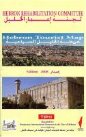
Palestine City Maps. Palmap, 2008. These maps, some litho-printed and some color plotted, offer up-to-date mapping of these historic, and in-the-news, cities in the Middle East.
Sample from the Gaza map
65-9292GA
Gaza City. 2008. Color plot, flat/rolled.
$39.95
65-9292HE
Hebron. 2008. Litho-printed map, folded.
$13.95
65-9292JE
Jericho. 2008. Color plot, flat/rolled.
$39.95
65-9292RA
Ramallah. 2008. Color plot, flat/rolled.
$39.95
Temporarily out of stock. Atlas of Palestine 1948 Salman Abu Sitta. Palestine Land Society. The atlas includes an introductory section on the Mandate, the Partition Plan, Palestine borders, the land ownership (Arab, Jewish, Public), the population composition, the 1948 War, al Nakba, the Armistice Agreements and DMZ, infrastructure, public amenities, religious sites, selected towns and villages, the remaining villages today, refugees in exile and pattern of dispersion.
450 colour pages (31.5 x 48 cm) containing information on :


 Sample from the Gaza map
 Al Nakba map sample
 Armistice Line map sample
 Cover of the atlas
 Dispersion map sample
 Sample of the Land Ownership map
 Sample of the Palestine Map
 Sample of the 1948 Villages & Old Sites map
 Sample of the Population Composition map
 Sample of the Vital Data pages
 Palestine Flags