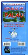
Palau Travel Map. Variable scale. Franko's Map. Franko's Guide Map of the Republic of Palau is just loaded with information for everything there is to see and do in Palau. Side One of Franko's Guide Map of the Republic of Palau focuses on scuba diving and snorkeling locations, and has a lot of information about Palau's states, and more. Side Two of Franko's Guide Map of the Republic of Palau describes many of the resorts, tourist sites, and has close-ups of Koror, Babeldaob, Peleliu, and Angaur and lots more information about the Republic of Palau. Size is 26 x 18 inches. 9781601901996.
66-12643
1 sheet, folded.
$8.99
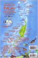
Palau Fish Card. Franko's Map. Laminated plastic fish card, with a hole for a lanyard. Side 1 is a mini map of the Republic of Palau, with a listing of the major dive and snorkeling spots. Side 2 is a Palau reef creatures identification guide.
Thumbnail image of the Palau fish card
66-12643FC
1 laminated card.
$5.99
Palau Sharks & Rays Card. Franko's Map. Stunning, realistic illustrations of the sharks and rays found in the waters of Palau. 5.5" x 8.5" with hole for lanyard, printed on both sides.
Reverse side of the sharks and rays card
66-12644SH
1 laminated card.
$5.99
Palau Islands Topographic Map. 1:25,000. U.S. Geological Survey. These are very detailed, oversize sheets, some reaching 3' x 5'. The names listed below are the names that appear as sheet titles on the sheets. The names after the dashes are the names of islands that appear on the sheets.
Unfortunately these are all out of print and we have only one sheet left in stock.


 Thumbnail image of the Palau fish card
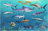
 Reverse side of the sharks and rays card
 Palau Flags