|
|
Oman Map of the Sultanate of Oman. 1:1,300,000. National Survey Authority. An official road map of Oman, published by the Omani government. In English.
Oman City Maps. National Survey Authority.
Oman Topographic MapsOman 1:100,000 Topographic Quadrangle Map Set. 1:100,000. Soviet government. High quality topographic maps for a country where little else is available. This set gives complete coverage of Oman in 110 sheets. In Russian.
For ordering individual sheets please look at the index to figure out which sheet(s) you need and then order them using the "Each, specify area" order button below. On the order form, specify the sheet number in the "Comments" section.
Oman 1:200,000 Topographic Quadrangle Map Set. 1:200,000. Soviet government.
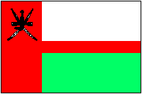
Oman Flags
|
|||||||||||||||||||||||||||||||||||||||||||||||||||||||||||||||||||||||||||||||||||||
 Oman Maps
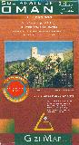
 Sample of the map detail
 Index showing map coverage
 Sample of the Oman map detail
 Sample of the Oman map detail.
 Sample from one of the street maps
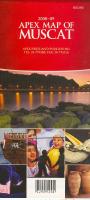

 Sample of the Muscat map
 Sample of Sur map (Salalah map identical style/format/detail)
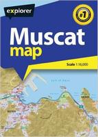
 Sample detail of the Muscat City Map
 Overall Index Map
 Index of numbering scheme
 Oman Flags