We are pleased to offer the complete line of maps produced by Nepa Maps, the only registered map publishing company in Nepal. These maps are of very high quality and are essential for anyone trekking in the region. Many of the maps - particularly the 1:50,000 ones - appear to be built on the new Nepal government topographic maps and contain hiking trails, huts, and other useful information, all in English. A few of the maps - particularly the smaller scale maps - appear to be built on the soviet 1:200,000 topo series.
The large-scale maps also contain latitude and longitude markings and typically 40 meter contours. The small-scale maps usually lack latitude/longitude markings and have 200 meter contours. Each large-scale map includes a useful place-name index - the small-scale maps lack this index. These maps are recommended - by far - over the Leomann (West Col) and Nelles Verlag maps. Please note that four maps have been replaced by new maps published in a joint effort by Nepa and National Geographic/Trails Illustrated. These four are noted below.
Finally there is a single series of maps at a useful scale for planning trekking trips in Nepal, or for using on guided trips.
While these will not replace the very detailed 1:25,000 and 1:50,000 topographic maps of Nepal, the larger area covered by these maps makes them quite useful and a very welcome addition to the maps of Nepal.
This series of ten maps offers detailed topographic and trekking map coverage of the entire northern are of Nepal. These maps are full topographic maps, in English.
Extensive tourist information has been added to the maps, including trekking trails, tourist sites such as historic sites, monuments, schools, view points, and much more.
All sheets are laminated.
Sheets 101 through 108 and single-sided. Sheets 109 and 110 are double-sided and hence cover twice the area of the other sheets.
The legend is multilingual, the maps are in English.
Annapurna Adventure Trekking Map. 1:125,000. National Geographic Maps.
The map covers Pokhara, Nayapul, Tatopani, Tukuche, Jomosom, Besisahar, Khudi, Chame, Manag, Muktinath, Nagdanda, Landrung, Ghandrung, and Hinku. This map is a new edition of the Nepa map, revised and published by National Geographic/Trails Illustrated.
$11.95
65-0481-01
1 sheet, folded
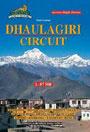
DHAULAGIRI: (The High Route Around Dhaulagiri Across High Passes). 1:87,500.
The map covers Thapa Pass, Hidden Valley, French Pass, Dhaulagiri Base Camp, West Dhaulagiri Glacier. One of Nepa's earlier maps, the topographic base map is not as detailed as the later maps although the hiking information is still there and the map is quite useful. With latitude and longitude markings and 500 meter contours. Not indexed.
$22.99
65-0481-03
1 sheet, folded
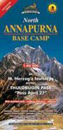
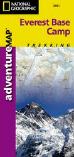
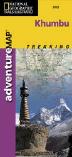
EVEREST Base Camp (Trekking from Lukla to Everest Base Camp). 1:50,000. National Geographic Maps.
The map covers Lukla, Namche Bazaar, Tyangboche, Pangboche, Pheriche, Lobuche, Kalapatthar, Khumbu Glacier, and Cho La Pass. With latitude and longitude markings and 40 meter contours. With index. The reverse side has a shaded relief map of Nepal and descriptive text and photos.
$11.95
65-0481-04
1 sheet, folded
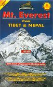
Mt. Everest from Tibet & Nepal Hiking Map. 1:40,000. Nepa.
This map covers both sides of Mt. Everest, showing the approach and climbing routes.
Sample of the North Island map detail
$24.99
65-0481-64
1 sheet, folded
CHO OYU - The Turquoise Goddess hiking map. 1:50,000.
With details of the Approach and Climbing Routes. The map covers the Tibetan side of the mountain, including Tingri, Gyedrak, Palung, Cho Oyu Base Camp and Advance Base Camp, plus Camps I, II, and III. The map covers the Nepalese side, including Lunak Dharmashala, Dzasampa, Nangpa La, Advance Base Camp, Camps I, II, III and the summit area.
$24.99
65-0481-58
1 sheet, folded
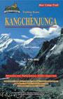
KANGCHENJUNGA (Trekking Routes Around Kangchenjunga). 1:100,000.
Quite detailed and useful, particularly since the Nepalese 1:50,000 are difficult to obtain for Kangchenjunga! The map covers Basantapur, Taplejung, Chirwa, Amjilassa, Ghunsa, Kambachen, Pangpema Base Camp, Jonsong La, Lapsand La, Mirgin La, Yalung Base Camp, Yamphudin, Gopetar, Ilam. With 200 meter contours, lacks latitude/longitude markings, lacks ISBN number. Not indexed.
$22.99
65-0481-06
1 sheet, folded
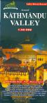
Around KATHMANDU VALLEY. 1:50,000.
An excellent topographic map of the Kathmandu Valley showing all of the highlights. The map covers Bhaktapur, Patan, Kirtipur, Dakshin Kali, Dhulikhel, Budhanilka, Pashupatinath, Swayambhunath, Monkey Temple, Bouddhanath, Gokharna, Shivapuri, Banepa, Panauti, Namo Buddha, Thimi, Changu Narayan, Sankhu, Nagarkot, Kakani, Balaju, Nagarjun, Ichangu, Phulchoki, Pharping, Chobar, Bungamati, Khokana, Lele, Bisanku. With a listing of highlights, an index, and latitude and longitude markings. No ISBN.
Trekking From POKHARA to MUKTINATH JOMOSOM along the Kali Gandaki Valley. 1:80,000.
The map covers Birethanti, Ghorapani, Tatopani, Dana, Ghasa, Larjung, Tukuche, Marpha, Syan, Jomosom, Lupra, Kagbeni, and Muktinath. This map is a good 1:75,000 topographic map with hiking information overlain. The map has latitude/longitude markings. Indexed.
$15.99
65-0481-14
1 sheet, folded
Treks Around Kathmandu Maps
Trekking Routes to GOSAINKUND - Shiva's Sacred Lakes. 1:50,000.
This topographic map covers this popular hike from Kathmandu to Gosainkund Sacred Lakes. The map covers Kathmandu, Trisuli Bazaar, Betrawati, Ramche, Grang, Thare, Bokajhunda, Dhunche, Bharkhu, Syabru, Chandrabari, Shin Gomba, Lauribinayak, Gosainkund.
$13.95
65-0481-22
1 sheet, folded
Treks Around Pokhara Maps
The ROYAL TREK - Shyaklung - Chisopani. 1:25,000. Nepa.
This detailed topographic map covers the Royal Trek from Pokhara to Kalikasthan, Thulakot, Majhasthan, Shaure Bhanjyang, Patle, Ojagaon, Lipeni, to Shyaklung, and back to Pokhara via Ramkot, Sarka Bhanjyang, Moharya, Chisopani, Tal Besi, Rupa Tal, Saukunda, Sundari Danda, and Begnas Tal. Longitude: 84° 00' - 84° 10'.
Latitude: 28° 07' - 28° 15'. Altitude Range: 580m - 1250m.
$17.99
65-0481-28
1 sheet, folded
Nepal Off the Beaten Path Maps
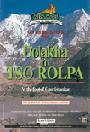
DOLAKHA to TSO ROLPA Hiking Map. 1:50,000 & 1:125,000.
This map has a 1:125,000 regional map and a 1:50,000 map that highlights the trek from Dolakha to Tso Rolpa, with detailed trails, walking distances, altitudes, and an index. The map covers Charikot, Dolakha, Malepu, Suri Dhoban, Manthale, Chetchet, Simigaon, Beding, Na, Tsho Rolpa.
$14.95
65-0481-30
1 sheet, folded
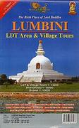
Lumbini Zone hiking map. 1:75,000.
Buddhist Circuit Tour, LDT Area and Village Tours.
$19.95
65-0481-63
1 sheet, folded
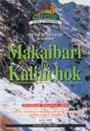
The Trail from MAKAIBARI TO KALINCHOK. 1:25,000 &1:125,000.
This topographic map includes a regional map at 1:125,000 and a detailed map at 1:25,000 covering the main trail. With detailed trails, walking distances, elevation profiles, altitudes, and more. Coverage includes Lamsangu, Makaibari, Gairi Kharka, Kuri Kharka, Tin Sang Pass, Kyi Dorje, Ghortali, Barahbise.
$14.95
65-0481-32
1 sheet, folded
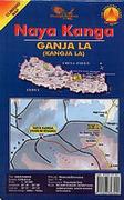
Naya Kanga (Kanga La) Hiking Map. 1:80,000.
Includes details of approaches and climbing routes and the southern flank of Langtang.
$19.95
65-0481-62
1 sheet, folded
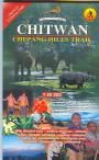
CHITWAN - Chepang Hills Trail. 1:50,000.
Covers the popular Chepang Hills Trail within Chitwan National Park. Includes Hugdi, Jayapuri, Hattibang, Jyandala, Siraichuli, Chisapani Tar, Upardhanggdhi, Shaktikhor, Sinti, Majhbang, and Chitram Waterfall.
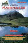
Panch Pokhari map - the Jugal Five Lakes. 1:40,000.
Covers Chautara, Ghunsa, Nasimpati, Laurebina Pass, Panch Pokhari, Tangbo Kharka.
$14.95
65-0481-55
1 sheet, folded.
Nepal Climbing Maps
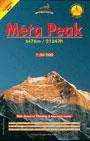
Mera Peak (21247 ft.) Climbing Map. 1:30,000.
This topographic map includes a map at 1:50,000 covering the approach routes and a map at 1:33,898 covering the climbing routes and the summit. Coverage includes Kathmandu, Lukla, Chutanga, Thuu Kharka, Tashing Ongma, Tangnang, Dig Khare, Mera La Base Camp, High Camp, Mera Peak Summit.
$22.99
65-0481-13
1 sheet, folded
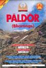
Paldor Climbing Map. 1:33,898 & 1:125,000. Himalaya Kartographisches Institut/Nepa. Oct. 1998.
(Bharange) (19449 ft.) This topographic map includes a regional map at 1:125,000 showing the approach routes to this 19,449 ft. peak. The reverse side has a 1:33,898 map of the climbing routes. Coverage includes Kathmandu, Dhunche, Syabru Besi, Gatlang, Khurphu Bhanjyang, Somdang, Paigutan Kharka, Lari Mine, Paldor Base Camp, Tilman's Ridge, South East Ridge, South West Buttress, West Ridge, Fang, Phuta's Peak, Neddy's Thumb, Pema's Peak, Paldor Summit.
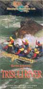
Rafting & Kayaking on the TRISULI RIVER. 1:150,000.
A topographic map of this popular rafting river in Nepal. The map covers Betrawati, Trisuli Bazaar, Denighat, Baireni, Mugling, Narayanghat, Chitwan.
$12.95
65-0481-40
1 sheet, folded
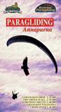
Paragliding Around Annapurna map. 1:25,000 & 1:50,000 & 1:80,000.
This map has one map at 1:50,000 showing the permissible flying areas and the no-fly zone, plus five inset maps at various scales covering specific paragliding spots such as the Sarangkot Drop, the Green Wall, the Korchon Circuit, Sarangkot Naudanda Cross-Over, and the Griffon's Challenge Pokhara to Besi Sahar..
$22.99
65-0481-52
1 sheet, folded.
City Maps
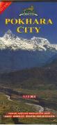
Pokhara City Map. 1:13,000.
A detailed street map that also shows the terrain surrounding the city. Shows locations of the numerous hotels and guesthouses, plus other tourist services. Includes inset maps showing Lake Side at 1:2,500 and Dam Side at 1:3,500.
 Laminated!
 Sample detail from the Kanchenjunga Trekking Map
 Sketch map showing areas covered by each sheet.
 Index map for this series
 Detailed index for the Annapurna area
 Detailed index for the Mt. Everest area
 Detailed index for the Kathmandu area
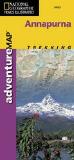


 Sample of the North Island map detail
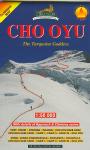


 Sample of the map detail
 Sample of the map detail
 Thumbnail image of the front of the map
 Thumbnail image of the reverse of the map
 Sample of the map detail
 Sample of the map detail
 Thumbnail image of the front of the map
 Thumbnail image of the reverse of the map