|
|
|
|||||||||||||||||||||||||||||||||||||||||||||||||||||||||||||||||||||||||||||||||||||||||||||||||||||||||||||||||||||||||||||||||||

 Sample of a text page from the North America road atlas
 Sample of a map page from the North America road atlas
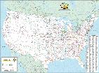
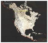
 Sample detail of North America road atlas

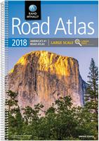
Rand McNally 2018 Large-scale Road Atlas. Rand McNally. Give road-weary eyes a break with this spiral-bound Large Scale edition featuring all the accuracy you ve come to expect from Rand McNally, only bigger. map.
| 
Rand McNally 2018 Gift Road Atlas. Rand McNally. A durable see-through vinyl cover enhances the classic Road Atlas (62-20700-2018 above), making it travel-ready with added protection against constant use, spills and exposure to the elements. 144 pages, dimensions are 10.875" x 15.375".
|

Rand McNally 2018 Mid-sized Easyfinder Road Atlas. Rand McNally.
|  Rand McNally 2018 Mid-sized Easy-to-read Road Atlas. Rand McNally.
Paperback (center-stapled), 96 pages, dimensions are 8" x 10.75".
|
 Rand McNally Deluxe Motor Carrier's Road Atlas 2018. Rand McNally.
|  Rand McNally Motor Carrier's Road Atlas 2018. Rand McNally.
|
USA/North America Road Atlases by Michelin Maps

USA/Mexico/Canada Road Atlas. Michelin. Covers USA, Canada and Mexico. Most detailed mapping of Michelin's 3 North American atlases, with spiral binding for lay-flat convenience. Includes 240+ large-scale city maps, and highlights 1,000+ travel center locations for breaks during the journey. Bonus index presents 2000+ national, state and provincial parks with GPS and map page coordinates. Features Michelin-rated scenic drives, pulled directly from Michelin's Green Guide travel series, for road trip discoveries. Size ix 9 x 10¾ inches, spiral-bound.  Sample detail of North America road atlas Sample detail of North America road atlas
| 
Large-format USA/Mexico/Canada Road Atlas. Michelin. Covers USA, Canada and Mexico. Easy-read mapping with bigger page size and larger lettering for towns and sites compared to midsize atlas. Driving Tours section, taken from Michelin's Green Guide series, provides great road trips ideas. Includes 50+ large-scale city maps and bonus Northeast section. Size is 10¾ x 14¾ inches, paperback (center-stapled).
|

Mid-sized USA/Mexico/Canada Road Atlas. Michelin. Covers USA, Canada and Mexico. Covers USA, Canada and Mexico. Easy-read mapping with bigger page size and larger lettering for towns and sites compared to midsize atlas. Driving Tours section, taken from Michelin's Green Guide series, provides great road trips ideas. Includes 50+ large-scale city maps and bonus Northeast section. Size is 8½ x 11 inches, center-stapled.
|
North America Wall Maps
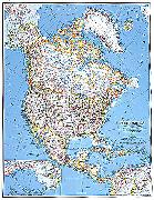
North America Political Map. National Geographic Maps. Available in two sizes. Classic political wall map for North America.
 A full image of the map
 | $14.99 | 66-23380 | Small size, flat/rolled. 1:13,000,000. |
| $24.99 | 66-23380L | Small size, laminated. 1:13,000,000. |
| $149.95 | 66-23380BL | Mounted, black. 1:13,000,000. |
| $149.95 | 66-23380GO | Mounted, gold. 1:13,000,000. |
| $149.95 | 66-23380WH | Mounted, white. 1:13,000,000. |
| $149.95 | 66-23380WO | Mounted, wood-grain. 1:13,000,000. |
| $24.99 | 66-23381 | Enlarged size - 36 x 46". |
| $39.99 | 66-23381L | Enlarged size - 36 x 46". Laminated |
 A detail of the map
Political Map of North America. 1:7,000,000. Maps International. This colorful wall map shows national boundaries, national capitals, cities, country flags, latitude and longitude lines,
physical features and terrain shading, ocean bathymetry, and major roads. It includes insets of: Hawaii, Aleutian Islands, and the Caribbean. Map size is 47" x 39".
 Thumbnail of the North America Map
 Sample detail of the North America Map
| $29.99 | 66-23492 | 1 sheet, rolled |
| $39.99 | 66-23492L | Laminated |
North America Railroad Maps & Atlases
Railroads of the Continental United States. Deskmap Systems. This map is the industry standard railroad map and is currently used by thousands of transportation professionals. The complete US rail system as well as southern Canada and northern Mexico are displayed on this 36" x 48" map. Printed in full colors, the highly detailed map shows more than 7,000 cities, towns, and station points.
Reporting marks on the map are indexed for more than 650 railroad companies to identify operations. Intermodal hubs and interchange points are clearly represented. Available only as laminated flat (rolled) map. Size is 36 x 48"

| $49.99 | 62-20905 | 1 sheet, flat. |
| $69.99 | 62-20905L | 1 sheet, laminated. |
North America Geologic and Thematic Maps
Large Earthquakes of North and Central America: 1970-1996. USGS. This large wall map (45 x 42") displays earthquakes that have ocurred in or near North and Central America during 1970-1996.
The epicenter symbol sizes are scaled into three magnitude categories: magnitudes 5.0-5.9, magnitudes 6.0-6.9, and magnitudes 7.0 and greater.
The epicenter symobls are color-coded to indicate shallow and deep earthquakes. Base map from Raven Maps.

| $13.95 | 66-2316 | Each, rolled |
North America Isostatic Gravity Anomaly Map (2.5mGal). Geological Survey of Canada. One sheet, in color, with legend in the margins.
| $9.95 | 66-23110 | 1 sheet, folded |
North America Magnetic Field Intensity Map. Geological Survey of Canada (Map 1811A). One sheet, in color, with legend in the margins.
| $5.00 | 66-23150 | 1 sheet, folded |
North America Tectonic Map. U.S. Geological Survey (Map I-688).
| $6.95 | 66-2321 | 1 sheet, rolled |
North America Late Wisconsin Glacier Complex. 1:7,500,000. Geological Survey of Canada. 91 x 86 cm.
| $10.95 | 66-2332 | 1 sheet, rolled |
North America Coal Map of North America. 1:5,000,000. U.S. Geological Survey. 1988.
| $9.95 | 66-2344 | 1 sheet, rolled |