Waterproof! Myanmar Travel Map. 1:1,500,000. Reise Know-How. This is a double-sided map dividing the country into north and south sections.
Combines clear road and tourist detail with general relief indicated by contours, altitude and bathymetric tinting, mountain passes and peak heights. Road detail includes selected tracks and also shows intermediate driving distances on main roads.
Main railways, ferries, airports, airfields and harbours are indicated and a range of symbols depicts many landmarks such as various antiquities, temples, pagodas, churches, lighthouses, waterfalls, viewpoints and places of interest, beach resorts, golf courses & museums. National parks and regional boundaries are also marked. Includes extensive index of place names. With a latitude/longitude grid at 1° intervals. Printed on durable waterproof, tear-resistant synthetic paper.
65-91902
1 sheet, folded
$15.99
Myanmar Road Map. 1:3,300,000. DPS Maps, Myanmar, 2005. This tourist map showsthe road network in Myanmar along with the political division and state boundaries. The map shows three levels of road, bridges, dams, passes, five levels of city/town, mountains with spot elevations, gas stations, airports, lighthouses, wildlife/nature reserves, and beaches. There is a distance table and small inset data tables for each state and division. The data tables show population, captail, area, and places of interest. The reverse side has three indexes; towns, dams, and bridges.
65-91904
1 sheet, folded.
$14.99
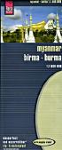
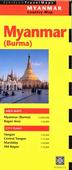
Myanmar Travel Map. ITMB.
Uganda is a lovely country and very touristic. The game parks, particularly the area around Murchison Falls, is spectacular, and well worth a week's visit. One favourite area is Kidepo Park in the far north; rather arid, but great for seeing animals.
Image of the front of the Myanmar map Image of the reverse of the Myanmar map
65-91903
1 sheet, folded
$12.95
Myanmar Travel Map. 1:1,500,000. Nelles Verlag. High quality map with contour lines and shaded relief.
65-9190
1 sheet, folded
$13.95
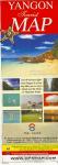
Myanmar Country Map & Yangon (Rangoon) City Map. 1:2,000,000 & 1:17,500. Periplus. With a large map of Yangon (1:35,000) and Central Yangon (1:17,500). Also includes inset maps of Old Bagan (1:15,000) and Mandalay (1:25,000).
65-91901
1 sheet, folded.
$8.95
Myanmar (Burma) City Maps. DPS Maps, Myanmar. These double-sided maps are typical tourist maps with several detailed street and city center maps, listings of pagodas, temples and monasteries, lists of places to stay and eat, and advertising around the margins. The reverse side as regional maps, flight schedules for several airlines, and more advertising. In English.
65-9192BA
Bagan (Pagan) city map. Variable scale.
$11.99
65-9192M
Mandalay city map. Variable scale.
$11.99
65-9192YA
Yangon (Rangoon) city map. Variable scale.
$11.99
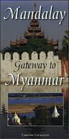
Mandalay City and Region Map. Odyssey Guides, 2014. ISBN 9789622178380.
This is a double sided and illustrated, folded map sheet of 'Upper Myanmar' - including a detailed city map of Mandalay. The map sheet is more than just a map, heavily illustrated with 49 colour photos and it includes useful information for the traveller - both before and during a visit.
The map sheet provides a detailed overview of Mandalay, Myanmar's (Burma) second biggest city, on one side and a comprehensive guide on how to explore 'Upper Myanmar' using Mandalay as a base on the other side. The full 1:2,150,000 scale map shows all the accessible parts of Myanmar to the tourist including Yangon (Rangoon), Nay Pyi Taw and Mandalay - the cities that have International airports.
The notes that accompany the maps show the location of religious and historic sites, hotels, essential tourist sites, architectural treasures with comprehensive notes covering cultural and historical information on key places and people.
65-9192MAN
1 sheet, folded.
$17.95
Nay Pyi Taw and Yangon Cities Map. Odyssey Guides, 2013. ISBN 9789622178427.
This is a double sided, illustrated, and folded map of Myanmar's principal cities - Nay Pyi Taw and Yangon. The maps show selected hotels and regional attractions plus the location of important religious and heritage architecture. There are 44 color photographs plus comprehensive notes with cultural and historical information on key places and people.
65-9192NAY
1 sheet, folded.
$17.95
Myanmar Topographic Maps
Myanmar Topographic Maps. 1:200,000. Soviet Military. This set offers extensive coverage of Myanmar. The maps are excellent topographic maps with extensive detail, including contours, power lines, pipelines, and much more. In cyrillic.
For ordering individual sheets or digital quads, please look at the index to figure out which sheet(s) you need and then order them by faxing a marked-up copy of the index to us at 336-227-3748.
NOTE: We supply color plots.
65-9150D
Each, specify area
$50.00
Myanmar Topographic Maps. 1:100,000. Soviet Military. This set offers extensive coverage of Myanmar. The maps are excellent topographic maps with extensive detail, including contours, power lines, pipelines, and much more. In cyrillic.
For ordering individual sheets or digital quads, please look at the index to figure out which sheet(s) you need and then order them by faxing a marked-up copy of the index to us at 336-227-3748. We hope to have a better index on-line shortly.
Please note that the index linked below is a 1:200,000 index. We will correlate to the appropriate 1:100,000 map sheets.
NOTE: We supply color plots.


 Waterproof!


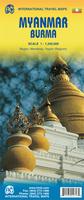
 Image of the front of the Myanmar map
 Image of the reverse of the Myanmar map
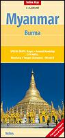

 Myanmar Country Map & Yangon (Rangoon) City Map. 1:2,000,000 & 1:17,500. Periplus. With a large map of Yangon (1:35,000) and Central Yangon (1:17,500). Also includes inset maps of Old Bagan (1:15,000) and Mandalay (1:25,000).