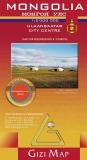
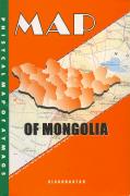
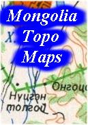
Recommended! Mongolia Geographic Map. 1:2,000,000. Gizimap. Detailed map of Mongolia. The map shows roads, towns, villages, rivers, etc. The geographic map has shaded relief, hypsometric shading, and spot heights to show elevation. Trilingual English/Russian/Mongolian. Size is 49" x 33" flat.
Sample #1 of the map detail Sample #2 of the map detail Thumbnail image of the entire map
65-89902
Geographic map, folded.
$14.99
65-89903
Geographic map, rolled.
$19.99
65-89903L
Geographic map, laminated.
$34.99
65-89903PB
Geographic map, mounted on pin-board with black frame. For use with map pins, etc.
$259.99
65-89903PM
Geographic map, mounted on pin-board with mahogany-colored frame. For use with map pins, etc.
$259.99
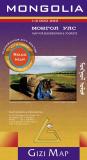
Mongolia Road Map. 1:2,000,000. Gizimap. Detailed maps of Mongolia, available in two versions. Both maps show roads, towns, villages, rivers, etc. The political map shows major political boundaries and shaded relief but lacks the hypsometric shading showing elevation. Trilingual English/Russian/Mongolian. Size is 49" x 27" flat.
Sample of the Mongolia map detail Thumbnail image of the entire map
65-89904
Road map, folded.
$14.99
65-89905
Road map, rolled.
$19.99
65-89905L
Road map, laminated.
$34.99
65-89905PB
Road map, mounted on pin-board with black frame. For use with map pins, etc.
$259.99
65-89905PM
Road map, mounted on pin-board with mahogany-colored frame. For use with map pins, etc.
$259.99
Waterproof! Mongolia Travel Map. 1:1,600,000. Reise Know-How. A double-sided map, splitting the country into east and west regions with a generous overlap of coverage.
Combines clear road and tourist detail with general relief indicated by contours, altitude tinting, mountain passes and peak heights. Road detail includes selected tracks and also shows intermediate driving distances on many roads.
Main railways, airports, airfields, and border crossings are indicated and a range of symbols depicts many landmarks eg. various ruins, monasteries, caves, oases, wells, seasonal rivers and places of interest. National parks and province boundaries are also marked. Includes extensive index of place names. Longitude and latitude lines are drawn at 1° intervals. Printed on durable waterproof paper.
65-89901
1 sheet, folded
$15.99
Mongolia Travel Map. 1:1,785,000. ITMB. The main road network is pretty much fixed in position, but secondary roads tend to be tracks that follow diverse paths towards obscure destinations. Because of this, accurate maps are very hard to prepare and this map does it well. Regardless, it is a lovely country to visit, with lots to see and friendly people. ITMB have updated the Ulaanbaatar capital city inset map, noting the train ticketing office (which isn't in the train station), several museums, various temples. ISBN 9781553414186.
Sample detail of the Mongolia travel map
65-8990
1 sheet, folded
$12.95
Mongolia Physical Map. 1:1,000,000. Ulsin Geodezi Zupag Zujin Gazar, 2001. Elevation is shown by 100- or 200-meter contours and numerous spot heights. 6 sheets, sheet size is 34 x 26." In Russian only.
Sample of the map detail
65-89472
6 sheets, rolled.
$229.95
"Map of Mongolia: Physical Map of Aymags". 1:1,000,000. Administration of Land Affairs, Geodesy & Cartography, and Gazryn Zurag. Attractive physical maps with hypsometric shading and latitude/longitude. Map set of 21 small sheets, one sheet per state. No dates on the maps, but the sheets look freshly printed. In English.
Sample of the map detail
65-8946
set, folded.
$74.95
Mongolia Physical Map. 1:3,000,000. CESBGC (Mongolia). 1985. One sheet with hypsometric shading to show elevation. Includes roads, railways, etc. In Mongolian.
Sample of the map detail
65-89473
1 sheet, flat.
$12.95
Mongolia Physical Map (with mineral resources marked). 1:2,500,000. Ulsin Geodezi Zupag Zujin Gazar, 1985. Elevation is shown with hypsometric contours, numerous spot heights, and relief shading. Locations of major mineral resources are marked for 11 minerals/ores. One sheet, size 24 x 42." In Mongolian only.
Sample of the map detail
65-89471
1 sheet, flat.
$12.95
Mongolia Physical Map. 1:3,000,000. CESBGC (Mongolia). 1992. One sheet with hypsometric shading to show elevation. Includes roads, railways, etc. In English.
65-8947
1 sheet, folded.
$21.95
Mongolia Provincial Maps
Mongolia Aymag (Province) Map Series. Variable scale. Monsudar, Mongolia, 2013-2014.
These maps are detailed physical / road maps of the Mongolian aymags (provinces).
The maps use satellite-derived mapping with shaded relief and numerous spot heights to show elevation.
The roads show route numbers and travel distances for the main roads.
Symbols locate tourist sites and services such as gas stations, hostels, tourist huts, cell phone towers, border stations, fossil sites, museusms, and much more. The maps also use symbols to show the locations and type of ore mined for the numerous mines found throughout Mongolia.
Each map has an extensive index of place names on the reverse - the index is in Mongolian only. The maps show the names of major cities in both Mongolian and western alphabet. The index is multilingual including English.
Darhan-Uul Aymag Travel Map, sheet 19. 1:120,000. 2013. 27 x 36 inches. ISBN 9789997300850. Note that this map was the first produced in the series and is not as detailed and uses more crude cartography.
$16.99
Mongolia Regional and City Maps
Sukhbaatar Atlas. 1:2,000,000 - 1:3,000,000. Geodezi, Mongolia, 1989. Small center-stapled atlas with 26 basic maps covering a variety of themes for this region in eastern Mongolia. In Mongolian. Size is 8-1/4 x 12".
Sample of the map detail
65-8981-SU
Atlas
$16.95
Terelj and Boydhan Uul Map. 1:100,000. Cartographic Enterprise, Mongolia. A beautiful, detailed topographic map centered on Ulan Bataar. Symbols locate tourist sites and services. With a 10-minute latitude/longitude grid. In English, size 23 x 40 inches, folded.
Sample of the map detail
65-8981-TE
1 sheet, folded.
$13.95
"Welcome to the Land of Chinggis Haan" Map (Genghis Khan). Scale approx. 1:400,000. Cartographic Enterprise of Mongolia, 2002. In English. Centered on Genghis Khan's birthplace, this regional topographic map covers from Dadal (NE) to Ondorhaan (SE), to Delgerhaan (SW) and Burdan Haldun (NW). Distances between towns is shown and symbols mark historic sites, ruins, and tourist services. With a 20 x 30-minute latitude/longitude grid. The reverse side has a small satellite image map and descriptive text. Map size is 30 x 32", folded. The maps are new, although they have suffered some shelf-wear in the Mongolian warehouse.
Sample of the map detail
65-8960
1 sheet, folded.
$13.95
Mongolia Provincial Maps. Mongolia. These are very general maps with some descriptive text. Scale and size varies. In Mongolian.
65-8986
UVS. 1990.
$8.95
Ulaan Baatar City Map. BAKS, 1992. A basic English-language street map of Ulaan Baatar done by a Polish engineering company that did a large water project for the Mongolian government. While a dated map, there is nothing else in English other than the little city-center inset map on the Mongolia road map (ITMB) listed above.
Sample of the map detail
65-8992U
1 sheet, folded.
$9.95
Ulaan Baatar Historical Map (reproduction). The historical map shows Ulan Bataar at about 1900.
65-8992UH
1 sheet, rolled.
$5.95
Mongolia Guidebooks
Trans-Siberian Handbook. Trailblazer. The most popular guide to the world's longest rail journey and packed with practical information on arranging a trip. Includes a km-by-km guide to the Trans-Siberian Railway, Trans-Manchurain and Trans-Mongolian routes. Fully updated and expanded. ISBN 1-873756-16-X. 4th edition, June 1997. 404 pages, 45 maps and 30 color photographs. 'The Trans-Siberian Handbook is a must.' The Sunday Times.
L-49Г. Ongon els (Shireet) / Dornogobi, Sikhbaatar.
$20.00
65-8953-L-50-A
L-50-A. Matad / Dornod Sikhbaatar.
$20.00
65-8953-L-50-B
L-50-Б. Tsagaannuur / Dornod.
$20.00
65-8953-L-50-C
L-50-B. Erdenetsagaan / Suhbaatar.
$20.00
65-8953-M-45-D
M-45Г/L-45-Б. Ulgii.
$20.00
65-8953-M-46-A
M-46-A/B. Ulaangom / Hovd, Uvs.
$20.00
65-8953-M-46-B
M-46-Б/Г. Baruunturuun / Uvs, Hovd, Zavhan.
$20.00
65-8953-M-47-A
M-47-A/N-47-B. Bayanzurkh.
$20.00
65-8953-M-47-B
M-47-Б. Huvsgul dalai.
$20.00
65-8953-M-47-C
M-47-B. Tosontsengel.
$20.00
65-8953-M-47-D
M-47Г. Moron.
$20.00
65-8953-M-48-A
M-48-A. Sliudianka / Hovsgol, Bulgan, Selenge.
$20.00
65-8953-M-48-B
M-48-Б/Г. Sukhbaatar (Darhan).
$20.00
65-8953-M-48-C
M-48-B. Bulgan.
$20.00
65-8953-M-49-B
M-49-Б/Г. Bayan Ovoo.
$20.00
65-8953-M-49-C
M-49-B. Batshireet (Eg).
$20.00
65-8953-M-50-A
M-50-A/B. Choibalsan / Dornod.
$20.00
65-8953
37 sheets.
$595.00
Mongolia Topographic Quadrangle Maps (TPC & ONC harts). 1:500,000 & 1:1,000,000. NGA (NIMA/DMA). These NGA aeronautical/topographic charts offer the best coverage available in English. Fourteen 1:500,000 TPC charts offer complete coverage of Mongolia or six 1:1,000,000 ONC charts offer complete coverage. World Aeronautical Charts, including TPC and ONC charts, cover land areas at a standard size and scale for navigation by aircraft operating at high altitudes. However, their level of detail makes them useful as topographic maps for those areas where little else is available. The topographical information includes city tints, principal roads, railroads, distinctive landmarks, drainage patterns, topography and relief. contour lines are at 500 feet intervals, with intermediate contours where appropriate, along with numerous spot heights. Color tints on a hypsometric scale are also shown. The aeronautical information includes visual and radio aids to navigation, airports, airways, restricted areas, obstructions and other pertinent data. There is less detail in some areas due to insufficient information - these areas are labelled on the charts. These are large maps, with a typical size of 42 x 56 inches. Due to the size and color variation of the different print runs and the Conformal Conic Projection, these maps do not splice together well. World Aeronautical Charts are not recommended for use by pilots of low speed, low altitude aircraft.
TPC/ONC Index for Mongolia.
These are the Soviet military 1:100,000 topographic maps of Mongolia to which the Mongolians have added an update-layer.
Language
Base maps are in cyrillic with update layer in Mongolian.
65-89525
Set of color plots, 1,170 quads
$23400.00
65-89526
Set of non-georeferenced raster scans, 1,170 quads
$23400.00
65-89527
Set of georeferenced raster scans, 1,170 quads
$23400.00
Mongolia Atlases
Nomadic Life in Central Asia (Visit at our Ancestors) - Photo Collection. Mihaly Benko. Timp Kiado, 1998. I included this book as I found it an interesting look at the life of the nomads of Central Asia; a people little known to most of us here in the USA. The author, a researcher of shamanic traditions of the Kazakhs of the Mongolian Altai,
captures daily life as it has been for centuries. The text, bilingual English/Russian, describes what he saw during the several years of travel throughout the region. Hardbound, with numerous color photographs.
66-2095CA
atlas.
$25.95
Mongolia Geologic & Thematic Maps
Hydrogeological Map of Mongolia. 1:1,000,000. Institute of Geology and Mineral Resources, Ulaanbaatar, 1996. The map shows five main rock types, divided into 42 sub-types, ranging from rocks with extensive, highly productive acquifers to rocks with no water production. Groundwater and springs, surface water, wells, drill holes, and man-made features are also shown. Each sheet has a list of wells and drill holes and associated water data such as depth to aquifer, yield, total dissolved solids, static groundwater level, and drawdown. 15 sheets, sheet size 24 x 30". Bilingual.
Sample of the map detail
65-8930
15 sheets.
$199.95
Mongolia Mineral Resources Map. 1:2,500,000. Ulsin Geodezi Zupag Zujin Gazar, 2000. This map uses a plain base map showing the outlines of the 21 aimags (provinces) and their capital cities. Symbols on the map show the locations of the various mineral resources. One sheet, size 22 x 40 inches. In Mongolian only.
Sample of the map detail
65-8940
1 sheet, flat.
$19.95
Mongolia Flora Map. 1:2,500,000. Ulsin Geodezi Zupag Zujin Gazar, 2005. The map displays 27 different flora zones with brief descriptions of each zone. In Mongolian. Map size is 22 x 40".
Sample of the map detail
65-8938
1 sheet, rolled.
$19.95
Mongolia Climate Map. 1:2,500,000. Mongolia. 1 sheet, in color. In Mongolian.


 Recommended!
 Sample #1 of the map detail
 Sample #2 of the map detail
 Thumbnail image of the entire map
 Sample of the Mongolia map detail
 Thumbnail image of the entire map
 Waterproof!


 Sample detail of the Mongolia travel map
 Sample of the map detail
 Sample of the map detail
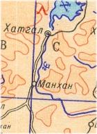
 Sample of the map detail
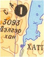
 Sample of the map detail
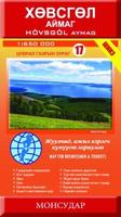
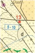
 Sample detail from the Hovsgol (Khuvsgul Aymag (Province) map
 Sketch map of the map layout for the Mongolia Aymag map series.
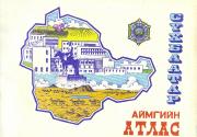
 Sample of the map detail
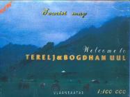
 Sample of the map detail
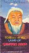
 Sample of the map detail
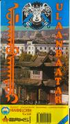
 Sample of the map detail
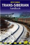

 Sample of the map detail.
 Index showing sheet coverage.
 TPC/ONC Index for Mongolia.
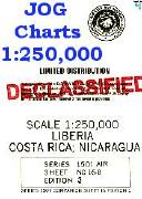
 Sample of the map detail
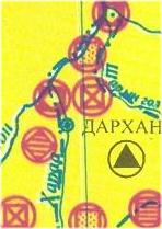
 Sample of the map detail
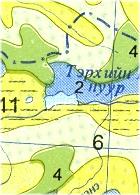
 Sample of the map detail