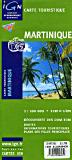
Martinique Tourist Map (Carte Touristique). 1:100,000. Institut Géographique National. This bilingual shaded relief map shows museums, parks, festival dates and locations, scenic routes, and more. 76 x 67 cm.
$19.99
66-33813
1 sheet, folded
Martinique Topographic Maps. 1:25,000. Institut Géographique National, France. A three-sheet set illustrates the spectacular topography of this volcanic island, including Mt. Pelée.
$16.95
66-3381A
Fort-de-France & Mont Pelee (NW sheet; #4501).
$16.95
66-3381B
Mont le Lamentin & La Trinité (NE sheet; #4502).
$16.95
66-3381C
Le Marin (S sheet; #4503).
$45.76
66-3381
3 sheets, folded
Martinique & Guadeloupe Travel Map. 1:65,000 & 1:100,000. ITMB, 2011. This is really two maps sharing one piece of paper. Each map fills one side and is a separate title in its own right. Martinique might be somewhat smaller in area, but is arguably better developed for tourism. In any case, this Caribbean island is lovingly portrayed and includes tourist resorts, nature reserves, beaches, dive sites, gas stations, marinas, camp sites, and anything else we could think to add. A beautiful inset map of the capital, Ile de France, is included. Guadaloupe, and its adjacent islands, fills the other side, along with a detailed inset of Point-a-Pitre, its capital. In addition to all the attractions shown on the Martinique side, this map shows the ferries to the 'out' islands of Marie-Galante, Les Saintes, and La Desirade. For extra value, we have added inset maps of Sint Martin and of Saint-Bartholomey at 1:100,000, which will at least provide map coverage for these islands until we can get around to preparing more detailed maps. This is the first new mapping of this part of the Caribbean in a decade or more, and is MUCH more economically priced than the 'other' maps. As an adjuct, these islands are linked to each other and to Saint Lucia and Dominica by inter-island ferries. This new system of ferries is linking the islands together for tourism, as well as economic cohesion.
Sample detail of the Martinique travel map


 Sample detail of the Martinique travel map