Downloadable digital maps! Malaysia Digital Road Map. 1:800,000. Reise Know-How. This map combines topographic mapping with road and tourist detail. The road information is clear and elevation is shown using contours, spot heights and altitude shading. The map shows six different types of roads, highlighting scenic routes, places of interest, archaeological sites, monasteries, monuments and viewpoints.
Digital versions available for immediate download! Digital versions are available for Compe-GPS, Fugawi, OziExplorer, and Touratech-Quo Vadis, for use with a PocketPC or a PC.
65-00907C
Immediate download digital version for CompeGPS. (min. v6.8, .rmap).
$21.99
65-00907F
Immediate download digital version for Fugawi. (.fx4).
$21.99
65-00907O
Immediate download digital version for OziExplorer. (.ozfx3 for v3.x).
$21.99
65-00907T
Immediate download digital version for Touratech QV. (.pny).
$21.99
Malaysia Road Atlas. 1:925,000. New Holland Publishers. 72 pages, 8-1/2 x 11". Softcover, perfect-bound.
65-00908
1 sheet, folded
$12.95
Malaysia wall map. 1:2,000,000. Periplus, 2006. Folded, unfolds to 40 x 28 inches. Physical map, with numerous cities and towns. In English.
65-0048
1 sheet, folded.
$14.95
Malaysia Travel Map. 1:1,500,000. Nelles Verlag. Double-sided map. Peninsular Malaysia appears on one side, with Sabah, Sarawak and Brunei on the other. Main roads and railways are shown, and mountain ranges are shown by relief shading. Places of tourist interest are clearly shown. The Kuala Lumpur region, Pangkor and Pulau Pilang are in insets at enlarged scales. The map also includes small street plans of Kuala Lumpur, Georgetown (Penang), Melaka, Kuching, Kota Kinabalu and Bandar Seri Begawan.
65-0090
1 sheet, folded
$13.95
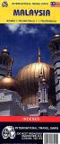
Malaysia Travel Map. Variable scale. Periplus. On one side is a small general map at 1:6.5m of the whole of Malaysia, with larger road maps of Peninsular Malaysia and Saba & Sarawak at 1:1.5m and 1:2m respectively. These maps have hill-shading to show the general relief and indicate marsh areas. Railways, regional boundaries and selected places of interest are included in the detail. The Klang Valley region from Kuala Lumpur to the Malacca Straits is
shown at 1:250,000. On the reverse is a more detailed map of Penang Island at 1: 80,000 and a street plan of central Kuala Lumpur at 1:15,000. Additional street plans at various scales show Georgetown, Kuching, Kota Kinabalu, Melaka and Johor Bahru.
Street plan detail includes railways, railway stations, ferry terminals & bus stations with many other symbols denoting useful features such as petrol stations, places of worship, food centres, post offices, embassies, hotels, hospitals, sites of interest, etc.
65-00903
1 sheet, folded
$8.95
Malaysia Travel Map. 1:700,000 & 1:1,130,000. ITMB. Detailed travel map for western Malaysia and slightly more general map for eastern Malaysia.
65-00904
1 sheet, folded
$12.95
Travel Map of Western (Peninsular) Malaysia. 1:650,000. Nelles Verlag. This is more detailed than 65-0090 above.
65-00905
1 sheet, folded
$13.95
Recommended Malaysia Regional Travel Maps. Periplus. These are excellent maps using shaded relief to show physical features. The maps also show roads, tourist information, and city inset maps.
Sample detail from the Penang map
65-0092G
Penang Island & Georgetown. 1:50,000.
$8.95
65-0092J
Johor.
$8.95
65-0092M
Peninsular Malaysia.
$8.95
65-0092S
Sabah & Kota Kinabalu. 1:980,000.
$8.95
65-0092T
Sarawak & Kuching. 1:1,000,000 + 1:15,000.
$8.95
Sarawak, Sabah, and Brunei Travel Map. 1:620,000. ITM. Detailed road map of these three regions in and around Malaysia.
Sample detail from the Sarawak map
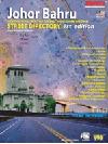
65-0093S
1 sheet, folded
$12.95
Johor Bahru Street Directory. 1:5,000 & 1:10,000. Rimman, 1st. ed., 2002. 24 pages @ 1:5,000 covering downtown Johor Bahru and 168 pages @ 1:10,000 covering the rest of the city and surrounding suburbs. Numerous symbols locate taxi stands, public telephones, traffic lights, public toilets, temples/churches/mosques, hospitals, and much more. Includes a full index covering streets, commercial buildings, golf courses, banks, hotels, and much more. In English.
Sample #1 Sample #2
65-0091JO
Atlas.
$19.95
Kuala Lumpur & Klang Valley Street Directory. Rimman, 4th ed. Roads, buildings, facilities including apartments & Condominiums, Commercial Buildings, Cinemas, Embassies, Fire Departments, Government Departments, Golf Courses, Hospitals, Hotels, Libraries, Places of Interest, Places of Worship, Police Stations, Post Offices, Schools, Shopping Complexes & Sporting Complexes.
65-0091KU
Atlas.
$39.95
Malaysia City Maps.
65-0092K
Kuala Lumpur Metro. Area + City Center. 1:50,000 + 1:15,000. Periplus.
$8.95
Malaysia Topographic Quadrangle Maps
Malaysia 1:200,000 Topographic Quadrangle Map Set. 1:200,000. Soviet government. 1982-1985. High quality topographic maps for a country where little else is available. Each sheet has extensive descriptive text on the reverse. This set gives only partial coverage of Peninsular Malaysia.
For ordering individual sheets, please look at the index to figure out which sheet(s) you need and then order them using the
"Each, specify area" order button below. Fill out the order form and print it out instead of submitting it. Fax it to us along with a copy of the index map, blacking out the quads you do not want.
65-0050
Each, specify area
$50.00
65-0051
Set of 28 sheets
$420.00
Sabah 1:50,000 Topographic Map Set. 1:50,000. Malaysia Directorate of National Mapping. Series DNMM 5201, 108 sheets.
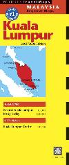
Sample detail from sheet 54 Labuan.
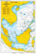
65-0050SA
Set, rolled.
$2499.99
Malaysia Nautical Charts
Malaysia Nautical Charts. Malaysia National Hydrographic Centre. Detailed nautical charts, ranging in scale from 1:10,000 harbor charts to 1:240,000 coastal charts to 1:500,000 regional charts. With latitude/longitude grid and tickmarks. In English/Malay. 75 charts are currently available.
Western Malaysia Geologic Map (Peta Kajibumi Malaysia Barat). 1:500,000. 1973 (7th Ed.). Geological Survey of Malaysia. Sheet size 109 x 76 cm.
65-0005
2 sheets, rolled
$19.95
Quaternary Geological Map of Peninsular Malaysia (Peta Geologi Kuaternari Semenanjung Malaysia). 1:500,000. Geological Survey, Malaysia. 1989. One sheet, in color, measuring 24.5 x 31 cm. The map shows coastal quaternary sediments.