Luxembourg & Belgium Travel Map. 1:250,000. ITMB, Canada. A good road map of Belgium and Luxembourg. Shaded relief indicates elevation.
Sample detail of the Belgium travel map
64-19911
1 sheet, folded.
$12.95
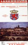
Luxembourg Topographic Map (Carte Topographique et Touristique/Touristenkarte). 1:100,000. 2006. Administration du Cadastre et de la Topographie. Indexed topographic map of the country with contours at 20-metre intervals. An overprint shows the GR5/E2 long-distance footpath, youth hostels and chateaux open to the public. The map also includes a detailed plan of the European Union institutions outside Luxembourg City. Margin ticks give latitude and longitude in steps of 10'. Map legend is in French and German only.
Sample map Enlargement - very large file.
64-97512
1 sheet, folded
$16.95
Recommended! Luxembourg Topographic Map (Carte Topographique/Topographische Karte). 1:50,000. ACTL. Topographic survey of Luxembourg at 1:50,000 covers the country on two sheets. The maps have contours at 10-metres intervals with additional relief shading. An overprint highlights long-distance footpaths, including the GR5 (E-2), special cycle tracks, campsites, and various places of interest. Each map covers approximately 53 x 43 km (33 x 27 miles). Map ticks give latitude and longitude at 5' intervals and national grid co-ordinates.
Sample image Sample image #2 Enlargement - very large file.
64-9750
2 sheets, folded
$34.95
Recommended! Luxembourg Topographic Tourist Map Series. 1:20,000. Administration du cadastre et de la topographie. Detailed topographic survey maps of Luxembourg at 1:20,000 with added tourist information, covering the country on 10 sheets. The maps have 5-meter contour intervals plus hill shading. The map detail includes roads, tracks, paths, railways, electricity lines, adminiatrative boundaries, buildings, churches, hospitals, walls, fences, hedges, vegetation variations.
An overprint highlights long-distance footpaths, cycle tracks and various places of interest and recreation locations eg. notable buildings, antiquities, tourist information offices, campsites, hostels, climbing sites, golf courses. A UTM grid is printed over the map. Map legend includes English.
Note: We recommend this series over the 64-97515 series below as the base maps are the same, it has less sheets and contains tourist information, bike routes, etc. If you want less clutter on your maps, then buy the 64-97515 series below.
Shows sheet coverage Sample of the map detail.
64-97511-01
Sheet 1 - Clervaux - Huldange.
$17.99
64-97511-02
Sheet 2 - Boulaide - Wiltz.
$17.99
64-97511-03
Sheet 3 - Diekirch - Putscheid.
$17.99
64-97511-04
Sheet 4 - Steinfort - Redange.
$17.99
64-97511-05
Sheet 5 - Larochette - Lorentzweiler.
$17.99
64-97511-06
Sheet 6 - Wasserbillig - Beaufort.
$17.99
64-97511-07
Sheet 7 - Luxembourg City and the Surrounding Area.
$17.99
64-97511-08
Sheet 8 - Sandweiler - Grevenmacher.
$17.99
64-97511-09
Sheet 9 - Dudelange - Clemency.
$17.99
64-97511-10
Sheet 10 - Schengen - Weiler-la-Tour.
$17.99
64-97516
Set of 10 sheets, folded
$175.00
Luxembourg Hydrogeologic Map (Carte hydrogéologique du Luxembourg). 1:200,000. 1981. LGS. Legend in French and German. 69 x 53 cm.
 Luxembourg Maps
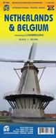
 Sample detail of the Belgium travel map
 Sample map
 Enlargement - very large file.
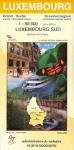 Recommended!
 Sample image
 Sample image #2
 Enlargement - very large file.
 Recommended!
 Shows sheet coverage
 Sample of the map detail.

 Luxembourg Flags