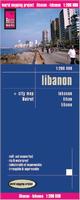
Waterproof! Lebanon Road Map. 1:200,000. Reise Know-How.
This map combines topographic mapping with road and tourist detail. On the reverse it has a large city map of Beirut. The road information is clear and elevation is shown using contours, spot heights and altitude shading. The map shows six different types of roads, highlighting scenic routes, places of interest, archaeological sites, monasteries, monuments and viewpoints. ISBN 9783831772322.
Sample detail of the Lebanon Road Map
64-92904
1 sheet, folded.
$15.99
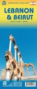
Lebanon and Beirut Travel Map. 1:220,000. ITMB.
A general road and physical map that uses altitude tinting and spot heights to show elevation, while the road network shows main roads, railroads, and some secondary roads. Symbols indicate tourist services and points of interest, such as mosques, historic sites, beaches, museums, airports, and more. The main map has a 15' latitude/longitude grid. The reverse side has a large map of Beirut, the most current map that is available. Map size is 70 x 88 cm.
Sample detail of the ITMB Lebanon road map Sample detail of the ITMB Beirut city map
64-92903
1 sheet, folded
$12.95
Beirut Area Pocket-Maps. GeoProjects, 2011.
These are new pocket-sized mini-maps that cover various neighborhoods of Beirut. The description of the Hamra map is that the city map is at 1:8,700 including Raoucheh, Ain el Mreisseh, Sanayeh and Unesco areas, showing detailed street patterns, built up areas, parks, important buildings and other places of interest. Key map in English, French and Arabic. Includes tourist information for hotels, restaurants, pubs, and useful information, and accompanying photographs.
The reverse side has a large scale of Hamra area at 1:5 000 showing all the hotels, ministries, embassies, restaurants, pubs, banks, places of interests and shops.
Comprehensive index with accompanying photographs. In English. Size when open is 50 x 30 cm.
64-9292BEI
Beirut Downtown Mini-Map. 1:3,000 and 1:6,000. Covers Downtown Beirut, including Gemmayzeh and Saifi, and Majidiyeh and Nejmeh.
$7.50
64-9292AC
Achrafiyeh Mini-Map. 1:6,000 and 1:9,000. This covers the oldest Christian district of Beirut.
$7.50
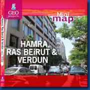
64-9292HA
Hamra, Ras Beirut, and Verdun Mini-Map. 1:5,000 and 1:8,700. This covers Raoucheh, Ain el Mreisseh, Sanayeh and Unesco areas, plus a separate map of Hamra.
$7.50
Lebanon Topographic Maps & Lebanon Flags
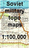
Lebanon 1:100,000 Topographic Quadrangle Map Set. 1:100,000. Soviet government. 1985. High quality topographic maps for a country where little else is available. Each sheet has extensive descriptive text on the reverse. This set gives complete coverage of Lebanon and Israel in 120 sheets. In Russian.
For ordering individual sheets, please look at the index to figure out which sheet(s) you need and then order them using the
"Each, specify area" order button below. On the order form, specify the sheet number or name in the "Comments" section, or fax a marked-up copy of the index to us at 336-227-3748.
 Waterproof!
 Sample detail of the Lebanon Road Map
 Sample detail of the ITMB Lebanon road map
 Sample detail of the ITMB Beirut city map